Pabillonis
Located in Province of South Sardinia, Sardinia Coordinates: 39°35′28″ N 8°43′15″ E
- Population
- 2,718
- 2.7K
- Elevation
- 47 m
- above sea level
- Local time
- UTC+01:00
- Europe/Rome · UTC+01:00
- Places inside
- 1
- listed under Pabillonis
- Airports
- CAG Cagliari Elmas Airport47 km
- AHO Alghero-Fertilia Airport121 km
About Pabillonis
Pabillonis is a municipality. Location: Province of South Sardinia, Sardinia. Population: 2,718. Elevation: 47 m. The best months to visit are May, October. The nearest airport is Cagliari Elmas Airport (47 km). Nearby sights include Monte Linas and Punta Trebinalonga.
Climate of Pabillonis
Best months for sightseeingBest months for sightseeing: May, October.
This month · November
Outside the best season
Day 18° · Night 10° · Rain 89 mm
- Hottest month
- August (day 32°)
- Coldest month
- January (night 6°)
- Wettest month
- November (89 mm)
- Driest month
- July (5 mm)
Bars: average monthly low and high temperature. Below: precipitation. Monthly averages for 1970–2000 at about 18 km resolution, adjusted for elevation. Highlighted months are mild and relatively dry. Source: WorldClim 2.1 (CC BY 4.0).
Show values as a table
| Month | Jan | Feb | Mar | Apr | May | Jun | Jul | Aug | Sep | Oct | Nov | Dec |
|---|---|---|---|---|---|---|---|---|---|---|---|---|
| Average high (°C) | 14° | 14° | 16° | 18° | 23° | 28° | 31° | 32° | 28° | 23° | 18° | 15° |
| Average low (°C) | 6° | 7° | 8° | 10° | 13° | 17° | 20° | 21° | 18° | 14° | 10° | 8° |
| Precipitation (mm) | 51 | 60 | 51 | 52 | 33 | 17 | 5 | 9 | 35 | 67 | 89 | 66 |
How to get to Pabillonis
The nearest airport is Cagliari Elmas Airport (CAG), 47 km to the southeast as the crow flies.
Airports
- Cagliari Elmas Airport (CAG) Cagliari 47 kmsoutheast
- Alghero-Fertilia Airport (AHO) Alghero 121 kmnorth
- Olbia Costa Smeralda Airport (OLB) Olbia (SS) 160 kmnortheast
Straight-line distances; road distances are longer. Airport data: OurAirports.
Day trips from Pabillonis
Within 100 km: 6 historic and cultural sites, 139 natural sites, 116 lakes, rivers and coasts.
0–25 km4 places
- Spiaggia di Funtanazza Beach 22 kmW
- Punta Trebinalonga Mountain 21 kmN
- Spiaggia della Marina di Arbus Beach 22 kmW
- Monte Linas Mountain 18 kmSW
25–60 km59 places
- Poetto Beach 58 kmSE
- Spiaggia di Sa Capanna Beach 58 kmN
- Monte Tusorgia Mountain 59 kmN
- Monte Olia Mountain 58 kmN
60–100 km198 places
- Spiaggia di Porto Alabe Beach 75 kmN
- Spiaggia di Santa Caterina Beach 60 kmN
- Monte Pittada Mountain 89 kmN
- Punta Oruvera Mountain 86 kmN
Straight-line distances.
Places in Pabillonis
1 placeBar: population relative to the most populous place in this list.
Nearby attractions & nature
Everything nearby-
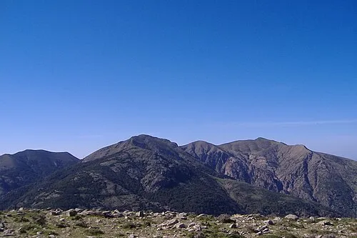 Monte Linas Mountain, Gonnosfanadiga18 km SW
-
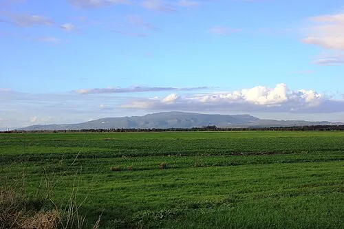 Punta Trebinalonga Mountain, Marrubiu21 km N
-
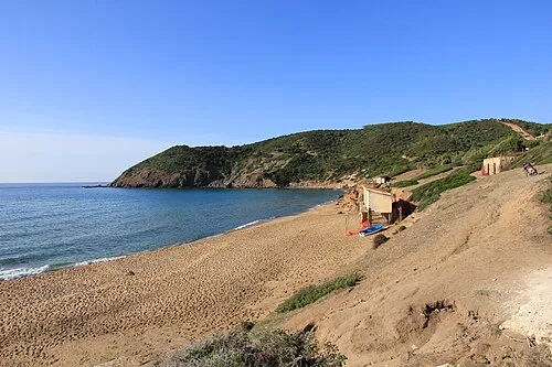 Spiaggia di Funtanazza Beach, Arbus22 km W
-
Spiaggia della Marina di Arbus Beach, Arbus22 km W
Sources & licences
Data last updated: