Cammarata
Located in Province of Agrigento, Sicily Coordinates: 37°37′48″ N 13°37′53″ E
- Population
- 6,129
- 6.1K
- Elevation
- 794 m
- above sea level
- Local time
- UTC+01:00
- Europe/Rome · UTC+01:00
- Places inside
- 3
- listed under Cammarata
- Airports
- PMO Falcone–Borsellino Airport77 km
- TPS Vincenzo Florio Airport Trapani-Birgi105 km
About Cammarata
Cammarata is a municipality. Location: Province of Agrigento, Sicily. Population: 6,129. Elevation: 794 m. The best months to visit are June–July, September. The nearest airport is Falcone–Borsellino Airport (77 km). Nearby sights include Montagna dei Cavalli and Vallone Riena.
Climate of Cammarata
Best months for sightseeingBest months for sightseeing: June–July, September.
This month · November
Outside the best season
Day 14° · Night 8° · Rain 72 mm
- Hottest month
- August (day 27°)
- Coldest month
- February (night 4°)
- Wettest month
- December (76 mm)
- Driest month
- July (5 mm)
Bars: average monthly low and high temperature. Below: precipitation. Monthly averages for 1970–2000 at about 18 km resolution, adjusted for elevation. Highlighted months are mild and relatively dry. Source: WorldClim 2.1 (CC BY 4.0).
Show values as a table
| Month | Jan | Feb | Mar | Apr | May | Jun | Jul | Aug | Sep | Oct | Nov | Dec |
|---|---|---|---|---|---|---|---|---|---|---|---|---|
| Average high (°C) | 10° | 10° | 11° | 14° | 19° | 24° | 27° | 27° | 24° | 19° | 14° | 11° |
| Average low (°C) | 4° | 4° | 4° | 7° | 11° | 14° | 17° | 18° | 15° | 12° | 8° | 5° |
| Precipitation (mm) | 65 | 54 | 45 | 48 | 25 | 7 | 5 | 13 | 40 | 75 | 72 | 76 |
How to get to Cammarata
The nearest airport is Falcone–Borsellino Airport (PMO), 77 km to the northwest as the crow flies.
Airports
- Falcone–Borsellino Airport (PMO) Palermo 77 kmnorthwest
- Vincenzo Florio Airport Trapani-Birgi (TPS) Trapani (TP) 105 kmwest
- Comiso Airport (CIY) Comiso 112 kmsoutheast
Straight-line distances; road distances are longer. Airport data: OurAirports.
Day trips from Cammarata
Within 100 km: 18 historic and cultural sites, 23 natural sites, 52 lakes, rivers and coasts.
0–25 km2 places
- Montagna dei Cavalli Mountain 19 kmNW
- Vallone Riena Natural site 18 kmNW
25–60 km49 places
- Rocca d'Entella Mountain 47 kmW
- Playa Lido Sabbia D'oro Beach 39 kmSW
- San Leone Beach 42 kmS
- Drasy Beach 47 kmS
60–100 km42 places
- Guidaloca Beach 79 kmNW
- La Praiola Beach 76 kmNW
- Playa San Vito Lo Capo Beach 99 kmNW
- Dolphin Beach Beach 75 kmNW
Straight-line distances.
Places in Cammarata
3 placesBar: population relative to the most populous place in this list.
Nearby attractions & nature
Everything nearby-
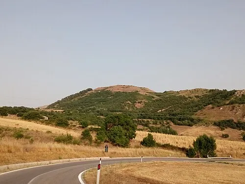 Montagna dei Cavalli Mountain, Prizzi19 km NW
-
Vallone Riena Natural site, Sicily18 km NW
Sources & licences
Data last updated: