Macari
Located in San Vito Lo Capo, Province of Trapani Coordinates: 38°08′38″ N 12°44′18″ E
- Population
- 329
- 329
- Elevation
- 100 m
- above sea level
- Local time
- UTC+01:00
- Europe/Rome · UTC+01:00
- Airports
- PMO Falcone–Borsellino Airport31 km
- TPS Vincenzo Florio Airport Trapani-Birgi34 km
About Macari
Macari is a village. Location: San Vito Lo Capo, Province of Trapani. Population: 329. Elevation: 100 m. The best months to visit are May–June, October. The nearest airport is Falcone–Borsellino Airport (31 km). Nearby sights include Spiaggia del Bue Marino and Playa San Vito Lo Capo.
Photos of Macari
-
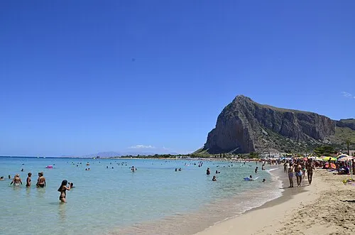
Playa San Vito Lo Capo Lost passenger · CC BY-SA 4.0 -
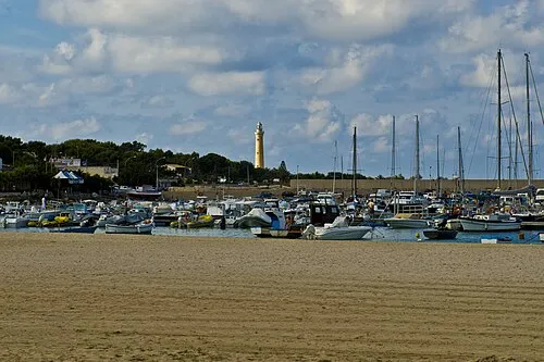
Capo San Vito Salvatore Ciambra from Palermo, Italia · CC BY-SA 2.0


Climate of Macari
Best months for sightseeingBest months for sightseeing: May–June, October.
This month · November
Outside the best season
Day 19° · Night 13° · Rain 78 mm
- Hottest month
- August (day 31°)
- Coldest month
- February (night 8°)
- Wettest month
- November (78 mm)
- Driest month
- July (4 mm)
Bars: average monthly low and high temperature. Below: precipitation. Monthly averages for 1970–2000 at about 18 km resolution, adjusted for elevation. Highlighted months are mild and relatively dry. Source: WorldClim 2.1 (CC BY 4.0).
Show values as a table
| Month | Jan | Feb | Mar | Apr | May | Jun | Jul | Aug | Sep | Oct | Nov | Dec |
|---|---|---|---|---|---|---|---|---|---|---|---|---|
| Average high (°C) | 14° | 15° | 16° | 18° | 23° | 27° | 30° | 31° | 27° | 23° | 19° | 16° |
| Average low (°C) | 9° | 8° | 9° | 11° | 15° | 18° | 21° | 22° | 20° | 16° | 13° | 10° |
| Precipitation (mm) | 62 | 53 | 48 | 46 | 23 | 6 | 4 | 13 | 44 | 75 | 78 | 69 |
How to get to Macari
The nearest airport is Falcone–Borsellino Airport (PMO), 31 km to the east as the crow flies.
Airports
- Falcone–Borsellino Airport (PMO) Palermo 31 kmeast
- Vincenzo Florio Airport Trapani-Birgi (TPS) Trapani (TP) 34 kmsouthwest
- Pantelleria Airport (PNL) Pantelleria (TP) 162 kmsouthwest
Straight-line distances; road distances are longer. Airport data: OurAirports.
Day trips from Macari
Within 100 km: 15 historic and cultural sites, 15 natural sites, 40 lakes, rivers and coasts.
0–25 km13 places
- Guidaloca Beach 18 kmSE
- Spiaggia Trapani Beach 23 kmSW
- Playa San Vito Lo Capo Beach 4 kmN
- Capo San Vito Natural site 5 kmN
25–60 km34 places
- Rocca d'Entella Mountain 53 kmSE
- Spiaggia di Piano Inferno Marina Beach 29 kmE
- La Praiola Beach 30 kmE
- Dolphin Beach Beach 35 kmE
60–100 km23 places
- Spiaggia Tre Fontane Beach 64 kmS
- Puzziteddu Beach 65 kmS
- Spiaggia Di San Marco Beach 74 kmS
- Spiaggia di Contrada San Marco Beach 76 kmS
Straight-line distances.
Nearby attractions & nature
Everything nearby-
Spiaggia del Bue Marino Beach, Italy0.4 km S
-
Playa San Vito Lo Capo Beach, San Vito Lo Capo3.7 km N
-
Capo San Vito Natural site, Sicily5.1 km N
-
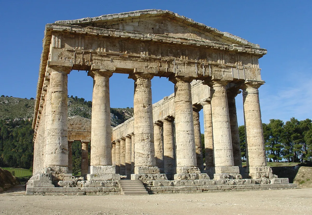 Segesta Historic site, Calatafimi-Segesta24 km S
-
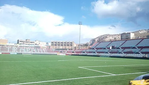 Stadio Polisportivo Provinciale Landmark, Erice21 km SW
-
Spiaggia Monte Cofano Beach, Italy8.6 km SW
Sources & licences
Data last updated: · 2 independent sources