Isera
Located in Province of Trente, Trentino-Alto Adige Coordinates: 45°53′15″ N 11°00′33″ E
- Population
- 2,775
- 2.8K
- Elevation
- 235 m
- above sea level
- Local time
- UTC+01:00
- Europe/Rome · UTC+01:00
- Places inside
- 9
- listed under Isera
- Airports
- VRN Verona Villafranca Valerio Catullo Airport56 km
- BZO Bolzano Airport68 km
About Isera
Isera is a municipality. Location: Province of Trente, Trentino-Alto Adige. Population: 2,775. Elevation: 235 m. The best months to visit are May–June, September. The nearest airport is Verona Villafranca Valerio Catullo Airport (56 km). Nearby sights include Monte Biaena and Monte Faè.
Photos of Isera
-
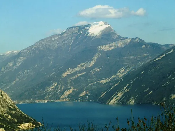
Monte Stivo No machine-readable author provided. Idéfix~commonswiki assumed · CC BY-SA 3.0 -
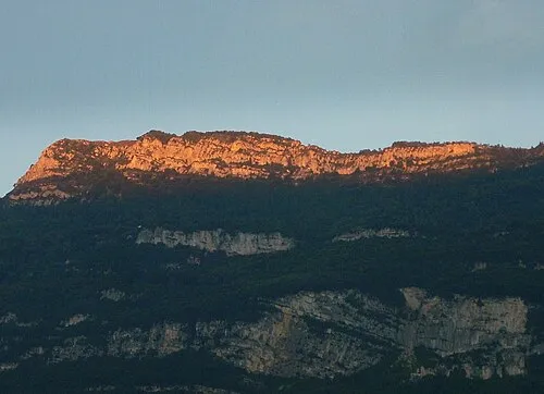
Monte Biaena Gio 2000 · Public domain


Climate of Isera
Best months for sightseeingBest months for sightseeing: May–June, September.
This month · November
A cold month
Day 11° · Night 4° · Rain 49 mm
- Hottest month
- July (day 28°)
- Coldest month
- January (night 0°)
- Wettest month
- June (74 mm)
- Driest month
- February (28 mm)
Bars: average monthly low and high temperature. Below: precipitation. Monthly averages for 1970–2000 at about 18 km resolution, adjusted for elevation. Highlighted months are mild and relatively dry. Source: WorldClim 2.1 (CC BY 4.0).
Show values as a table
| Month | Jan | Feb | Mar | Apr | May | Jun | Jul | Aug | Sep | Oct | Nov | Dec |
|---|---|---|---|---|---|---|---|---|---|---|---|---|
| Average high (°C) | 7° | 9° | 13° | 17° | 22° | 25° | 28° | 28° | 23° | 18° | 11° | 8° |
| Average low (°C) | 0° | 1° | 4° | 7° | 12° | 16° | 18° | 18° | 14° | 10° | 4° | 1° |
| Precipitation (mm) | 33 | 28 | 37 | 50 | 66 | 74 | 66 | 72 | 66 | 74 | 49 | 35 |
How to get to Isera
The nearest airport is Verona Villafranca Valerio Catullo Airport (VRN), 56 km to the south as the crow flies. The nearest large city is Innsbruck, 156 km to the north.
Airports
- Verona Villafranca Valerio Catullo Airport (VRN) Caselle (VR) 56 kmsouth
- Bolzano Airport (BZO) Bolzano (BZ) 68 kmnorth
- Brescia Gabriele d'Annunzio Airport (VBS) Montichiari (BS) 73 kmsouthwest
Nearby large cities
- Innsbruck Population: 132.5K 156 kmnorth
- Zurich Population: 415.4K 250 kmnorthwest
- Winterthur Population: 111.8K 251 kmnorthwest
- Munich Population: 1.5M 254 kmnorth
- Salzburg Population: 157.2K 263 kmnortheast
Straight-line distances; road distances are longer. Airport data: OurAirports.
Day trips from Isera
Within 100 km: 44 historic and cultural sites, 1,581 natural sites, 33 lakes, rivers and coasts.
0–25 km211 places
- Dosso Rotondo Mountain 12 kmS
- Lora Mountain 16 kmSE
- Selvata Mountain 12 kmSE
- Dossa Mountain 21 kmN
25–60 km515 places
- Spadalone Mountain 36 kmNW
- Mislkopf Mountain 50 kmNE
- Santa Corona Attraction 56 kmSE
- Monte Croce Mountain 43 kmNE
60–100 km932 places
- Lago di Poschiavo Lake 84 kmNW
- Lago Bianco Lake 96 kmNW
- Lej Minor Lake 97 kmNW
- Lai da Juata Lake 98 kmNW
Straight-line distances.
Places in Isera
9 places- 1 Isera 974
- 2 Marano 396
- 3 Cornalè 391
- 4 Patone 276
- 5 Lenzima 271
- 6 Folas 83
- 7 Casette 43
- 8 Bordala 11
Bar: population relative to the most populous place in this list.
Mountains & nature1
- Monte Somator · Mountain
Nearby attractions & nature
Everything nearby-
Monte Biaena Mountain, Ronzo-Chienis3 km W
-
Monte Faè Mountain, Mori3.2 km SW
-
Dos del Longo Mountain, Ronzo-Chienis3.8 km NW
-
Monte Stivo Mountain, Arco5.1 km NW
-
Monte Ghello Mountain, Rovereto4.1 km E
-
La Becchetta Mountain, Ronzo-Chienis4.5 km NW
-
Cima Bassa Mountain, Lombardy5.1 km NW
-
Cima Alta Mountain, Drena5.8 km N
Sources & licences
Data last updated: