- Population
- 99,179
- 99.2K
- Elevation
- 248 m
- above sea level
- Local time
- UTC+01:00
- Europe/Rome · UTC+01:00
- Places inside
- 62
- listed under Arezzo
- Airports
- FLR Florence Airport, Peretola65 km
- PEG Perugia San Francesco d'Assisi – Umbria International Airport67 km
About Arezzo
Arezzo is a municipality. Location: Province of Arezzo, Tuscany. Population: 99,179. Elevation: 248 m. The best months to visit are May–June, September. The nearest airport is Florence Airport, Peretola (65 km). Nearby sights include Valle Chimento and Valle Padonchia.
Photos of Arezzo
-
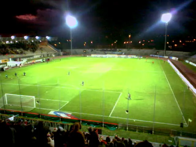
Stadio Città di Arezzo Wikimedia Commons · CC BY 2.5

Climate of Arezzo
Best months for sightseeingBest months for sightseeing: May–June, September.
This month · November
A wet month
Day 13° · Night 6° · Rain 114 mm
- Hottest month
- July (day 29°)
- Coldest month
- January (night 2°)
- Wettest month
- November (114 mm)
- Driest month
- July (41 mm)
Bars: average monthly low and high temperature. Below: precipitation. Monthly averages for 1970–2000 at about 18 km resolution, adjusted for elevation. Highlighted months are mild and relatively dry. Source: WorldClim 2.1 (CC BY 4.0).
Show values as a table
| Month | Jan | Feb | Mar | Apr | May | Jun | Jul | Aug | Sep | Oct | Nov | Dec |
|---|---|---|---|---|---|---|---|---|---|---|---|---|
| Average high (°C) | 9° | 10° | 13° | 17° | 22° | 26° | 29° | 29° | 25° | 19° | 13° | 10° |
| Average low (°C) | 2° | 3° | 5° | 7° | 11° | 15° | 17° | 17° | 15° | 11° | 6° | 3° |
| Precipitation (mm) | 63 | 70 | 72 | 83 | 73 | 66 | 41 | 53 | 78 | 102 | 114 | 87 |
How to get to Arezzo
The nearest airport is Florence Airport, Peretola (FLR), 65 km to the northwest as the crow flies. The nearest large city is Rijeka, 291 km to the northeast.
Airports
- Florence Airport, Peretola (FLR) Firenze (FI) 65 kmnorthwest
- Perugia San Francesco d'Assisi – Umbria International Airport (PEG) Perugia (PG) 67 kmsoutheast
- Forlì-Luigi Ridolfi International Airport (FRL) Forlì (FC) 82 kmnorth
Nearby large cities
- Rijeka Population: 108K 291 kmnortheast
- Ljubljana Population: 272.2K 354 kmnortheast
- Split Population: 149.8K 370 kmeast
- Nice Population: 342.7K 373 kmwest
- Klagenfurt Population: 100.3K 399 kmnortheast
Straight-line distances; road distances are longer. Airport data: OurAirports.
Day trips from Arezzo
Within 100 km: 94 historic and cultural sites, 241 natural sites, 26 lakes, rivers and coasts.
0–25 km3 places
- Valle Padonchia Natural site 20 kmE
- Valle Chimento Natural site 11 kmSE
- Stadio Città di Arezzo Landmark 3 kmSE
25–60 km123 places
- Monte del Pantano Mountain 54 kmE
- Isola Polvese Island 45 kmSE
- Monte della Zucca Mountain 33 kmNE
- Le Masse di Siena Mountain 47 kmSW
60–100 km235 places
- Appennino Umbro Mountain 67 kmSE
- Poggio di Iavello Mountain 84 kmNW
- Poggio Mosconcino Mountain 94 kmSW
- Parco della Rimembranza Natural site 100 kmSW
Straight-line distances.
Places in Arezzo
62 places- 1 Pitigliano 4.1K
- 2 Pratantico-Indicatore 3.1K
- 3 Battifolle-Ruscello-Poggiola 2.7K
- 4 Chiassa-Tregozzano 1.8K
- 5 Giovi-Ponte alla Chiassa 1.7K
- 6 Quarata 1.3K
- 7 Palazzo del Pero 645
- 8 Puglia 452
- 9 Patrignone 405
- 10 Antria 395
- 11 Cincelli 344
- 12 Campoluci 274
- 13 San Polo 219
- 14 Venere 192
- 15 Monte Sopra Rondine 125
- 16 Gorgone-Marmorino 113
- 17 Marcena 111
- 18 Stroppiello 111
- 19 San Firenze-Fonte di Sala 110
- 20 Meliciano 89
- 21 Salceta-Formicheto-Osteria 81
- 22 La Costa 66
- 23 Molin Bianco-Pian d'Usciano 59
- 24 Bossi-Cellaio 55
- 25 Lentignano 52
- 26 Campi 49
- 27 Casa alla Sisa 47
- 28 Molin Nuovo 45
- 29 Ranco di Frassineto 44
- 30 Bottega 42
- 31 La Pazienza 40
- 32 Peneto 39
- 33 La Filandra 34
- 34 Mugliano-Fattoria Mugliano 33
- 35 Osteria Nuova 33
- 36 Petrognano Basso 33
- 37 Tregozzano 32
- 38 Scopeto 31
- 39 Casa al Cincio 30
- 40 Stoppedarca 29
- 41 Molinelli 27
- 42 I Ponti 26
- 43 Talzano 26
- 44 Buon Riposo 25
- 45 I Sadotti 25
- 46 Le Poggiacce 22
- 47 Palazzetti 22
- 48 Donatiella 21
- 49 Il Busco 20
- 50 Porcile 18
- 51 Sereni 17
- 52 Le Lastre 16
- 53 Monte Petrognano 16
- 54 Muciafora 16
- 55 Terrarossa 16
- 56 Dosso 15
- 57 Il Torre 15
- 58 Fusatone-Molin Bianco 14
- 59 Santa Maria alla Rassinata 11
- 60 Casanuova di Ceciliano 9
Bar: population relative to the most populous place in this list.
Nearby attractions & nature
Everything nearby-
Valle Chimento Natural site, Tuscany11 km SE
-
Valle Padonchia Natural site, Tuscany20 km E
Sources & licences
Data last updated: