Lamporecchio
Located in Province of Pistoia, Tuscany Coordinates: 43°48′32″ N 10°53′19″ E
- Population
- 7,440
- 7.4K
- Elevation
- 55 m
- above sea level
- Local time
- UTC+01:00
- Europe/Rome · UTC+01:00
- Places inside
- 19
- listed under Lamporecchio
- Airports
- FLR Florence Airport, Peretola25 km
- PSA Pisa International Airport42 km
About Lamporecchio
Lamporecchio is a municipality. Location: Province of Pistoia, Tuscany. Population: 7,440. Elevation: 55 m. The best months to visit are May. The nearest airport is Florence Airport, Peretola (25 km). Nearby sights include Poggio Papinta and Sasso Regina.
Photos of Lamporecchio
-
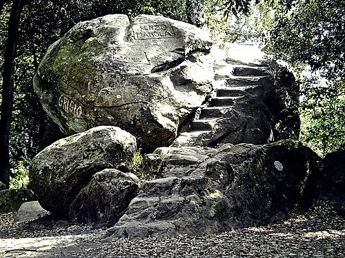
Monte Pietramarina Massimilianogalardi · CC BY-SA 3.0

Climate of Lamporecchio
Best months for sightseeingBest months for sightseeing: May.
This month · November
A wet month
Day 15° · Night 6° · Rain 118 mm
- Hottest month
- July (day 31°)
- Coldest month
- January (night 2°)
- Wettest month
- November (118 mm)
- Driest month
- July (35 mm)
Bars: average monthly low and high temperature. Below: precipitation. Monthly averages for 1970–2000 at about 18 km resolution, adjusted for elevation. Highlighted months are mild and relatively dry. Source: WorldClim 2.1 (CC BY 4.0).
Show values as a table
| Month | Jan | Feb | Mar | Apr | May | Jun | Jul | Aug | Sep | Oct | Nov | Dec |
|---|---|---|---|---|---|---|---|---|---|---|---|---|
| Average high (°C) | 11° | 12° | 15° | 18° | 23° | 27° | 31° | 31° | 26° | 21° | 15° | 11° |
| Average low (°C) | 2° | 3° | 5° | 8° | 12° | 15° | 18° | 18° | 15° | 11° | 6° | 3° |
| Precipitation (mm) | 70 | 63 | 71 | 84 | 65 | 56 | 35 | 58 | 88 | 113 | 118 | 83 |
Other places to visit in this season: May
How to get to Lamporecchio
The nearest airport is Florence Airport, Peretola (FLR), 25 km to the east as the crow flies. The nearest large city is Nice, 292 km to the west.
Airports
- Florence Airport, Peretola (FLR) Firenze (FI) 25 kmeast
- Pisa International Airport (PSA) Pisa (PI) 42 kmwest
- Bologna Guglielmo Marconi Airport (BLQ) Bologna 87 kmnorth
Nearby large cities
- Nice Population: 342.7K 292 kmwest
- Rijeka Population: 108K 329 kmnortheast
- Ljubljana Population: 272.2K 379 kmnortheast
- Innsbruck Population: 132.5K 386 kmnorth
Straight-line distances; road distances are longer. Airport data: OurAirports.
Day trips from Lamporecchio
Within 100 km: 67 historic and cultural sites, 208 natural sites, 32 lakes, rivers and coasts.
0–25 km43 places
- Poggio di Iavello Mountain 24 kmNE
- I Fornelli Mountain 10 kmE
- Poggio Ferrato Mountain 20 kmNE
- Monte Acuto Mountain 24 kmNE
25–60 km115 places
- Cala del Leone Beach 58 kmSW
- Spiaggia di Calignaia Beach 58 kmSW
- Spiaggia per Cani Beach 57 kmSW
- Spiaggia del Felciaio Beach 56 kmSW
60–100 km149 places
- Ultima Spiaggia Beach 99 kmS
- Mirollino Beach 97 kmS
- Fosso alle Canne Beach 99 kmS
- Altamarea Beach 95 kmS
Straight-line distances.
Places in Lamporecchio
19 places- 1 Lamporecchio 5.2K
- 2 San Baronto 522
- 3 Fornello 149
- 4 La Casuccia 125
- 5 Spicchio 113
- 6 Porciano 97
- 7 Ceppeto 75
- 8 Alberghi 56
- 9 Giugnano 42
- 10 Collececioli 41
- 11 La Berga 37
- 12 Centocampi 36
- 13 La Carraia 32
- 14 Poggio alla Baghera 28
- 15 Nardini 18
- 16 Lampaggio 14
- 17 Papiano 14
- 18 Casorelle 13
Bar: population relative to the most populous place in this list.
Mountains & nature1
- Monte Fiore · Mountain
Nearby attractions & nature
Everything nearby-
Poggio Papinta Mountain, Quarrata4.8 km NE
-
Sasso Regina Mountain, Quarrata5.8 km E
-
La Cupola Mountain, Vinci6.2 km E
-
Monte Cupoli Mountain, Larciano6.3 km N
-
Il Cupolino Mountain, Vinci6.4 km E
-
Monte Pietramarina Mountain, Vinci7.6 km E
-
Colle Belvedere Mountain, Serravalle Pistoiese8.1 km N
-
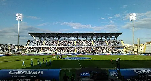 Stadio Carlo Castellani Landmark, Empoli11 km SE
Sources & licences
Data last updated: