
- Population
- 22
- 22
- Elevation
- 1,200 m
- above sea level
- Local time
- UTC+01:00
- Europe/Rome · UTC+01:00
- Airports
- PEG Perugia San Francesco d'Assisi – Umbria International Airport68 km
- PSR Abruzzo Airport92 km
About Opagna
Opagna is a village. Location: Cascia, Province of Perugia. Population: 22. Elevation: 1,200 m.
Opagna is a hamlet (frazione) of the municipality of Cascia in Umbria, Italy. It is situated at an elevation of 1,200 metres (3,900 ft) above sea level. Opagna is located along the SP 474 provincial road, which connects Cascia with Civita. The hamlet is known for the presence of dairy farms. As of 2021, it had a population of 16 inhabitants.
Source: Wikipedia · CC BY-SA 4.0
Photos of Opagna
-

LigaDue · CC BY-SA 4.0 -

LigaDue · CC BY-SA 4.0 -
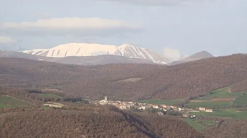
Monte Pozzoni Sentruper at Italian Wikipedia · Public domain


Climate of Opagna
Best months for sightseeingBest months for sightseeing: July–August.
This month · November
A cold month
Day 8° · Night 2° · Rain 83 mm
- Hottest month
- July (day 23°)
- Coldest month
- February (night -2°)
- Wettest month
- October (97 mm)
- Driest month
- January (41 mm)
Bars: average monthly low and high temperature. Below: precipitation. Monthly averages for 1970–2000 at about 18 km resolution, adjusted for elevation. Highlighted months are mild and relatively dry. Source: WorldClim 2.1 (CC BY 4.0).
Show values as a table
| Month | Jan | Feb | Mar | Apr | May | Jun | Jul | Aug | Sep | Oct | Nov | Dec |
|---|---|---|---|---|---|---|---|---|---|---|---|---|
| Average high (°C) | 4° | 4° | 7° | 10° | 15° | 19° | 23° | 23° | 18° | 13° | 8° | 4° |
| Average low (°C) | -2° | -2° | 0° | 2° | 7° | 10° | 13° | 13° | 10° | 6° | 2° | -1° |
| Precipitation (mm) | 41 | 50 | 51 | 66 | 78 | 79 | 68 | 67 | 89 | 97 | 83 | 56 |
How to get to Opagna
The nearest airport is Perugia San Francesco d'Assisi – Umbria International Airport (PEG), 68 km to the northwest as the crow flies. The nearest large city is Split, 288 km to the east.
Airports
- Perugia San Francesco d'Assisi – Umbria International Airport (PEG) Perugia (PG) 68 kmnorthwest
- Abruzzo Airport (PSR) Pescara 92 kmeast
- Ciampino–G. B. Pastine International Airport (CIA) Rome 104 kmsouthwest
Nearby large cities
- Split Population: 149.8K 288 kmeast
- Rijeka Population: 108K 316 kmnorth
- Ljubljana Population: 272.2K 393 kmnorth
Straight-line distances; road distances are longer. Airport data: OurAirports.
Day trips from Opagna
Within 100 km: 175 historic and cultural sites, 283 natural sites, 28 lakes, rivers and coasts.
0–25 km42 places
- Monte Guaidone Mountain 17 kmNE
- Monte Tilia Mountain 17 kmSW
- Monte Terminillo Mountain 22 kmS
- Monte Solenne Mountain 25 kmW
25–60 km172 places
- Valle Cerrese Natural site 48 kmSW
- Monte Zoccane Mountain 39 kmSW
- Monte Veticoso Mountain 55 kmSE
- Monte Vergozze Mountain 32 kmNW
60–100 km272 places
- Appennino Umbro Mountain 71 kmNW
- Giulianova Beach Beach 72 kmE
- Spiaggia Marina Palmense Beach 80 kmNE
- Spiaggia Lido di Fermo Beach 83 kmNE
Straight-line distances.
Nearby attractions & nature
Everything nearby-
Valle di Terzone Natural site, Lazio2.9 km SW
-
Monte Pozzoni Mountain, Lazio5.2 km E
-
Monte Laghetto Mountain, Accumoli6.2 km E
-
Monte Utero Mountain, Norcia9.4 km NE
-
Monte Arile Mountain, Monteleone di Spoleto11 km W
-
Monte Alto Mountain, Monteleone di Spoleto11 km W
Other cities and towns in Cascia


Sources & licences
Data last updated: · 2 independent sources