- Population
- 37,855
- 37.9K
- Elevation
- 312 m
- above sea level
- Local time
- UTC+01:00
- Europe/Rome · UTC+01:00
- Places inside
- 86
- listed under Spoleto
- Airports
- PEG Perugia San Francesco d'Assisi – Umbria International Airport43 km
- CIA Ciampino–G. B. Pastine International Airport106 km
About Spoleto
Spoleto is a municipality. Location: Province of Perugia, Umbria. Population: 37,855. Elevation: 312 m. The best months to visit are May–June, September–October. The nearest airport is Perugia San Francesco d'Assisi – Umbria International Airport (43 km). Nearby sights include Monte Solenne and Monte Felcito.
Photos of Spoleto
-
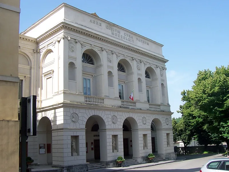
Teatro Nuovo Gian Carlo Menotti Geobia · CC BY-SA 3.0

Climate of Spoleto
Best months for sightseeingBest months for sightseeing: May–June, September–October.
This month · November
Outside the best season
Day 13° · Night 6° · Rain 76 mm
- Hottest month
- July (day 29°)
- Coldest month
- January (night 2°)
- Wettest month
- October (78 mm)
- Driest month
- January (40 mm)
Bars: average monthly low and high temperature. Below: precipitation. Monthly averages for 1970–2000 at about 18 km resolution, adjusted for elevation. Highlighted months are mild and relatively dry. Source: WorldClim 2.1 (CC BY 4.0).
Show values as a table
| Month | Jan | Feb | Mar | Apr | May | Jun | Jul | Aug | Sep | Oct | Nov | Dec |
|---|---|---|---|---|---|---|---|---|---|---|---|---|
| Average high (°C) | 9° | 10° | 13° | 16° | 21° | 25° | 29° | 29° | 24° | 19° | 13° | 10° |
| Average low (°C) | 2° | 2° | 4° | 7° | 11° | 15° | 17° | 18° | 14° | 11° | 6° | 3° |
| Precipitation (mm) | 40 | 47 | 46 | 56 | 62 | 58 | 42 | 51 | 71 | 78 | 76 | 58 |
Other places to visit in this season: May June September October
How to get to Spoleto
The nearest airport is Perugia San Francesco d'Assisi – Umbria International Airport (PEG), 43 km to the northwest as the crow flies. The nearest large city is Split, 313 km to the east.
Airports
- Perugia San Francesco d'Assisi – Umbria International Airport (PEG) Perugia (PG) 43 kmnorthwest
- Ciampino–G. B. Pastine International Airport (CIA) Rome 106 kmsouth
- Marche Airport (AOI) Falconara Marittima (AN) 109 kmnortheast
Nearby large cities
- Split Population: 149.8K 313 kmeast
- Rijeka Population: 108K 318 kmnortheast
- Ljubljana Population: 272.2K 393 kmnorth
Straight-line distances; road distances are longer. Airport data: OurAirports.
Day trips from Spoleto
Within 100 km: 152 historic and cultural sites, 291 natural sites, 12 lakes, rivers and coasts.
0–25 km23 places
- Monte Vergozze Mountain 13 kmNE
- Monte Vagliamenti Mountain 15 kmSW
- Monte Solenne Mountain 11 kmSE
- Monte Sciudri Mountain 17 kmSE
25–60 km109 places
- Appennino Umbro Mountain 49 kmN
- Valle Cerrese Natural site 44 kmS
- Monte Guaidone Mountain 39 kmE
- Monte Zoccane Mountain 45 kmS
60–100 km323 places
- Monte del Pantano Mountain 92 kmN
- Spiaggia Marina Palmense Beach 99 kmNE
- Spiaggia Lido di Fermo Beach 100 kmNE
- Spiaggia Cupra Marittima Beach 97 kmE
Straight-line distances.
Places in Spoleto
86 places- 61 San Filippo 34
- 62 Casal di Mezzo 31
- 63 Meggiano 31
- 64 Perchia 30
- 65 Case Vecchie 28
- 66 Monteluco 27
- 67 Osteria di Palazzaccio 27
- 68 Belvedere 25
- 69 Morro 25
- 70 Case Mareggio 24
- 71 Pincano 24
- 72 Rapicciano 22
- 73 San Beroide 21
- 74 Carbognano 18
- 75 Petrognano 18
- 76 Zona Industriale San Giacomo 18
- 77 Cascinano 17
- 78 Vallocchia 16
- 79 Acqualacastagna 13
- 80 Il Palazzo 13
- 81 Torrecola 11
- 82 Cese 9
- 83 Cappuccini 7
- 84 Cementir 6
Bar: population relative to the most populous place in this list.
Mountains & nature1
- Monte Fionchi · Mountain
Heritage & sights1
- Teatro Nuovo Gian Carlo Menotti · Attraction
Nearby attractions & nature
Everything nearby-
Monte Solenne Mountain, Ferentillo11 km SE
-
Monte Felcito Mountain, Campello sul Clitunno11 km NE
-
Monte Vergozze Mountain, Campello sul Clitunno13 km NE
-
Monte Santo Mountain, Campello sul Clitunno13 km NE
-
Monte della Rocca Mountain, Poggiodomo14 km E
-
Monte Brunette Mountain, Trevi16 km N
-
Monte Pagliaro Mountain, Cerreto di Spoleto17 km E
-
Monte Motola Mountain, Monteleone di Spoleto17 km SE
Sources & licences
Data last updated: