- Population
- 281
- 281
- Elevation
- 463 m
- above sea level
- Local time
- UTC+01:00
- Europe/Rome · UTC+01:00
- Airports
- PEG Perugia San Francesco d'Assisi – Umbria International Airport62 km
- FCO Rome–Fiumicino Leonardo da Vinci International Airport83 km
About Porchiano
Porchiano is a village. Location: Amelia, Province of Terni. Population: 281. Elevation: 463 m. The best months to visit are May–June, September. The nearest airport is Perugia San Francesco d'Assisi – Umbria International Airport (62 km). Nearby sights include Villa Lante and Monte Croce di Serra.
Climate of Porchiano
Best months for sightseeingBest months for sightseeing: May–June, September.
This month · November
Outside the best season
Day 12° · Night 5° · Rain 54 mm
- Hottest month
- July (day 28°)
- Coldest month
- January (night 1°)
- Wettest month
- October (54 mm)
- Driest month
- July (20 mm)
Bars: average monthly low and high temperature. Below: precipitation. Monthly averages for 1970–2000 at about 18 km resolution, adjusted for elevation. Highlighted months are mild and relatively dry. Source: WorldClim 2.1 (CC BY 4.0).
Show values as a table
| Month | Jan | Feb | Mar | Apr | May | Jun | Jul | Aug | Sep | Oct | Nov | Dec |
|---|---|---|---|---|---|---|---|---|---|---|---|---|
| Average high (°C) | 8° | 9° | 12° | 15° | 20° | 24° | 28° | 28° | 24° | 18° | 12° | 9° |
| Average low (°C) | 1° | 2° | 3° | 6° | 10° | 14° | 16° | 16° | 14° | 10° | 5° | 2° |
| Precipitation (mm) | 31 | 34 | 32 | 39 | 40 | 33 | 20 | 30 | 45 | 54 | 54 | 42 |
How to get to Porchiano
The nearest airport is Perugia San Francesco d'Assisi – Umbria International Airport (PEG), 62 km to the north as the crow flies. The nearest large city is Split, 350 km to the east.
Airports
- Perugia San Francesco d'Assisi – Umbria International Airport (PEG) Perugia (PG) 62 kmnorth
- Rome–Fiumicino Leonardo da Vinci International Airport (FCO) Rome 83 kmsouth
- Ciampino–G. B. Pastine International Airport (CIA) Rome 86 kmsouth
Nearby large cities
- Split Population: 149.8K 350 kmeast
- Rijeka Population: 108K 351 kmnortheast
Straight-line distances; road distances are longer. Airport data: OurAirports.
Day trips from Porchiano
Within 100 km: 119 historic and cultural sites, 214 natural sites, 21 lakes, rivers and coasts.
0–25 km11 places
- Monte Vagliamenti Mountain 23 kmNE
- Monte Trassiuari Mountain 18 kmSE
- Monte San Pancrazio Mountain 24 kmSE
- Monte la Pallanzana Mountain 24 kmSW
25–60 km83 places
- Valle Cerrese Natural site 35 kmSE
- Isola Bisentina Island 37 kmW
- Monte Zoccane Mountain 48 kmSE
- Monti Volsini Mountain 38 kmW
60–100 km260 places
- Appennino Umbro Mountain 71 kmN
- Boca Do Mar Beach 66 kmSW
- Ultima Spiaggia Beach 77 kmW
- Siaggia delle graticciare Beach 76 kmW
Straight-line distances.
Nearby attractions & nature
Everything nearby-
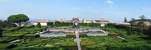 Villa Lante Attraction, Viterbo21 km SW
-
Monte Croce di Serra Mountain, Montecchio11 km N
-
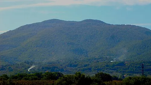 Monte Cimino Mountain, Soriano nel Cimino20 km SW
-
Monte Castellaro Mountain, Montecchio15 km N
-
Monte Bello Mountain, Baschi17 km N
-
Monte Trassiuari Mountain, Narni18 km SE
Other cities and towns in Amelia
-
 Fornole Village, Amelia8.4 km E
-
Macchie Village, Amelia5.3 km N
-
 Foce Village, Amelia8.5 km E
-
Testa di Lepre Village, Amelia8.1 km E
-
Fornaci Village, Amelia7.9 km E
-
Montecampano Village, Amelia7.5 km SE
Sources & licences
Data last updated: