Monte Solarolo
Located in Seren del Grappa, Province of Belluno Coordinates: 45°55′00″ N 11°50′00″ E
- Elevation
- 1,625 m
- above sea level
- Local time
- UTC+01:00
- Europe/Rome · UTC+01:00
- Airports
- TSF Treviso Airport41 km
- VCE Venice Marco Polo Airport61 km
About Monte Solarolo
Monte Solarolo is a mountain. Location: Seren del Grappa, Province of Belluno. Elevation: 1,625 m.
Monte Solarolo is a mountain of the Veneto, Italy. It has an elevation of 1,625 metres. Monte Solarolo, one of the "Solaroli" peaks, is one of several peaks on the ridge from Monte Valderoa leads to the summit of Monte Grappa. This divides two important valleys of the massif, the Valley of Mure, descending becomes the torrent valley muscardine (Alano di Piave) and the Valley of Seren del Grappa, on the low Feltrino territory on the border with the municipalities of the Treviso foothills of Mt. Grappa.
Source: Wikipedia · CC BY-SA 4.0
Climate of Monte Solarolo
Best months for sightseeingBest months for sightseeing: July–August.
This month · November
A cold month
Day 3° · Night -4° · Rain 68 mm
- Hottest month
- July (day 19°)
- Coldest month
- January (night -8°)
- Wettest month
- June (99 mm)
- Driest month
- February (39 mm)
Bars: average monthly low and high temperature. Below: precipitation. Monthly averages for 1970–2000 at about 18 km resolution, adjusted for elevation. Highlighted months are mild and relatively dry. Source: WorldClim 2.1 (CC BY 4.0).
Show values as a table
| Month | Jan | Feb | Mar | Apr | May | Jun | Jul | Aug | Sep | Oct | Nov | Dec |
|---|---|---|---|---|---|---|---|---|---|---|---|---|
| Average high (°C) | -2° | 0° | 4° | 7° | 12° | 16° | 19° | 18° | 14° | 9° | 3° | -1° |
| Average low (°C) | -8° | -8° | -5° | -1° | 4° | 7° | 9° | 9° | 6° | 1° | -4° | -8° |
| Precipitation (mm) | 40 | 39 | 50 | 67 | 87 | 99 | 88 | 92 | 84 | 91 | 68 | 44 |
How to get to Monte Solarolo
The nearest airport is Treviso Airport (TSF), 41 km to the southeast as the crow flies. The nearest large city is Innsbruck, 153 km to the north.
Airports
- Treviso Airport (TSF) Treviso (TV) 41 kmsoutheast
- Venice Marco Polo Airport (VCE) Venezia (VE) 61 kmsoutheast
- Bolzano Airport (BZO) Bolzano (BZ) 72 kmnorthwest
Nearby large cities
- Innsbruck Population: 132.5K 153 kmnorth
- Klagenfurt Population: 100.3K 206 kmnortheast
- Ljubljana Population: 272.2K 208 kmeast
- Rijeka Population: 108K 214 kmeast
- Salzburg Population: 157.2K 229 kmnortheast
Straight-line distances; road distances are longer. Airport data: OurAirports.
Day trips from Monte Solarolo
Within 100 km: 64 historic and cultural sites, 1,341 natural sites, 27 lakes, rivers and coasts.
0–25 km40 places
- Col de Moi Mountain 25 kmNE
- Col Moscher Mountain 20 kmNE
- Monte Tesoro Mountain 11 kmE
- Monte Roncon Mountain 7 kmN
25–60 km505 places
- Croda Nera Mountain 58 kmN
- Mislkopf Mountain 36 kmNW
- Santa Corona Attraction 46 kmSW
- Lora Mountain 54 kmW
60–100 km887 places
- Burano Island 66 kmSE
- Sacca Fisola Island 66 kmSE
- San Clemente Island 69 kmSE
- Spadalone Mountain 90 kmW
Straight-line distances.
Nearest towns and villages
-
Pieve del Grappa Municipality, Province of Treviso6.7 km S
-
 Stalle Village, Seren del Grappa5.7 km N
-
Alano di Piave Village, Setteville5.9 km E
-
Setteville Municipality, Province of Belluno7 km E
-
Schievenin Village, Setteville5.2 km NE
-
Campo Village, Setteville6.6 km E
Nearby attractions & nature
Everything nearby-
Cima Sassuma Mountain, Seren del Grappa6.6 km NE
-
Monte Roncon Mountain, Seren del Grappa6.7 km N
-
Monte Santo Mountain, Seren del Grappa7.1 km NE
-
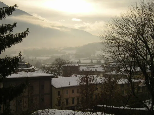 Monte Tomatico Mountain, Feltre9.1 km NE
-
Monte Palla Mountain, Borso del Grappa8.4 km SW
-
Monte Tesoro Mountain, Segusino11 km E
-
Monte Barbari Mountain, Valdobbiadene15 km E
-
Monega Di Campo Mountain, Arsiè15 km NW
Sources & licences
Data last updated: · 2 independent sources