- Population
- 19,347
- 19.3K
- Elevation
- 2 m
- above sea level
- Local time
- UTC+01:00
- Europe/Rome · UTC+01:00
- Places inside
- 27
- listed under Adria
- Airports
- VCE Venice Marco Polo Airport55 km
- TSF Treviso Airport67 km
About Adria
Adria is a municipality. Location: Province of Rovigo, Veneto. Population: 19,347. Elevation: 2 m. The best months to visit are May–June, September. The nearest airport is Venice Marco Polo Airport (55 km). Nearby sights include Teatro Sociale and Valle del Brenta.
Climate of Adria
Best months for sightseeingBest months for sightseeing: May–June, September.
This month · November
A cold month
Day 11° · Night 5° · Rain 67 mm
- Hottest month
- July (day 28°)
- Coldest month
- January (night 0°)
- Wettest month
- August (71 mm)
- Driest month
- February (35 mm)
Bars: average monthly low and high temperature. Below: precipitation. Monthly averages for 1970–2000 at about 18 km resolution, adjusted for elevation. Highlighted months are mild and relatively dry. Source: WorldClim 2.1 (CC BY 4.0).
Show values as a table
| Month | Jan | Feb | Mar | Apr | May | Jun | Jul | Aug | Sep | Oct | Nov | Dec |
|---|---|---|---|---|---|---|---|---|---|---|---|---|
| Average high (°C) | 6° | 9° | 13° | 18° | 23° | 26° | 28° | 28° | 24° | 18° | 11° | 7° |
| Average low (°C) | 0° | 1° | 4° | 8° | 13° | 16° | 19° | 18° | 15° | 10° | 5° | 1° |
| Precipitation (mm) | 47 | 35 | 45 | 53 | 61 | 62 | 43 | 71 | 64 | 69 | 67 | 52 |
How to get to Adria
The nearest airport is Venice Marco Polo Airport (VCE), 55 km to the northeast as the crow flies. The nearest large city is Rijeka, 190 km to the east.
Airports
- Venice Marco Polo Airport (VCE) Venezia (VE) 55 kmnortheast
- Treviso Airport (TSF) Treviso (TV) 67 kmnorth
- Bologna Guglielmo Marconi Airport (BLQ) Bologna 84 kmsouthwest
Nearby large cities
- Rijeka Population: 108K 190 kmeast
- Ljubljana Population: 272.2K 221 kmnortheast
- Klagenfurt Population: 100.3K 247 kmnortheast
- Innsbruck Population: 132.5K 250 kmnorth
- Salzburg Population: 157.2K 314 kmnorth
Straight-line distances; road distances are longer. Airport data: OurAirports.
Day trips from Adria
Within 100 km: 73 historic and cultural sites, 59 natural sites, 36 lakes, rivers and coasts.
0–25 km5 places
- Spiaggia di Isola Bacucco Beach 25 kmNE
- Spiaggia di Rosolina Mare Beach 23 kmE
- Spiaggia Libera Albarella Beach 22 kmE
- Valle del Brenta Natural site 24 kmNE
25–60 km79 places
- Burano Island 56 kmNE
- Sacca Fisola Island 46 kmNE
- San Clemente Island 45 kmNE
- Lido di Pomposa Beach 40 kmS
60–100 km84 places
- Spiaggia di Caorle Beach 88 kmNE
- Spiaggia di Levante Beach 90 kmNE
- Santa Corona Attraction 68 kmNW
- Vela Beach 70 kmS
Straight-line distances.
Places in Adria
27 places- 1 Adria 13K
- 2 Bottrighe 2.1K
- 3 Valliera 719
- 4 Baricetta 616
- 5 Ca' Emo 423
- 6 Fasana Polesine 347
- 7 Bellombra 238
- 8 Palazzon 138
- 9 Mazzorno Sinistro 123
- 10 San Pietro Basso 93
- 11 Canton 70
- 12 Canareggio 68
- 13 Case Beviacqua 63
- 14 Piantamelon 56
- 15 Canton Basso 53
- 16 Isolella 50
- 17 Sabbioni 50
- 18 Capitello 42
- 19 San Giovanni 39
- 20 Case Matte 34
- 21 Fienile Santissimo 27
- 22 Adriatica 26
- 23 Montefalche 26
- 24 Campelli II 21
- 25 Forcarigoli 19
- 26 Tiro a Segno 18
- 27 Smergoncino 14
Bar: population relative to the most populous place in this list.
Nearby attractions & nature
Everything nearby-
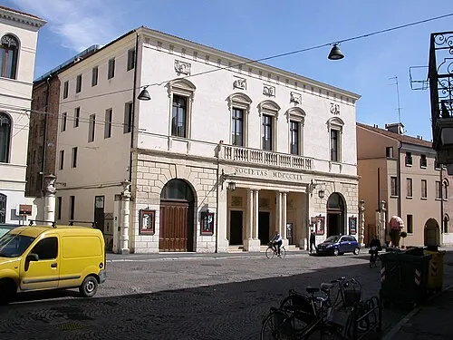 Teatro Sociale Attraction, Rovigo21 km W
-
Valle del Brenta Natural site, Veneto24 km NE
-
Spiaggia di Isola Bacucco Beach, Chioggia25 km NE
-
Spiaggia di Rosolina Mare Beach, Rosolina23 km E
-
Spiaggia Libera Albarella Beach, Rosolina22 km E
Sources & licences
Data last updated: