- Population
- 16
- 16
- Elevation
- 15 m
- above sea level
- Local time
- UTC+01:00
- Europe/Rome · UTC+01:00
- Airports
- TSF Treviso Airport7 km
- VCE Venice Marco Polo Airport15 km
About Tegolaia
Tegolaia is a village. Location: Casier, Province of Treviso. Population: 16. Elevation: 15 m. The best months to visit are May–June, September. The nearest airport is Treviso Airport (7 km).
Photos of Tegolaia
-
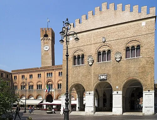
Palazzo dei Trecento Didier Descouens · CC BY-SA 4.0 -
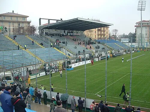
Stadio Omobono Tenni LigaDue · CC BY-SA 3.0


Climate of Tegolaia
Best months for sightseeingBest months for sightseeing: May–June, September.
This month · November
A cold month
Day 12° · Night 4° · Rain 77 mm
- Hottest month
- July (day 28°)
- Coldest month
- January (night -1°)
- Wettest month
- June (89 mm)
- Driest month
- February (45 mm)
Bars: average monthly low and high temperature. Below: precipitation. Monthly averages for 1970–2000 at about 18 km resolution, adjusted for elevation. Highlighted months are mild and relatively dry. Source: WorldClim 2.1 (CC BY 4.0).
Show values as a table
| Month | Jan | Feb | Mar | Apr | May | Jun | Jul | Aug | Sep | Oct | Nov | Dec |
|---|---|---|---|---|---|---|---|---|---|---|---|---|
| Average high (°C) | 7° | 9° | 13° | 17° | 22° | 26° | 28° | 28° | 24° | 18° | 12° | 7° |
| Average low (°C) | -1° | 0° | 4° | 7° | 12° | 16° | 18° | 18° | 14° | 9° | 4° | 0° |
| Precipitation (mm) | 56 | 45 | 56 | 73 | 82 | 89 | 65 | 74 | 76 | 84 | 77 | 58 |
How to get to Tegolaia
The nearest airport is Treviso Airport (TSF), 7 km to the west as the crow flies. The nearest large city is Rijeka, 173 km to the east.
Airports
- Treviso Airport (TSF) Treviso (TV) 7 kmwest
- Venice Marco Polo Airport (VCE) Venezia (VE) 15 kmsouth
- Trieste Airport (TRS) Ronchi dei Legionari/Trieste 95 kmeast
Nearby large cities
- Rijeka Population: 108K 173 kmeast
- Ljubljana Population: 272.2K 179 kmeast
- Klagenfurt Population: 100.3K 191 kmnortheast
- Innsbruck Population: 132.5K 193 kmnorth
- Salzburg Population: 157.2K 248 kmnorth
Straight-line distances; road distances are longer. Airport data: OurAirports.
Day trips from Tegolaia
Within 100 km: 51 historic and cultural sites, 677 natural sites, 36 lakes, rivers and coasts.
0–25 km38 places
- Burano Island 20 kmSE
- Sacca Fisola Island 23 kmS
- Litorale Sant Erasmo Beach 22 kmSE
- San Servolo Island 25 kmS
25–60 km114 places
- San Clemente Island 25 kmS
- Spiaggia di Caorle Beach 47 kmE
- Spiaggia di Levante Beach 48 kmE
- Santa Corona Attraction 58 kmW
60–100 km612 places
- Croda Nera Mountain 97 kmNW
- Mislkopf Mountain 83 kmNW
- Savudrija Lighthouse Landmark 96 kmE
- Spiaggia di Marina Julia Beach 99 kmE
Straight-line distances.
Sources & licences
Data last updated: · 2 independent sources