Montebelluna
Located in Province of Treviso, Veneto Coordinates: 45°46′41″ N 12°02′55″ E
- Population
- 31,380
- 31.4K
- Elevation
- 116 m
- above sea level
- Local time
- UTC+01:00
- Europe/Rome · UTC+01:00
- Places inside
- 33
- listed under Montebelluna
- Airports
- TSF Treviso Airport18 km
- VCE Venice Marco Polo Airport38 km
About Montebelluna
Montebelluna is a municipality. Location: Province of Treviso, Veneto. Population: 31,380. Elevation: 116 m. The best months to visit are May–June, September. The nearest airport is Treviso Airport (18 km). Nearby sights include Colesel Val dell'Acqua and Monte Collalto.
Climate of Montebelluna
Best months for sightseeingBest months for sightseeing: May–June, September.
This month · November
A cold month
Day 12° · Night 3° · Rain 84 mm
- Hottest month
- July (day 29°)
- Coldest month
- January (night -2°)
- Wettest month
- June (103 mm)
- Driest month
- February (51 mm)
Bars: average monthly low and high temperature. Below: precipitation. Monthly averages for 1970–2000 at about 18 km resolution, adjusted for elevation. Highlighted months are mild and relatively dry. Source: WorldClim 2.1 (CC BY 4.0).
Show values as a table
| Month | Jan | Feb | Mar | Apr | May | Jun | Jul | Aug | Sep | Oct | Nov | Dec |
|---|---|---|---|---|---|---|---|---|---|---|---|---|
| Average high (°C) | 7° | 9° | 13° | 17° | 22° | 26° | 29° | 28° | 24° | 18° | 12° | 7° |
| Average low (°C) | -2° | -1° | 3° | 7° | 12° | 15° | 18° | 17° | 13° | 8° | 3° | -1° |
| Precipitation (mm) | 61 | 51 | 65 | 80 | 94 | 103 | 75 | 84 | 84 | 100 | 84 | 65 |
How to get to Montebelluna
The nearest airport is Treviso Airport (TSF), 18 km to the southeast as the crow flies. The nearest large city is Innsbruck, 173 km to the north.
Airports
- Treviso Airport (TSF) Treviso (TV) 18 kmsoutheast
- Venice Marco Polo Airport (VCE) Venezia (VE) 38 kmsoutheast
- Bolzano Airport (BZO) Bolzano (BZ) 94 kmnorthwest
Nearby large cities
- Innsbruck Population: 132.5K 173 kmnorth
- Ljubljana Population: 272.2K 193 kmeast
- Rijeka Population: 108K 194 kmeast
- Klagenfurt Population: 100.3K 198 kmnortheast
- Salzburg Population: 157.2K 237 kmnorth
Straight-line distances; road distances are longer. Airport data: OurAirports.
Day trips from Montebelluna
Within 100 km: 66 historic and cultural sites, 1,061 natural sites, 32 lakes, rivers and coasts.
0–25 km23 places
- Mondragon Mountain 23 kmNE
- Monte Tesoro Mountain 18 kmN
- Monte Solarolo Mountain 23 kmNW
- Col Pasanova Mountain 19 kmN
25–60 km277 places
- Burano Island 43 kmSE
- Sacca Fisola Island 44 kmSE
- San Clemente Island 47 kmSE
- Mislkopf Mountain 59 kmNW
60–100 km859 places
- Dosso Rotondo Mountain 83 kmW
- Piz Gralba Mountain 85 kmN
- Piz Miara Mountain 85 kmN
- Croda Nera Mountain 76 kmN
Straight-line distances.
Places in Montebelluna
33 places- 1 Montebelluna 26.7K
- 2 Busta 554
- 3 Martinella-Alte 337
- 4 Traversaghi 127
- 5 Capitello 99
- 6 Martinella I-Picciol 96
- 7 Poloniato 65
- 8 Ca Falier 62
- 9 Dei Venturato 58
- 10 Calmaggiore I 50
- 11 Degli Ontani 41
- 12 Cerer 39
- 13 M.Pertica 36
- 14 Del Cristo 35
- 15 Maglio 32
- 16 Case Bergamin 31
- 17 Talponada 31
- 18 Case Piva 30
- 19 Vaccari 29
- 20 Zapparè Sud 29
- 21 Case Mangilli 28
- 22 Caberlotto 27
- 23 Case Dametto 27
- 24 Sottorive 24
- 25 Perer 23
- 26 Castellana I 21
- 27 Del Termine 21
- 28 Case Brunetta 18
- 29 Rive 18
- 30 Florida 15
- 31 Villette 14
- 32 Feltrina 13
- 33 Campi Longhi 4
Bar: population relative to the most populous place in this list.
Nearby attractions & nature
Everything nearby-
Colesel Val dell'Acqua Mountain, Volpago del Montello5.1 km NE
-
Monte Collalto Mountain, Maser8.3 km NW
-
Monte Calmoreggio Mountain, Maser8.6 km NW
-
Col Mongarda Mountain, Valdobbiadene14 km N
-
Monte Moncader Mountain, Farra di Soligo15 km N
-
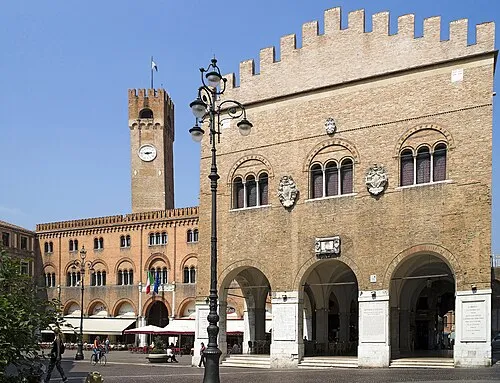 Palazzo dei Trecento Historic site, Treviso20 km SE
-
Col Maor Mountain, Farra di Soligo17 km N
-
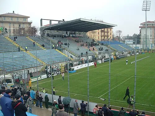 Stadio Omobono Tenni Landmark, Treviso20 km SE
Sources & licences
Data last updated: