- Population
- 24,909
- 24.9K
- Elevation
- 4 m
- above sea level
- Local time
- UTC+01:00
- Europe/Rome · UTC+01:00
- Places inside
- 38
- listed under Portogruaro
- Airports
- VCE Venice Marco Polo Airport49 km
- TRS Trieste Airport49 km
About Portogruaro
Portogruaro is a municipality. Location: Province of Venice, Veneto. Population: 24,909. Elevation: 4 m. The best months to visit are May–June, September. The nearest airport is Venice Marco Polo Airport (49 km). Nearby sights include Spiaggia di Caorle and Spiaggia di Porto Santa Margherita.
Climate of Portogruaro
Best months for sightseeingBest months for sightseeing: May–June, September.
This month · November
Outside the best season
Day 12° · Night 4° · Rain 92 mm
- Hottest month
- July (day 29°)
- Coldest month
- January (night 0°)
- Wettest month
- June (114 mm)
- Driest month
- February (51 mm)
Bars: average monthly low and high temperature. Below: precipitation. Monthly averages for 1970–2000 at about 18 km resolution, adjusted for elevation. Highlighted months are mild and relatively dry. Source: WorldClim 2.1 (CC BY 4.0).
Show values as a table
| Month | Jan | Feb | Mar | Apr | May | Jun | Jul | Aug | Sep | Oct | Nov | Dec |
|---|---|---|---|---|---|---|---|---|---|---|---|---|
| Average high (°C) | 7° | 9° | 13° | 17° | 22° | 26° | 29° | 28° | 24° | 19° | 12° | 8° |
| Average low (°C) | 0° | 1° | 4° | 8° | 13° | 16° | 18° | 18° | 14° | 9° | 4° | 1° |
| Precipitation (mm) | 65 | 51 | 78 | 94 | 93 | 114 | 69 | 81 | 106 | 114 | 92 | 78 |
How to get to Portogruaro
The nearest airport is Venice Marco Polo Airport (VCE), 49 km to the southwest as the crow flies. The nearest large city is Ljubljana, 133 km to the east.
Airports
- Venice Marco Polo Airport (VCE) Venezia (VE) 49 kmsouthwest
- Trieste Airport (TRS) Ronchi dei Legionari/Trieste 49 kmeast
- Treviso Airport (TSF) Treviso (TV) 52 kmwest
Nearby large cities
- Ljubljana Population: 272.2K 133 kmeast
- Rijeka Population: 108K 135 kmeast
- Klagenfurt Population: 100.3K 147 kmnortheast
- Innsbruck Population: 132.5K 199 kmnorthwest
- Salzburg Population: 157.2K 225 kmnorth
Straight-line distances; road distances are longer. Airport data: OurAirports.
Day trips from Portogruaro
Within 100 km: 53 historic and cultural sites, 604 natural sites, 54 lakes, rivers and coasts.
0–25 km7 places
- Spiaggia di Caorle Beach 21 kmS
- Spiaggia di Levante Beach 20 kmS
- Spiaggia di Porto Santa Margherita Beach 22 kmS
- Spiaggia di Bibione Beach 24 kmSE
25–60 km145 places
- Burano Island 46 kmSW
- Sacca Fisola Island 56 kmSW
- San Clemente Island 57 kmSW
- Spiaggia Sorriso Beach 56 kmSW
60–100 km559 places
- Raša River 82 kmE
- Lake Bohinj Lake 97 kmNE
- Markovec Mountain 72 kmE
- Prestreljenik Mountain 81 kmNE
Straight-line distances.
Places in Portogruaro
38 places- 1 Portogruaro 17.5K
- 2 Summaga 1.6K
- 3 Lugugnana 1.1K
- 4 Pradipozzo 798
- 5 Giussago 485
- 6 Lison 209
- 7 Torresella 159
- 8 Beni Comuni 153
- 9 Mazzolada 150
- 10 Osteria al Trovatore 101
- 11 Fossalato 90
- 12 Ca' Longa 80
- 13 Ca' Gaiotto 79
- 14 Serrai 77
- 15 Alta di Pradipozzo 67
- 16 Contrada Monteron 50
- 17 Marina 48
- 18 Bussolini 45
- 19 La Pietra 45
- 20 Viola 45
- 21 Scuola Serrai 42
- 22 Ronchi 39
- 23 Stazione Lison 35
- 24 Debbio 33
- 25 Campeio 32
- 26 Gardissere 31
- 27 Borgo di Mezzo 27
- 28 Ca' Ghetto 26
- 29 Cao Mozzo 21
- 30 De' Franceschi 21
- 31 Le Lame 19
- 32 Ca' Regini 18
- 33 Ca' Cantele 17
- 34 Cavariol 17
- 35 Frassinella 17
- 36 Selvamaggiore 17
- 37 Ca' Macchinetta 15
- 38 Nosedo 12
Bar: population relative to the most populous place in this list.
Nearby attractions & nature
Everything nearby-
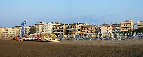 Spiaggia di Caorle Beach, Province of Venice21 km S
-
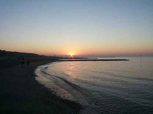 Spiaggia di Porto Santa Margherita Beach, Caorle22 km S
-
Spiaggia di Duna Verde Beach, Caorle24 km S
-
Spiaggia di Bibione Pineda Beach, San Michele al Tagliamento21 km SE
-
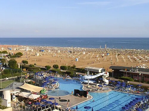 Spiaggia di Bibione Beach, San Michele al Tagliamento24 km SE
-
Spiaggia di Lignano Pineta Beach, Italy25 km SE
-
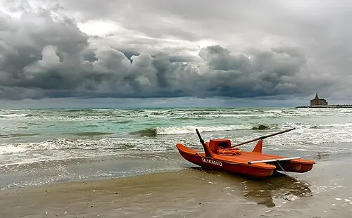 Spiaggia di Levante Beach, Italy20 km S
Sources & licences
Data last updated: