- Population
- 22,064
- 22.1K
- Elevation
- 7 m
- above sea level
- Local time
- UTC+09:00
- Asia/Tokyo · UTC+09:00
- Airports
- NGO Chubu Centrair International Airport51 km
- NKM Nagoya Airport / JASDF Komaki Air Base64 km
About Kozakai-chō
Kozakai-chō is a neighbourhood. Location: Toyokawa-shi, Aichi. Population: 22,064.
Kozakai (小坂井町, Kozakai-chō) was a town located in Hoi District, Aichi Prefecture, Japan. As of November 1, 2007, (the last census information available) the town had an estimated population of 22,708 and a population density of 2,188.31 persons per km2. The total area was 9.92 km2. On February 1, 2010, Kozakai was merged into the expanded city of Toyokawa. Therefore, Hoi District was dissolved as a result of this merger.
Source: Wikipedia · CC BY-SA 4.0
At a glance
- Built
- 1926
- Area
- 9.9 km²
Source: Wikidata
Climate of Kozakai-chō
Best months for sightseeingBest months for sightseeing: May–June, October.
This month · November
A wet month
Day 17° · Night 9° · Rain 107 mm
Better nearby cities in November
- Fujinomiya · 124 km east18°
- Fuji · 127 km east20°
- Numazu · 141 km east18°
- Hottest month
- August (day 31°)
- Coldest month
- January (night 2°)
- Wettest month
- June (259 mm)
- Driest month
- December (60 mm)
Bars: average monthly low and high temperature. Below: precipitation. Monthly averages for 1970–2000 at about 18 km resolution, adjusted for elevation. Highlighted months are mild and relatively dry. Source: WorldClim 2.1 (CC BY 4.0).
Show values as a table
| Month | Jan | Feb | Mar | Apr | May | Jun | Jul | Aug | Sep | Oct | Nov | Dec |
|---|---|---|---|---|---|---|---|---|---|---|---|---|
| Average high (°C) | 9° | 10° | 14° | 19° | 23° | 25° | 29° | 31° | 27° | 22° | 17° | 12° |
| Average low (°C) | 2° | 2° | 5° | 10° | 14° | 19° | 22° | 23° | 20° | 15° | 9° | 4° |
| Precipitation (mm) | 61 | 81 | 136 | 185 | 201 | 259 | 227 | 217 | 228 | 177 | 107 | 60 |
How to get to Kozakai-chō
The nearest airport is Chubu Centrair International Airport (NGO), 51 km to the west as the crow flies. The nearest large city is Toyokawa, 4 km to the northeast.
Airports
- Chubu Centrair International Airport (NGO) Tokoname 51 kmwest
- Nagoya Airport / JASDF Komaki Air Base (NKM) Nagoya 64 kmnorthwest
- Mount Fuji Shizuoka Airport (FSZ) Makinohara / Shimada 76 kmeast
Nearby large cities
- Toyokawa Population: 184.7K 4 kmnortheast
- Toyohashi Population: 377.5K 4 kmsoutheast
- Okazaki Population: 384.7K 24 kmnorthwest
- Nishio Population: 170K 29 kmwest
- Anjo Population: 188.7K 31 kmnorthwest
Straight-line distances; road distances are longer. Airport data: OurAirports.
Day trips from Kozakai-chō
Within 100 km: 8 historic and cultural sites, 12 natural sites, 29 lakes, rivers and coasts.
0–25 km4 places
- Toyo River River 4 kmSW
- Mikawa-wan Natural site 23 kmSW
- Hongū-zan Mountain 12 kmNE
- Atsumi Peninsula Natural site 19 kmSW
25–60 km22 places
- Tōshi-jima Island 53 kmSW
- Himakajima Island 34 kmW
- Sakate-jima Island 58 kmSW
- Kami-jima Island 44 kmSW
60–100 km23 places
- Kashiko Island Island 74 kmSW
- Oi River River 85 kmE
- Abe River River 96 kmE
- Kumozu River River 77 kmW
Straight-line distances.
Nearby attractions & nature
Everything nearby-
Toyo River River, Japan4.4 km SW
-
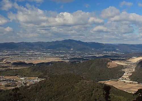 Hongū-zan Mountain, Toyokawa-shi12 km NE
-
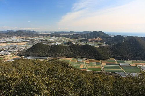 Atsumi Peninsula Natural site, Aichi19 km SW
-
Mikawa-wan Natural site, Japan23 km SW
Sources & licences
Data last updated: · 2 independent sources