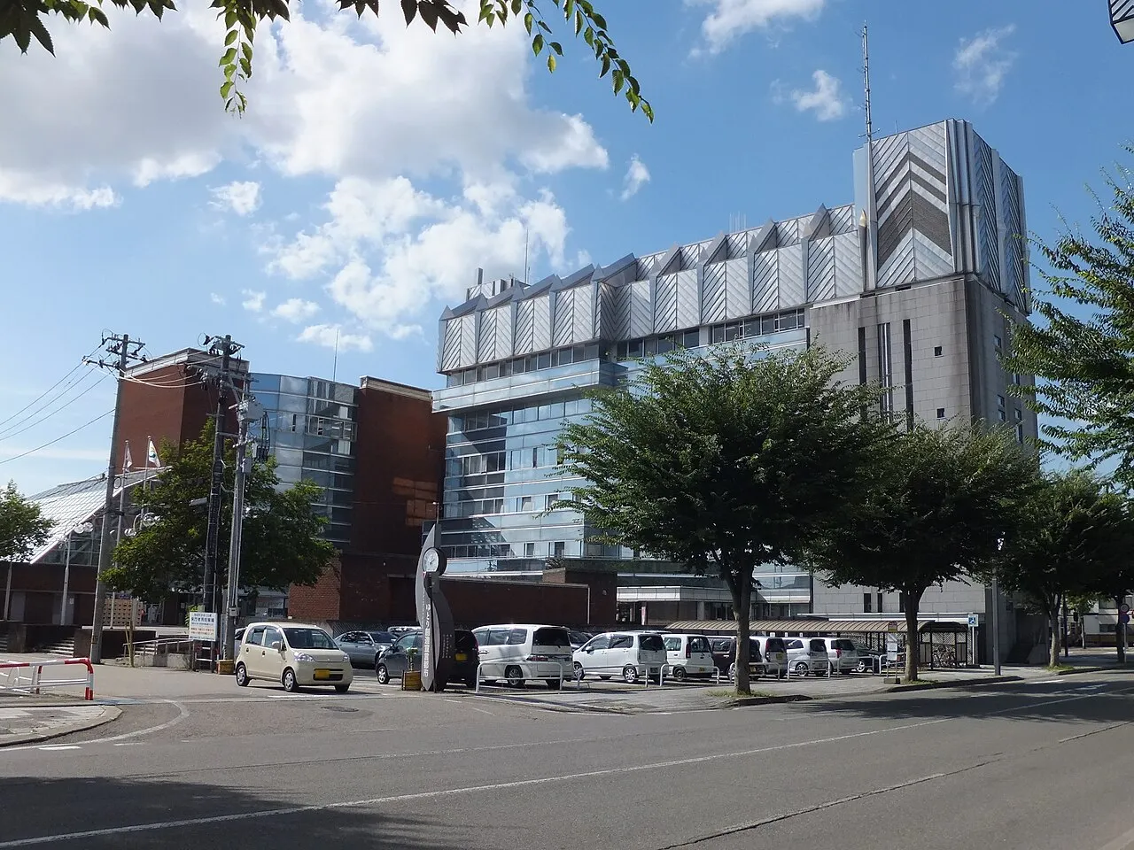
- Population
- 85,555
- 85.6K
- Elevation
- 61 m
- above sea level
- Local time
- UTC+09:00
- Asia/Tokyo · UTC+09:00
- Airports
- AXT Akita Airport44 km
- HNA Iwate Hanamaki Airport52 km
About Yokote
Yokote is a city. Location: Yokote Shi, Akita. Population: 85,555. Elevation: 61 m. The best months to visit are May–June, September. The nearest airport is Akita Airport (44 km).
Photos of Yokote
-

Rarisan · CC0 -

Rarisan · CC BY-SA 4.0 -

カスタヌー · CC BY-SA 3.0 -

掬茶 · CC BY-SA 3.0 -

shikabane taro · CC BY 3.0


Travel notes for Yokote
From Wikivoyage
Yokote (横手市 Yokote-shi) is a city in Akita prefecture.
Understand+
Tourist information sites:
The city's official site has a tourism section with integrated machine translation. In addition, there is a separate tourist information page in English.
The local tourist association has a Japanese-only guide site with integrated Google Translate.
Get in+
By plane:
The nearest airport is Akita Airport in Akita. Akita Airport's domestic flights fly from Tokyo, Nagoya, Osaka, Sapporo, and other cities. A shuttle bus runs twice daily from the airport to Yokote for ¥300. Basically, reservations must be made online or by phone, and payment can be made in cash, by credit card, or by transportation system IC (Suica, PASMO etc).
秋田空港-横手ウェルカムシャトル よこてWARP (Yokote WARP)
Otherwise, you can take a bus from the airport to Akita Station (秋田駅) and then come to Yokote Station (横手駅) on the JR Ōu Line (奥羽本線).
By train:
For most train travelers, taking the Akita Shinkansen to Omagari (Daisen) and changing to the Ou Line to reach Yokote Station will be the fastest way to reach Yokote. Those in Yamagata, can go north along the Ou Line, but trains are infrequent. The Kitakami Line (Kitakami) also terminates in Yokote. If timetables align, the Kitakami Line is the fastest way from southern Iwate.
Source: Wikivoyage · CC BY-SA 4.0 · abridged
Climate of Yokote
Best months for sightseeingBest months for sightseeing: May–June, September.
This month · November
A wet month
Day 11° · Night 3° · Rain 143 mm
- Hottest month
- August (day 29°)
- Coldest month
- January (night -5°)
- Wettest month
- July (176 mm)
- Driest month
- May (92 mm)
Bars: average monthly low and high temperature. Below: precipitation. Monthly averages for 1970–2000 at about 18 km resolution, adjusted for elevation. Highlighted months are mild and relatively dry. Source: WorldClim 2.1 (CC BY 4.0).
Show values as a table
| Month | Jan | Feb | Mar | Apr | May | Jun | Jul | Aug | Sep | Oct | Nov | Dec |
|---|---|---|---|---|---|---|---|---|---|---|---|---|
| Average high (°C) | 2° | 2° | 6° | 13° | 20° | 23° | 27° | 29° | 24° | 18° | 11° | 4° |
| Average low (°C) | -5° | -5° | -2° | 4° | 10° | 15° | 20° | 21° | 16° | 9° | 3° | -2° |
| Precipitation (mm) | 148 | 115 | 98 | 101 | 92 | 120 | 176 | 148 | 157 | 134 | 143 | 166 |
How to get to Yokote
The nearest airport is Akita Airport (AXT), 44 km to the northwest as the crow flies. The nearest large city is Ōshū, 57 km to the east.
Airports
- Akita Airport (AXT) Akita 44 kmnorthwest
- Iwate Hanamaki Airport (HNA) Hanamaki 52 kmeast
- Shonai Airport (SYO) Shonai 87 kmsouthwest
Nearby large cities
- Ōshū Population: 112.9K 57 kmeast
- Akita Population: 307.7K 58 kmnorthwest
- Morioka Population: 290.7K 67 kmnortheast
- Ichinoseki Population: 114.5K 67 kmsoutheast
- Sakata Population: 100.3K 75 kmsouthwest
Straight-line distances; road distances are longer. Airport data: OurAirports.
Day trips from Yokote
Within 100 km: 2 historic and cultural sites, 13 natural sites, 13 lakes, rivers and coasts.
25–60 km11 places
- Koyoshi River River 47 kmW
- Waga River River 50 kmE
- Sarugaishi River River 51 kmE
- Anano River River 40 kmE
60–100 km17 places
- Tobi Shima Island 87 kmW
- Oga Quasi National Park Natural site 96 kmNW
- Mount Funagata Mountain 96 kmS
- Oga Peninsula Natural site 91 kmNW
Straight-line distances.
Yokote and similar cities
Side by side with cities of similar size in the same country: population, elevation and climate.
| Measure | Yokote | Moriyama | Ryūgasaki | Sekimachi |
|---|---|---|---|---|
| Population | 85.6K | 85.5K | 85.8K | 85.3K |
| Elevation | 61 m | 92 m | 8 m | 51 m |
| Summer day (hottest month) | 29° | 31° | 29° | 31° |
| Winter night (coldest month) | -5° | 0° | -2° | -1° |
| Annual rainfall | 1,598 mm | 1,634 mm | 1,343 mm | 2,087 mm |
| Best months | May–Jun, Sep | May–Jun, Sep–Oct | May–Jul, Sep–Oct | May–Jun, Oct |
| Distance | — | 622 km | 381 km | 533 km |
Climate values are 1970–2000 monthly averages; straight-line distance.
Sources & licences
Data last updated: