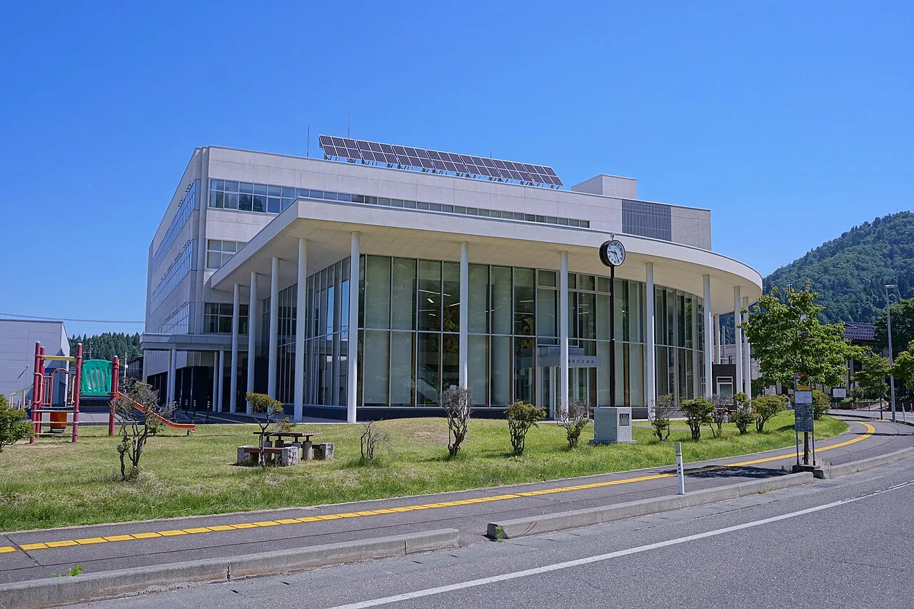
- Population
- 44,346
- 44.3K
- Elevation
- 100 m
- above sea level
- Local time
- UTC+09:00
- Asia/Tokyo · UTC+09:00
- Airports
- AXT Akita Airport55 km
- HNA Iwate Hanamaki Airport62 km
About Yuzawa
Yuzawa is a city. Location: Yuzawa Shi, Akita. Population: 44,346. Elevation: 100 m.
Yuzawa (湯沢市, Yuzawa-shi) is a city located in Akita Prefecture, Japan. As of 31 January 2023, the city had an estimated population of 41,404 in 17,551 households and a population density of 52 persons per km2. The total area of the city is 790.91 km2 (305.37 sq mi). Yuzawa claims to be the birthplace of the famous Heian period poet Ono no Komachi.
Source: Wikipedia · CC BY-SA 4.0
Photos of Yuzawa
-

さかおり · CC BY-SA 4.0 -

Douglas Paul Perkins · CC BY 4.0 -

掬茶 · CC BY-SA 3.0 -

掬茶 · CC BY-SA 3.0 -

ぺ有家音 · CC0


Travel notes for Yuzawa
From Wikivoyage
Yuzawa (湯沢市; yuzawa-shi) is a city at the southeastern corner of Akita Prefecture, along the border with Yamagata and Miyagi. It is southeast of Yurihonjo and south of Yokote.
Understand+
Tourist information site:
The local tourist association has a Japanese-only guide site.
Get in+
Yuzawa is accessible by train. The main station is Yuzawa Station (湯沢駅). By car, Yuzawa is located on Highway 13, which goes to Yokote and Daisen in the north, and Yamagata in the south. The expressway is free between Yuzawa and Yamagata — however, Yokote is not free.
Source: Wikivoyage · CC BY-SA 4.0 · abridged
Places bordering Yuzawa
- Yurihonjō
- Yokote
- Ugo Machi
- Kurihara
- Ōsaki
- Shinjō
- Mogami Machi
- Higashinaruse Mura
- Kaneyama
- Mamurogawa Machi
Twin towns and sister cities of Yuzawa
- Kushiro· Japan
Source: Wikidata. Only places with a page on this site are shown.
Population of Yuzawa over time
| 2010 | 50,849 | |
|---|---|---|
| 2015 | 46,613 | |
| 2021 | 41,601 |
Censuses and official estimates; source: Wikidata.
Climate of Yuzawa
Best months for sightseeingBest months for sightseeing: May–June, September.
This month · November
A wet month
Day 11° · Night 3° · Rain 143 mm
- Hottest month
- August (day 29°)
- Coldest month
- January (night -5°)
- Wettest month
- July (176 mm)
- Driest month
- May (92 mm)
Bars: average monthly low and high temperature. Below: precipitation. Monthly averages for 1970–2000 at about 18 km resolution, adjusted for elevation. Highlighted months are mild and relatively dry. Source: WorldClim 2.1 (CC BY 4.0).
Show values as a table
| Month | Jan | Feb | Mar | Apr | May | Jun | Jul | Aug | Sep | Oct | Nov | Dec |
|---|---|---|---|---|---|---|---|---|---|---|---|---|
| Average high (°C) | 1° | 2° | 5° | 13° | 19° | 23° | 27° | 29° | 24° | 18° | 11° | 4° |
| Average low (°C) | -5° | -5° | -2° | 3° | 9° | 15° | 19° | 21° | 16° | 8° | 3° | -2° |
| Precipitation (mm) | 148 | 115 | 98 | 101 | 92 | 120 | 176 | 148 | 157 | 134 | 143 | 166 |
How to get to Yuzawa
The nearest airport is Akita Airport (AXT), 55 km to the northwest as the crow flies. The nearest large city is Ōshū, 58 km to the east.
Airports
- Akita Airport (AXT) Akita 55 kmnorthwest
- Iwate Hanamaki Airport (HNA) Hanamaki 62 kmnortheast
- Shonai Airport (SYO) Shonai 73 kmsouthwest
Nearby large cities
- Ōshū Population: 112.9K 58 kmeast
- Ichinoseki Population: 114.5K 61 kmsoutheast
- Sakata Population: 100.3K 62 kmsouthwest
- Akita Population: 307.7K 69 kmnorthwest
- Ōsaki Population: 128.8K 76 kmsoutheast
Straight-line distances; road distances are longer. Airport data: OurAirports.
Day trips from Yuzawa
Within 100 km: 2 historic and cultural sites, 12 natural sites, 13 lakes, rivers and coasts.
25–60 km7 places
- Koyoshi River River 49 kmNW
- Waga River River 55 kmE
- Mount Chōkai Mountain 40 kmW
- Isawa-gawa River 56 kmE
60–100 km20 places
- Tobi Shima Island 82 kmW
- Dewa Sanzan Mountain 74 kmSW
- Aka River River 71 kmSW
- Mount Funagata Mountain 80 kmS
Straight-line distances.
Sources & licences
Data last updated: · 2 independent sources