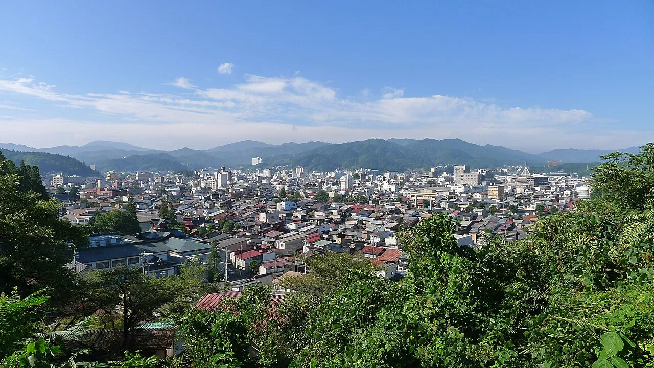
- Population
- 88,473
- 88.5K
- Elevation
- 583 m
- above sea level
- Local time
- UTC+09:00
- Asia/Tokyo · UTC+09:00
- Airports
- TOY Toyama Kitokito Airport57 km
- MMJ Shinshu-Matsumoto Airport61 km
About Takayama
Takayama is a city. Location: Takayama Shi, Gifu. Population: 88,473. Elevation: 583 m.
Takayama (高山市, Takayama-shi; Japanese pronunciation: [tä̀.kä́.jä̀.mä̀, -jä́.mä́(.ɕì)]) is a city located in Gifu Prefecture, Japan. As of 1 September 2025, the city had an estimated population of 81,968 in 36,815 households, and a population density of 41 persons per km2. The total area of the city was 2,177.61 square kilometers (840.78 sq mi) making it the largest city by area in Japan.
Source: Wikipedia · CC BY-SA 4.0
Photos of Takayama
-

Saigen Jiro · CC0 -

Takipoint123 · CC BY-SA 4.0 -

Dimitri Ségard · CC BY 3.0 -

Ryōmen-sukunaI · CC BY-SA 4.0 -
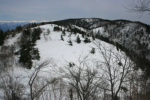
Kurai Yama Alpsdake · CC0


Travel notes for Takayama
From Wikivoyage
Takayama (高山市 Takayama-shi), sometimes called Hida-Takayama (飛騨高山) to distinguish it from other towns of the same name, is a city near the northern Japan Alps of Gifu prefecture, in the Chubu region of Japan.
Understand+
Takayama is famous for its well-preserved quarter with Edo-style streets. Sometimes called "Little Kyoto of Hida" (飛騨の小京都), the traditional townscape is a major attraction to visitors, only rivalled by that of Kanazawa among cities in the Chubu region.
Much of the city had been established when it had been a castle town surrounding the Takayama Castle (高山城) since the 15th century until the 18th century. The central Tokugawa shogunate then took over the control and demolished the castle. Over the period of some 200 years since then, the city saw development of the forestry industry and boasted the crafts made by its artisans. The art of woodcraft and other works of craftsmanship has then been passed over through the Meiji era to the present day.
Having a humid continental climate, there is a large variation in temperature in the city in summer, sometimes from 0 to 35 °C in a day. With much of the area close to or midst of mountains, winter brings constant snowfalls to the city, with temperatures sometimes falling below -10 °C.
Tourist office:
1 Hida Tourist Information Office, Hanasato-machi 5-51 (In the Hida Hotel Plaza, in front of JR Takayama Station), ☏ +81 577 32-5328, kankou@hida.jp. Daily 08:30-17:00. The staff speak English and are a mine of information for the area.
Tourist information site:
The local tourist association has a multilingual guide site.
Get in+
Takayama is the major transport hub of the Hida region.
By train:
1 Takayama Station (高山駅). This station is on the JR Takayama Line, which has spectacular views of the valley and the Hida River below. Note that this station does not accept IC cards, and local line tickets have to be bought in cash. Thus, arrive sufficiently early not to be stuck in the queue right before your train departs. That also means that trips to Takayama must partly be paid in cash and don't allow for the usage of an IC card, like the local train from Toyama with transfer in Inotani. (updated Oct 2024)
The Hida (ひだ) limited express train runs from Toyama in the north, 1½ hrs (¥3,360), and Nagoya in the south, 2-2½ hrs (¥6,030). Local trains from Toyama take 2 hours, including a transfer at Inotani (¥1,690).
From Tokyo there are two equally viable routes: the Tokaido Shinkansen to Nagoya on the Nozomi (4-4½ hours) or Hikari (just over 4½ hours), or the Hokuriku Shinkansen to Toyama on the Kagayaki or Hakutaka (4 hours). Both routes are around ¥15,000. Search engines may find only the Tokaido route; try searching with a stop in Toyama, or experiment with the departure or arrival time.
From Kyoto, take the Tokaido Shinkansen to Nagoya, which takes 2½-3 hours (around ¥10,500). Alternately, one Hida leaves Kansai in the morning (#25 at 07:58 from Osaka Station) and returns in the evening (#36 at 15:38 from Takayama) using conventional lines. This is convenient because there are no transfers, and it's cheaper than the Shinkansen, but it's slower and no food or drink is sold on the train. Travel on this service from Kyoto takes around 4 hours (¥7,650), and from Osaka around 4¼ hours (¥8,300).
Source: Wikivoyage · CC BY-SA 4.0 · abridged
Places bordering Takayama
- Furukawa
- Gujō
- Gero
- Shirakawa Mura
- Ōmachi-shi
- Matsumoto
- Kiso Machi
- Toyama
- Hakusan Shi
- Ono
Twin towns and sister cities of Takayama
- Denver· United States
- Matsumoto· Japan
- Kaminoyama· Japan
Source: Wikidata. Only places with a page on this site are shown.
Population of Takayama over time
| 2010 | 92,747 | |
|---|---|---|
| 2015 | 89,182 | |
| 2020 | 85,199 |
Censuses and official estimates; source: Wikidata.
Climate of Takayama
Best months for sightseeingBest months for sightseeing: May–June, September.
This month · November
A wet month
Day 13° · Night 3° · Rain 102 mm
Better nearby cities in November
- Kofu · 129 km southeast17°
- Fujinomiya · 160 km southeast18°
- Fuji · 168 km southeast20°
- Hottest month
- August (day 29°)
- Coldest month
- January (night -5°)
- Wettest month
- September (257 mm)
- Driest month
- December (84 mm)
Bars: average monthly low and high temperature. Below: precipitation. Monthly averages for 1970–2000 at about 18 km resolution, adjusted for elevation. Highlighted months are mild and relatively dry. Source: WorldClim 2.1 (CC BY 4.0).
Show values as a table
| Month | Jan | Feb | Mar | Apr | May | Jun | Jul | Aug | Sep | Oct | Nov | Dec |
|---|---|---|---|---|---|---|---|---|---|---|---|---|
| Average high (°C) | 3° | 4° | 8° | 16° | 21° | 24° | 28° | 29° | 24° | 18° | 13° | 7° |
| Average low (°C) | -5° | -5° | -2° | 5° | 10° | 15° | 19° | 20° | 16° | 9° | 3° | -2° |
| Precipitation (mm) | 89 | 86 | 124 | 156 | 156 | 233 | 253 | 210 | 257 | 141 | 102 | 84 |
How to get to Takayama
The nearest airport is Toyama Kitokito Airport (TOY), 57 km to the north as the crow flies. For international flights: Komatsu Airport / JASDF Komatsu Air Base (KMQ) (81 km). The nearest large city is Toyama, 63 km to the north.
Airports
- Toyama Kitokito Airport (TOY) Toyama 57 kmnorth
- Shinshu-Matsumoto Airport (MMJ) Matsumoto 61 kmeast
- Komatsu Airport / JASDF Komatsu Air Base (KMQ) Kanazawa 81 kmwest
Nearby large cities
- Toyama Population: 415.8K 63 kmnorth
- Matsumoto Population: 241.1K 65 kmeast
- Takaoka Population: 170.1K 72 kmnorth
- Matsutō Population: 110.4K 75 kmnorthwest
- Kanazawa Population: 466K 77 kmnorthwest
Straight-line distances; road distances are longer. Airport data: OurAirports.
Day trips from Takayama
Within 100 km: 2 historic and cultural sites, 43 natural sites, 20 lakes, rivers and coasts.
0–25 km1 place
- Kurai Yama Mountain 12 kmSW
25–60 km23 places
- Mount Iō Mountain 59 kmNW
- Itoshiro River River 58 kmSW
- Mount Norikura Mountain 27 kmE
- Mount Dainichi Mountain 40 kmW
60–100 km41 places
- Honshu Island 69 kmE
- Kakehashi River River 79 kmNW
- Mount Utatsu Mountain 71 kmNW
- Mount Sekidō Mountain 96 kmN
Straight-line distances.
Takayama and similar cities
Side by side with cities of similar size in the same country: population, elevation and climate.
| Measure | Takayama | Fukuroi | Mobara | Iga |
|---|---|---|---|---|
| Population | 88.5K | 88.4K | 88.3K | 88.9K |
| Elevation | 583 m | 11 m | 14 m | 152 m |
| Summer day (hottest month) | 29° | 30° | 29° | 31° |
| Winter night (coldest month) | -5° | 2° | 0° | -1° |
| Annual rainfall | 1,891 mm | 2,132 mm | 1,562 mm | 1,621 mm |
| Best months | May–Jun, Sep | May–Jun, Oct | May–Jul, Sep–Oct | May–Jun, Sep–Oct |
| Distance | — | 165 km | 286 km | 183 km |
Climate values are 1970–2000 monthly averages; straight-line distance.
Sources & licences
Data last updated: · 2 independent sources