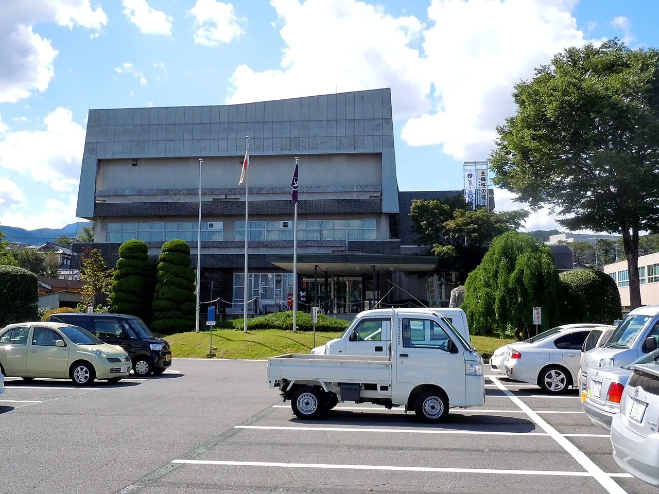
- Population
- 76,098
- 76.1K
- Elevation
- 202 m
- above sea level
- Local time
- UTC+09:00
- Asia/Tokyo · UTC+09:00
- Airports
- MMJ Shinshu-Matsumoto Airport103 km
- HND Tokyo Haneda International Airport126 km
About Shibukawa
Shibukawa is a city. Location: Shibukawa-shi, Gunma. Population: 76,098. Elevation: 202 m. The best months to visit are May. The nearest airport is Shinshu-Matsumoto Airport (103 km). Nearby sights include Agatsuma River and Lake Haruna.
Photos of Shibukawa
-

inunami · CC BY 2.0 -

Lake Haruna Adolfo Farsari · Public domain -
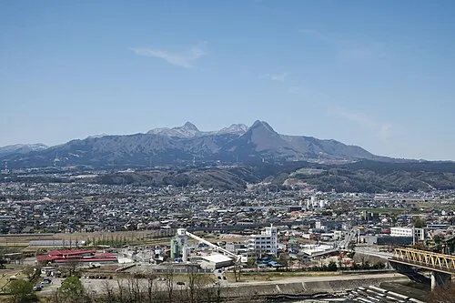
Mount Haruna Qurren · CC BY-SA 4.0 -
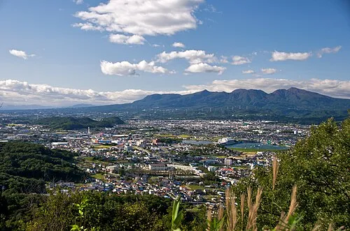
Mount Akagi Javbw · CC BY-SA 3.0


Travel notes for Shibukawa
From Wikivoyage
Shibukawa (渋川) is a city in Gunma, known for hot springs in Ikaho (伊香保) area.
Understand+
Shibukawa is known as the belly button of Japan, as it is in the very centre of Japan (not taking Okinawan islands into count). Famous for the "Heso Matsuri" or belly button festival, Shibukawa lies in the shadow of Mount Haruna with great views of Mount Akagi and Mount Komochi. Shibukawa municipality includes the famous hot spring resort town of Ikaho.
Tourist information site:
The local tourism association maintains a multilingual guide site.
Get in+
Shibukawa is easily accessible by train from Takasaki station, which can be reached by Shinkansen (bullet train). By car it can be accessed via Route 17.
Source: Wikivoyage · CC BY-SA 4.0 · abridged
Climate of Shibukawa
Best months for sightseeingBest months for sightseeing: May.
This month · November
Outside the best season
Day 15° · Night 5° · Rain 73 mm
Better nearby cities in November
- Kofu · 99 km southwest17°
- Isehara · 124 km south18°
- Odawara · 137 km south19°
- Hottest month
- August (day 30°)
- Coldest month
- January (night -3°)
- Wettest month
- September (187 mm)
- Driest month
- December (60 mm)
Bars: average monthly low and high temperature. Below: precipitation. Monthly averages for 1970–2000 at about 18 km resolution, adjusted for elevation. Highlighted months are mild and relatively dry. Source: WorldClim 2.1 (CC BY 4.0).
Show values as a table
| Month | Jan | Feb | Mar | Apr | May | Jun | Jul | Aug | Sep | Oct | Nov | Dec |
|---|---|---|---|---|---|---|---|---|---|---|---|---|
| Average high (°C) | 8° | 9° | 12° | 18° | 23° | 25° | 29° | 30° | 25° | 20° | 15° | 11° |
| Average low (°C) | -3° | -2° | 1° | 6° | 11° | 16° | 20° | 21° | 17° | 11° | 5° | -1° |
| Precipitation (mm) | 68 | 73 | 75 | 87 | 101 | 157 | 161 | 169 | 187 | 126 | 73 | 60 |
Other places to visit in this season: May
How to get to Shibukawa
The nearest airport is Shinshu-Matsumoto Airport (MMJ), 103 km to the west as the crow flies. For international flights: Tokyo Haneda International Airport (HND) (126 km). The nearest large city is Maebashi, 12 km to the southeast.
Airports
- Shinshu-Matsumoto Airport (MMJ) Matsumoto 103 kmwest
- Tokyo Haneda International Airport (HND) Tokyo 126 kmsoutheast
- Ibaraki Airport (IBR) Omitama 131 kmeast
Nearby large cities
- Maebashi Population: 332.1K 12 kmsoutheast
- Takasaki Population: 373K 17 kmsouth
- Isesaki Population: 211.8K 26 kmsoutheast
- Kiryū Population: 109K 31 kmeast
- Ōta Population: 224.4K 39 kmsoutheast
Straight-line distances; road distances are longer. Airport data: OurAirports.
Day trips from Shibukawa
Within 100 km: 6 historic and cultural sites, 45 natural sites, 14 lakes, rivers and coasts.
0–25 km4 places
- Lake Haruna Lake 12 kmW
- Mount Akagi Mountain 18 kmNE
- Mount Haruna Mountain 12 kmW
- Agatsuma River River 2 kmNE
25–60 km19 places
- Umeda Ko Lake 37 kmE
- Mount Bukō Mountain 60 kmS
- Tanigawa Dake Mountain 40 kmN
- Lake Chūzenji Lake 50 kmNE
60–100 km42 places
- Takada castle Historic site 96 kmNW
- Saitama Super Arena Landmark 87 kmSE
- Iruma River River 80 kmSE
- Lake Nojiri Lake 79 kmNW
Straight-line distances.
Shibukawa and similar cities
Side by side with cities of similar size in the same country: population, elevation and climate.
| Measure | Shibukawa | Yurihonjō | Kiyose | Aira |
|---|---|---|---|---|
| Population | 76.1K | 76.1K | 76.2K | 76.3K |
| Elevation | 202 m | 4 m | 53 m | 76 m |
| Summer day (hottest month) | 30° | 29° | 30° | 31° |
| Winter night (coldest month) | -3° | -3° | -1° | 2° |
| Annual rainfall | 1,337 mm | 1,711 mm | 1,461 mm | 2,342 mm |
| Best months | May | May–Jun, Sep | May–Jun, Oct | May, Oct–Nov |
| Distance | — | 336 km | 92 km | 934 km |
Climate values are 1970–2000 monthly averages; straight-line distance.
Nearby attractions & nature
Everything nearby-
Agatsuma River River, Gunma2.3 km NE
-
Lake Haruna Lake, Gunma12 km W
-
Mount Haruna Mountain, Gunma12 km W
-
Mount Akagi Mountain, Gunma18 km NE
Sources & licences
Data last updated: