Ōzora Chō
Local name: 大空町
Located in Abashiri District, Hokkaido Coordinates: 43°50′22″ N 144°14′52″ E
- Population
- 7,841
- 7.8K
- Elevation
- 112 m
- above sea level
- Local time
- UTC+09:00
- Asia/Tokyo · UTC+09:00
- Places inside
- 2
- listed under Ōzora Chō
- Airports
- MMB Memanbetsu Airport8 km
- SHB Nakashibetsu Airport64 km
About Ōzora Chō
Ōzora Chō is a municipality. Location: Abashiri District, Hokkaido. Population: 7,841. Elevation: 112 m.
Ōzora (大空町, Ōzora-chō) is a town located in Okhotsk Subprefecture, Hokkaido, Japan. Ōzora was formed on March 31, 2006, as a result of the merger of the town of Memanbetsu, and the village of Higashimokoto. Memanbetsu Village (later Memanbetsu Town) split from the Town of Abashiri (now the City of Abashiri) in 1921, and Higashimokoto Village split from Abashiri Town on February 11, 1947. Therefore, all of Ōzora's territory once was a part of Abashiri.
Source: Wikipedia · CC BY-SA 4.0
Places bordering Ōzora Chō
- Abashiri
- Kitami
- Motomachi
- Koshimizu
Population of Ōzora Chō over time
| 2010 | 7,933 | |
|---|---|---|
| 2015 | 7,360 | |
| 2020 | 6,966 |
Censuses and official estimates; source: Wikidata.
Climate of Ōzora Chō
Best months for sightseeingBest months for sightseeing: July–August.
This month · November
A cold month
Day 7° · Night -1° · Rain 73 mm
- Hottest month
- August (day 23°)
- Coldest month
- February (night -12°)
- Wettest month
- September (126 mm)
- Driest month
- February (41 mm)
Bars: average monthly low and high temperature. Below: precipitation. Monthly averages for 1970–2000 at about 18 km resolution, adjusted for elevation. Highlighted months are mild and relatively dry. Source: WorldClim 2.1 (CC BY 4.0).
Show values as a table
| Month | Jan | Feb | Mar | Apr | May | Jun | Jul | Aug | Sep | Oct | Nov | Dec |
|---|---|---|---|---|---|---|---|---|---|---|---|---|
| Average high (°C) | -4° | -4° | 1° | 8° | 14° | 17° | 21° | 23° | 19° | 14° | 7° | -1° |
| Average low (°C) | -12° | -12° | -7° | 0° | 5° | 9° | 14° | 16° | 12° | 5° | -1° | -8° |
| Precipitation (mm) | 60 | 41 | 63 | 64 | 75 | 71 | 84 | 110 | 126 | 90 | 73 | 57 |
How to get to Ōzora Chō
The nearest airport is Memanbetsu Airport (MMB), 8 km to the northwest as the crow flies. The nearest large city is Kitami, 29 km to the west.
Airports
- Memanbetsu Airport (MMB) Ōzora 8 kmnorthwest
- Nakashibetsu Airport (SHB) Nakashibetsu 64 kmsoutheast
- Monbetsu Airport (MBE) Monbetsu 85 kmnorthwest
Nearby large cities
- Kitami Population: 119.1K 29 kmwest
- Kushiro Population: 167.9K 97 kmsouth
- Obihiro Population: 166.5K 133 kmsouthwest
- Asahikawa Population: 333.5K 152 kmwest
- Ebetsu Population: 134K 233 kmwest
Straight-line distances; road distances are longer. Airport data: OurAirports.
Places in Ōzora Chō
2 placesBar: population relative to the most populous place in this list.
Cities & villages1
- Memambetsu · Neighbourhood
Nearby attractions & nature
Everything nearby-
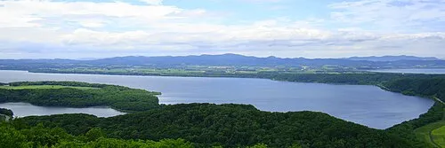 Lake Abashiri Lake, Hokkaido16 km N
-
Abashiri River River, Japan20 km N
-
Lake Tōfutsu Lake, Hokkaido16 km NE
Sources & licences
Data last updated: · 2 independent sources