Abashiri
Local name: 網走市
Located in Abashiri Shi, Hokkaido Coordinates: 44°01′17″ N 144°16′11″ E
- Population
- 35,759
- 35.8K
- Elevation
- 4 m
- above sea level
- Local time
- UTC+09:00
- Asia/Tokyo · UTC+09:00
- Airports
- MMB Memanbetsu Airport18 km
- SHB Nakashibetsu Airport74 km
About Abashiri
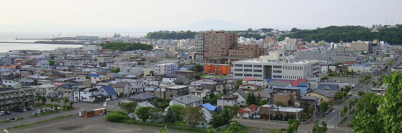
Abashiri is a city. Location: Abashiri Shi, Hokkaido. Population: 35,759. Elevation: 4 m.
Abashiri (網走市, Abashiri-shi; Japanese pronunciation: [ä̀.bä́.ɕì.ɾʲì, -ɕí.ɾʲí.ɕì]) is a city located in Okhotsk Subprefecture, Hokkaido, Japan. Abashiri is known as the site of the Abashiri Prison, a Meiji-era facility used for the incarceration of political prisoners. The old prison has been turned into a museum, but the city's new maximum-security prison is still in use. As of 2008, the city has an estimated population of 40,333 and a density of 85.6 persons per km2 (222 persons per sq. mi.).
Source: Wikipedia · CC BY-SA 4.0
Places bordering Abashiri
- Kitami
- Ōzora Chō
- Koshimizu
Twin towns and sister cities of Abashiri
- Itoman· Japan
- Tendō· Japan
- Atsugi· Japan
Source: Wikidata. Only places with a page on this site are shown.
Population of Abashiri over time
| 2010 | 40,998 | |
|---|---|---|
| 2015 | 39,077 | |
| 2020 | 34,640 |
Censuses and official estimates; source: Wikidata.
Climate of Abashiri
Best months for sightseeingBest months for sightseeing: July–August.
This month · November
A cold month
Day 7° · Night 0° · Rain 70 mm
- Hottest month
- August (day 23°)
- Coldest month
- February (night -11°)
- Wettest month
- September (121 mm)
- Driest month
- February (39 mm)
Bars: average monthly low and high temperature. Below: precipitation. Monthly averages for 1970–2000 at about 18 km resolution, adjusted for elevation. Highlighted months are mild and relatively dry. Source: WorldClim 2.1 (CC BY 4.0).
Show values as a table
| Month | Jan | Feb | Mar | Apr | May | Jun | Jul | Aug | Sep | Oct | Nov | Dec |
|---|---|---|---|---|---|---|---|---|---|---|---|---|
| Average high (°C) | -3° | -3° | 1° | 8° | 13° | 16° | 21° | 23° | 20° | 15° | 7° | 1° |
| Average low (°C) | -10° | -11° | -6° | 1° | 5° | 9° | 14° | 16° | 13° | 7° | 0° | -6° |
| Precipitation (mm) | 60 | 39 | 59 | 58 | 70 | 68 | 82 | 105 | 121 | 85 | 70 | 56 |
How to get to Abashiri
The nearest airport is Memanbetsu Airport (MMB), 18 km to the southwest as the crow flies. The nearest large city is Kitami, 39 km to the southwest.
Airports
- Memanbetsu Airport (MMB) Ōzora 18 kmsouthwest
- Nakashibetsu Airport (SHB) Nakashibetsu 74 kmsoutheast
- Monbetsu Airport (MBE) Monbetsu 76 kmnorthwest
Nearby large cities
- Kitami Population: 119.1K 39 kmsouthwest
- Kushiro Population: 167.9K 117 kmsouth
- Obihiro Population: 166.5K 150 kmsouthwest
- Asahikawa Population: 333.5K 156 kmwest
- Ebetsu Population: 134K 242 kmsouthwest
Straight-line distances; road distances are longer. Airport data: OurAirports.
Nearby attractions & nature
Everything nearby-
Abashiri River River, Japan0.5 km E
-
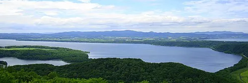 Lake Abashiri Lake, Hokkaido9.4 km SW
-
 Lake Notoro Lake, Hokkaido10 km NW
-
Lake Tōfutsu Lake, Hokkaido14 km SE
Sources & licences
Data last updated: · 2 independent sources