- Population
- 5,046
- 5K
- Elevation
- 534 m
- above sea level
- Local time
- UTC+09:00
- Asia/Tokyo · UTC+09:00
- Places inside
- 2
- listed under Kamishihoro Chō
- Airports
- AKJ Asahikawa Airport68 km
- OBO Tokachi-Obihiro Airport72 km
About Kamishihoro Chō
Kamishihoro Chō is a municipality. Location: Katō-gun, Hokkaido. Population: 5,046. Elevation: 534 m.
Kamishihoro (上士幌町, Kamishihoro-chō) is a town located in Tokachi Subprefecture, Hokkaidō, Japan. As of 31 December 2025, the town had an estimated population of 4,677 in 2578 households, and a population density of 5 people per km2. The total area of the town is 694.23 km2 (268.04 sq mi).
Source: Wikipedia · CC BY-SA 4.0
Travel notes for Kamishihoro Chō
From Wikivoyage
Kamishihoro (上士幌) is a town in Tokachi, in the far north of Hokkaido, Japan. South area of the town is located on Tokachi Plain, where the town center resides. North and Central area of the town is in the mountains of Daisetsu. Forestry was prosperous in the past, but it has declined by now. More northerly area from Nukabira has become nearly abandoned.
Understand+
Tourist Information Site:
The local tourist association has a Japanese-only guide site with integrated Google Translate.
The Roadside Station Kamishihoro (see Buy below) has another good Japanese-only guide site, Kamishihoro Navi.
Get in+
By bus:
Bus service from Obihiro to Kamishihoro (center of town) with 16 round trips each weekday. There is another Highway bus from Obihiro to Asahikawa with 2 round trips.
By car:
National Route 241 passes through the city on its way from Obihiro to Ashoro. National Route 273 runs from the center of town to Asahikawa.
Source: Wikivoyage · CC BY-SA 4.0 · abridged
Places bordering Kamishihoro Chō
- Shikaoi Chō
- Honbetsu Chō
- Ashoro Chō
- Shintoku
- Kamikawa
- Kitami
- Oketo
Population of Kamishihoro Chō over time
| 2010 | 5,080 | |
|---|---|---|
| 2015 | 4,765 | |
| 2020 | 4,964 |
Censuses and official estimates; source: Wikidata.
Climate of Kamishihoro Chō
Best months for sightseeingBest months for sightseeing: July–August.
This month · November
A wet month
Day 5° · Night -3° · Rain 102 mm
- Hottest month
- August (day 22°)
- Coldest month
- January (night -15°)
- Wettest month
- September (163 mm)
- Driest month
- February (50 mm)
Bars: average monthly low and high temperature. Below: precipitation. Monthly averages for 1970–2000 at about 18 km resolution, adjusted for elevation. Highlighted months are mild and relatively dry. Source: WorldClim 2.1 (CC BY 4.0).
Show values as a table
| Month | Jan | Feb | Mar | Apr | May | Jun | Jul | Aug | Sep | Oct | Nov | Dec |
|---|---|---|---|---|---|---|---|---|---|---|---|---|
| Average high (°C) | -5° | -5° | -1° | 7° | 13° | 17° | 22° | 22° | 18° | 12° | 5° | -1° |
| Average low (°C) | -15° | -15° | -10° | -1° | 4° | 9° | 14° | 15° | 10° | 3° | -3° | -10° |
| Precipitation (mm) | 63 | 50 | 77 | 77 | 97 | 93 | 113 | 156 | 163 | 124 | 102 | 68 |
How to get to Kamishihoro Chō
The nearest airport is Asahikawa Airport (AKJ), 68 km to the northwest as the crow flies. The nearest large city is Obihiro, 52 km to the south.
Airports
- Asahikawa Airport (AKJ) Higashikagura 68 kmnorthwest
- Tokachi-Obihiro Airport (OBO) Obihiro 72 kmsouth
- Kushiro Airport (KUH) Kushiro 90 kmsoutheast
Nearby large cities
- Obihiro Population: 166.5K 52 kmsouth
- Kitami Population: 119.1K 73 kmnortheast
- Asahikawa Population: 333.5K 79 kmnorthwest
- Kushiro Population: 167.9K 106 kmsoutheast
- Ebetsu Population: 134K 137 kmwest
Straight-line distances; road distances are longer. Airport data: OurAirports.
Day trips from Kamishihoro Chō
Within 100 km: 1 historic or cultural site, 52 natural sites, 9 lakes, rivers and coasts.
0–25 km8 places
- Hokkaido Island 22 kmW
- Mount Numanohara Mountain 23 kmNW
- Mount Nipesotsu Mountain 15 kmNW
- Ishikari-sanchi Mountain 20 kmNW
25–60 km14 places
- Mount Tokachi Mountain 41 kmW
- Mount Kuro Mountain 41 kmNW
- Mount Chitokaniushi Mountain 59 kmN
- Mount Hakuun Mountain 38 kmNW
60–100 km40 places
- Tokachi River River 85 kmSE
- Pon’yaoromappu Dake Mountain 99 kmS
- Ahoro Dake Mountain 73 kmE
- Mount Poroshiri Mountain 85 kmSW
Straight-line distances.
Places in Kamishihoro Chō
2 placesBar: population relative to the most populous place in this list.
Mountains & nature1
- Mikuni-yama · Mountain
Nearby attractions & nature
Everything nearby-
 Mount Nipesotsu Mountain, Shintoku Chō15 km NW
-
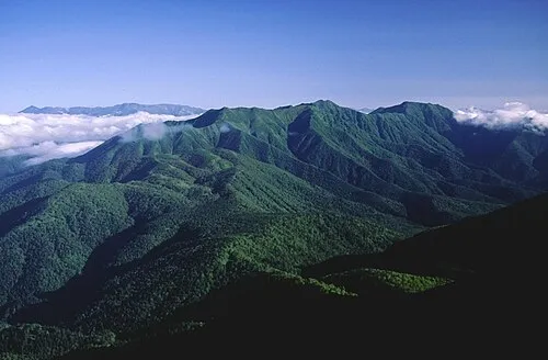 Ishikari-sanchi Mountain, Japan20 km NW
-
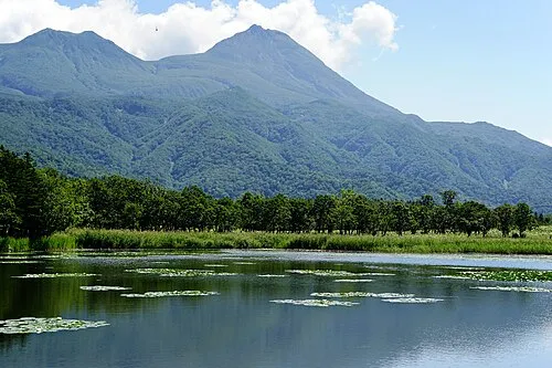 Hokkaido Island, Shintoku Chō22 km W
-
Mount Otofuke Mountain, Kamikawa Chō23 km NW
-
Mount Numanohara Mountain, Shintoku Chō23 km NW
-
Mount Ishikari Mountain, Kamikawa Chō23 km NW
-
Daisetsuzan National Park Natural site, Shintoku Chō22 km NW
Other cities and towns in Katō-gun
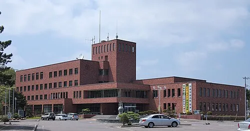
Sources & licences
Data last updated: · 2 independent sources