- Elevation
- 42 m
- above sea level
- Local time
- UTC+09:00
- Asia/Tokyo · UTC+09:00
- Airports
- MMB Memanbetsu Airport27 km
- MBE Monbetsu Airport59 km
About Tokoro
Tokoro is a village. Location: Kitami Shi, Hokkaido. Elevation: 42 m.
Tokoro (常呂町, Tokoro-chō) is a small town, formerly an independent administrative division located in Tokoro District, Abashiri Subprefecture (now Okhotsk Subprefecture), Hokkaido, Japan. On March 5, 2006, the division, along with the towns of Rubeshibe and Tanno (all from Tokoro District), was merged into a part of the expanded city of Kitami, and became Tokoro Town, Kitami City.
Source: Wikipedia · CC BY-SA 4.0
At a glance
- Built
- 1950
Source: Wikidata
Climate of Tokoro
Best months for sightseeingBest months for sightseeing: July–August.
This month · November
A cold month
Day 7° · Night -1° · Rain 70 mm
- Hottest month
- August (day 23°)
- Coldest month
- February (night -12°)
- Wettest month
- September (123 mm)
- Driest month
- February (40 mm)
Bars: average monthly low and high temperature. Below: precipitation. Monthly averages for 1970–2000 at about 18 km resolution, adjusted for elevation. Highlighted months are mild and relatively dry. Source: WorldClim 2.1 (CC BY 4.0).
Show values as a table
| Month | Jan | Feb | Mar | Apr | May | Jun | Jul | Aug | Sep | Oct | Nov | Dec |
|---|---|---|---|---|---|---|---|---|---|---|---|---|
| Average high (°C) | -3° | -3° | 1° | 8° | 14° | 17° | 21° | 23° | 20° | 14° | 7° | 0° |
| Average low (°C) | -11° | -12° | -7° | 0° | 5° | 9° | 14° | 16° | 12° | 6° | -1° | -7° |
| Precipitation (mm) | 59 | 40 | 60 | 59 | 71 | 70 | 83 | 110 | 123 | 88 | 70 | 57 |
How to get to Tokoro
The nearest airport is Memanbetsu Airport (MMB), 27 km to the south as the crow flies. The nearest large city is Kitami, 39 km to the southwest.
Airports
- Memanbetsu Airport (MMB) Ōzora 27 kmsouth
- Monbetsu Airport (MBE) Monbetsu 59 kmwest
- Nakashibetsu Airport (SHB) Nakashibetsu 92 kmsoutheast
Nearby large cities
- Kitami Population: 119.1K 39 kmsouthwest
- Kushiro Population: 167.9K 129 kmsouth
- Asahikawa Population: 333.5K 144 kmwest
- Obihiro Population: 166.5K 152 kmsouthwest
- Ebetsu Population: 134K 234 kmsouthwest
Straight-line distances; road distances are longer. Airport data: OurAirports.
Nearby attractions & nature
Everything nearby-
 Lake Notoro Lake, Hokkaido7.7 km SE
-
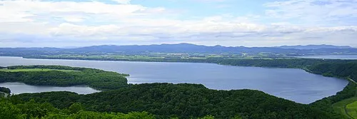 Lake Abashiri Lake, Hokkaido17 km S
-
Abashiri River River, Japan18 km SE
-
Lake Saroma Lake, Hokkaido21 km W
Sources & licences
Data last updated: · 2 independent sources