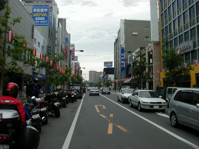
- Population
- 166,536
- 166.5K
- Elevation
- 44 m
- above sea level
- Local time
- UTC+09:00
- Asia/Tokyo · UTC+09:00
- Airports
- OBO Tokachi-Obihiro Airport20 km
- KUH Kushiro Airport82 km
About Obihiro
Obihiro is a city. Location: Obihiro Shi, Hokkaido. Population: 166,536. Elevation: 44 m.
Obihiro (帯広市, Obihiro-shi; Japanese pronunciation: [ò̞.bʲí.çí.ɾó̞(.ɕì)]) is a city located in Tokachi Subprefecture, Hokkaidō, Japan. As of 31 December 2025, the city had an estimated population of 159,294 in 90105 households, and a population density of 257 people per km2. The total area of the city is 619.34 km2 (239.13 sq mi). The next most populous municipality in Tokachi is the adjacent town of Otofuke, with less than a third of Obihiro's population.
Source: Wikipedia · CC BY-SA 4.0
Places bordering Obihiro
- Otofuke
- Memuro-minami
- Sarabetsu
- Nakasatsunai Mura
- Makubetsu Chō
- Biratori Chō
- Hidaka Chō
- Niikappu Chō
Twin towns and sister cities of Obihiro
- Seward· United States
- City of Madison· United States
- Ōita· Japan
- Matsuzaki· Japan
- Tokushima Shi· Japan
Source: Wikidata. Only places with a page on this site are shown.
Population of Obihiro over time
| 2010 | 168,057 | |
|---|---|---|
| 2015 | 169,327 | |
| 2020 | 165,684 |
Censuses and official estimates; source: Wikidata.
Climate of Obihiro
Best months for sightseeingBest months for sightseeing: June–August.
This month · November
A cold month
Day 8° · Night -2° · Rain 88 mm
- Hottest month
- August (day 25°)
- Coldest month
- January (night -15°)
- Wettest month
- September (160 mm)
- Driest month
- February (41 mm)
Bars: average monthly low and high temperature. Below: precipitation. Monthly averages for 1970–2000 at about 18 km resolution, adjusted for elevation. Highlighted months are mild and relatively dry. Source: WorldClim 2.1 (CC BY 4.0).
Show values as a table
| Month | Jan | Feb | Mar | Apr | May | Jun | Jul | Aug | Sep | Oct | Nov | Dec |
|---|---|---|---|---|---|---|---|---|---|---|---|---|
| Average high (°C) | -3° | -2° | 3° | 11° | 17° | 20° | 23° | 25° | 21° | 15° | 8° | 1° |
| Average low (°C) | -15° | -14° | -7° | 0° | 6° | 10° | 15° | 16° | 12° | 4° | -2° | -9° |
| Precipitation (mm) | 53 | 41 | 62 | 76 | 93 | 97 | 109 | 148 | 160 | 115 | 88 | 54 |
How to get to Obihiro
The nearest airport is Tokachi-Obihiro Airport (OBO), 20 km to the south as the crow flies. The nearest large city is Kushiro, 96 km to the east.
Airports
- Tokachi-Obihiro Airport (OBO) Obihiro 20 kmsouth
- Kushiro Airport (KUH) Kushiro 82 kmeast
- Asahikawa Airport (AKJ) Higashikagura 104 kmnorthwest
Nearby large cities
- Kushiro Population: 167.9K 96 kmeast
- Kitami Population: 119.1K 113 kmnortheast
- Asahikawa Population: 333.5K 117 kmnorthwest
- Tomakomai Population: 174.8K 135 kmwest
- Ebetsu Population: 134K 136 kmwest
Straight-line distances; road distances are longer. Airport data: OurAirports.
Sources & licences
Data last updated: · 2 independent sources