Rishiri Zan
Local name: 利尻山
Located in Rishir-ifuji Chō, Rishiri Gun Coordinates: 45°10′50″ N 141°14′27″ E
- Elevation
- 1,719 m
- above sea level
- Local time
- UTC+09:00
- Asia/Tokyo · UTC+09:00
- Airports
- RIS Rishiri Airport8 km
- WKJ Wakkanai Airport50 km
About Rishiri Zan
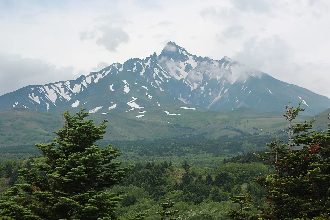
Rishiri Zan is a mountain. Location: Rishir-ifuji Chō, Rishiri Gun. Elevation: 1,719 m.
Mount Rishiri (利尻山, Rishiri-zan) is a Quaternary stratovolcano located off the coast of Hokkaidō, Japan in the Sea of Japan. It rises out of the Sea of Japan forming Rishiri Island. Because its cone shape resembles Mount Fuji it is sometimes referred to as Rishiri Fuji. It is one of the 100 famous mountains in Japan. Mount Rishiri's opening festival is held annually on July 2 and July 3. This festival officially opens the climbing season.
Source: Wikipedia · CC BY-SA 4.0
At a glance
- Topographic prominence
- 1,721 m
Source: Wikidata
Photos of Rishiri Zan
-

Raita Futo from Tokyo, Japan · CC BY 2.0 -

Raita Futo from Tokyo, Japan · CC BY 2.0 -

Raita Futo from Tokyo, Japan · CC BY 2.0 -

Raita Futo from Tokyo, Japan · CC BY 2.0 -

Raita Futo from Tokyo, Japan · CC BY 2.0


Climate of Rishiri Zan
This month · November
A wet month
Day -5° · Night -10° · Rain 126 mm
- Hottest month
- August (day 12°)
- Coldest month
- February (night -19°)
- Wettest month
- October (135 mm)
- Driest month
- April (58 mm)
Bars: average monthly low and high temperature. Below: precipitation. Monthly averages for 1970–2000 at about 18 km resolution, adjusted for elevation. Highlighted months are mild and relatively dry. Source: WorldClim 2.1 (CC BY 4.0).
Show values as a table
| Month | Jan | Feb | Mar | Apr | May | Jun | Jul | Aug | Sep | Oct | Nov | Dec |
|---|---|---|---|---|---|---|---|---|---|---|---|---|
| Average high (°C) | -14° | -14° | -10° | -4° | 1° | 6° | 10° | 12° | 9° | 3° | -5° | -11° |
| Average low (°C) | -19° | -19° | -15° | -10° | -5° | 0° | 4° | 6° | 3° | -3° | -10° | -15° |
| Precipitation (mm) | 95 | 66 | 60 | 58 | 70 | 68 | 100 | 128 | 134 | 135 | 126 | 113 |
How to get to Rishiri Zan
The nearest airport is Rishiri Airport (RIS), 8 km to the northwest as the crow flies. The nearest large city is Asahikawa, 180 km to the southeast.
Airports
- Rishiri Airport (RIS) Rishiri 8 kmnorthwest
- Wakkanai Airport (WKJ) Wakkanai 50 kmnortheast
- Asahikawa Airport (AKJ) Higashikagura 193 kmsoutheast
Nearby large cities
- Asahikawa Population: 333.5K 180 kmsoutheast
- Otaru Population: 115.3K 222 kmsouth
- Ebetsu Population: 134K 232 kmsouth
- Sapporo Population: 2M 235 kmsouth
- Kitami Population: 119.1K 260 kmsoutheast
Straight-line distances; road distances are longer. Airport data: OurAirports.
Day trips from Rishiri Zan
Within 100 km: 3 natural sites, 7 lakes, rivers and coasts.
0–25 km1 place
- Rishiri Tō Island 1 kmE
25–60 km5 places
- Rebun Tō Island 26 kmNW
- Rebun Dake Mountain 28 kmNW
- Koetoi River River 48 kmNE
- Sōya Bay Natural site 51 kmNE
60–100 km4 places
- Teuri Island Island 84 kmS
- Yagishiri Island Island 84 kmS
- Benten-jima Island 66 kmNE
- Cape Soya Natural site 66 kmNE
Straight-line distances.
Nearest towns and villages
-
Rishiri Town Village, Rishiri Chō4.2 km SW
-
Rishiri Chō Municipality, Rishiri Gun4.1 km SW
-
Rebun Chō Municipality, Rebun Gun27 km NW
-
 Wakkanai City, Wakkanai Shi42 km NE
-
Teshio-cho Municipality, Teshio Gun51 km SE
-
Toyotomi Village, Toyotomi Chō43 km E
Sources & licences
Data last updated: · 2 independent sources