- Population
- 2,684
- 2.7K
- Elevation
- 355 m
- above sea level
- Local time
- UTC+09:00
- Asia/Tokyo · UTC+09:00
- Airports
- RIS Rishiri Airport9 km
- WKJ Wakkanai Airport55 km
About Rishiri Town
Rishiri Town is a village. Location: Rishiri Chō, Rishiri Gun. Population: 2,684. Elevation: 355 m.
Rishiri (利尻町, Rishiri-chō) is a town located on Rishiri Island in Sōya Subprefecture, Hokkaido, Japan. As of September 2016, the town has an estimated population of 2,169 and a density of 28 persons per km2. The total area is 76.49 km2. Rishiri Airport is located in nearby Rishirifuji. The town's name originates from the ainu phrase "ri-sir", meaning "tall island" or "island with tall mountain", describing the island's 1721m tall Mount Rishiri
Source: Wikipedia · CC BY-SA 4.0
Places bordering Rishiri Town
- Rishir-ifuji Chō
Population of Rishiri Town over time
| 2010 | 2,590 | |
|---|---|---|
| 2015 | 2,303 | |
| 2020 | 1,966 |
Censuses and official estimates; source: Wikidata.
Climate of Rishiri Town
Best months for sightseeingBest months for sightseeing: July–September.
This month · November
A wet month
Day 5° · Night -1° · Rain 128 mm
- Hottest month
- August (day 21°)
- Coldest month
- February (night -10°)
- Wettest month
- October (140 mm)
- Driest month
- April (61 mm)
Bars: average monthly low and high temperature. Below: precipitation. Monthly averages for 1970–2000 at about 18 km resolution, adjusted for elevation. Highlighted months are mild and relatively dry. Source: WorldClim 2.1 (CC BY 4.0).
Show values as a table
| Month | Jan | Feb | Mar | Apr | May | Jun | Jul | Aug | Sep | Oct | Nov | Dec |
|---|---|---|---|---|---|---|---|---|---|---|---|---|
| Average high (°C) | -5° | -4° | -1° | 5° | 10° | 14° | 19° | 21° | 18° | 12° | 5° | -2° |
| Average low (°C) | -10° | -10° | -6° | -1° | 4° | 8° | 13° | 15° | 11° | 6° | -1° | -6° |
| Precipitation (mm) | 97 | 68 | 62 | 61 | 71 | 69 | 98 | 128 | 136 | 140 | 128 | 116 |
How to get to Rishiri Town
The nearest airport is Rishiri Airport (RIS), 9 km to the north as the crow flies. The nearest large city is Asahikawa, 180 km to the southeast.
Airports
- Rishiri Airport (RIS) Rishiri 9 kmnorth
- Wakkanai Airport (WKJ) Wakkanai 55 kmnortheast
- Asahikawa Airport (AKJ) Higashikagura 193 kmsoutheast
Nearby large cities
- Asahikawa Population: 333.5K 180 kmsoutheast
- Otaru Population: 115.3K 219 kmsouth
- Ebetsu Population: 134K 230 kmsouth
- Sapporo Population: 2M 233 kmsouth
- Kitami Population: 119.1K 262 kmsoutheast
Straight-line distances; road distances are longer. Airport data: OurAirports.
Nearby attractions & nature
Everything nearby-
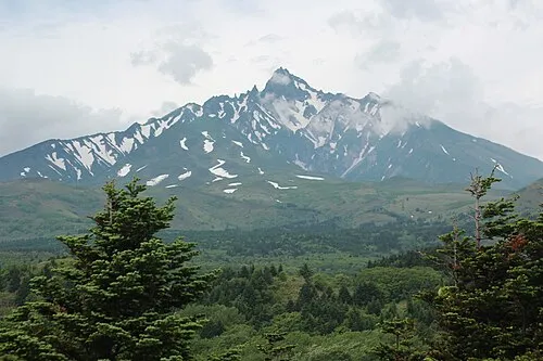 Rishiri Zan Mountain, Rishir-ifuji Chō4.2 km NE
-
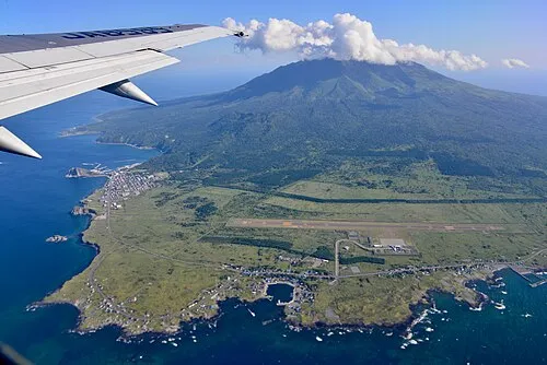 Rishiri Tō Island, Hokkaido4.4 km NE
Sources & licences
Data last updated: · 2 independent sources