Miyakonojō
Local name: 都城市
Located in Miyakonojō Shi, Miyazaki Coordinates: 31°44′00″ N 131°04′00″ E
- Population
- 161,137
- 161.1K
- Elevation
- 148 m
- above sea level
- Local time
- UTC+09:00
- Asia/Tokyo · UTC+09:00
- Airports
- KOJ Kagoshima Airport34 km
- KMI Miyazaki Airport40 km
About Miyakonojō
Miyakonojō is a city. Location: Miyakonojō Shi, Miyazaki. Population: 161,137. Elevation: 148 m.
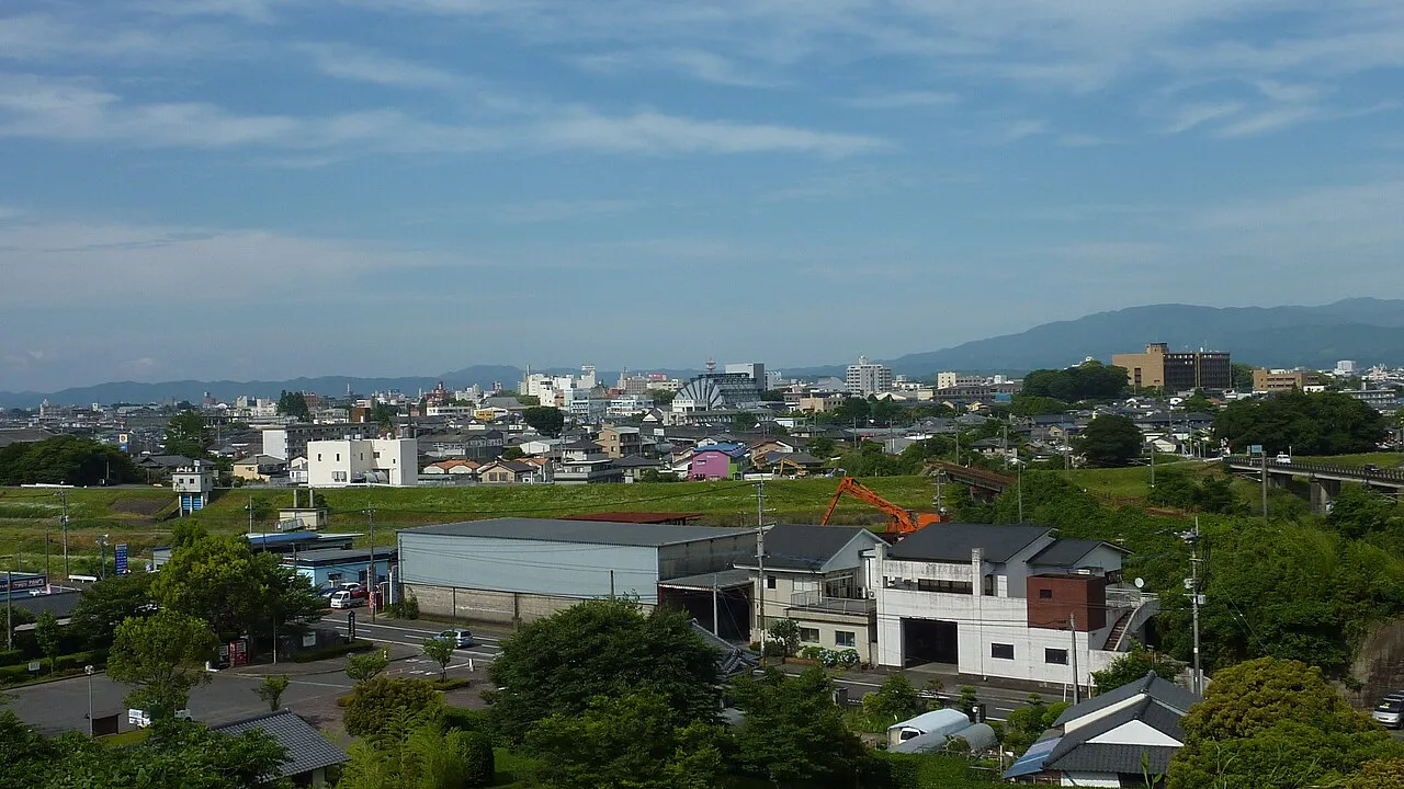
Miyakonojō (都城市, Miyakonojō-shi) is a city in Miyazaki Prefecture, Japan. As of 1 November 2023, the city had an estimated population of 158,235 in 72,394 households, and a population density of 240 persons per km2. The total area of the city is 653.36 km2 (252.26 sq mi), making it the largest city in the prefecture in terms of area.
Source: Wikipedia · CC BY-SA 4.0
Photos of Miyakonojō
-

あじさか · CC BY-SA 4.0 -

あじさか · CC BY-SA 4.0 -

あじさか · CC BY-SA 4.0 -

あじさか · CC BY-SA 4.0 -

あじさか · CC BY-SA 4.0


Travel notes for Miyakonojō
From Wikivoyage
Miyakonojo (都城) is a city in Miyazaki prefecture.
Understand+
Tourist information sites:
The local tourist association has a multilingual guide site.
The city government's official site has a Japanese-only tourism section.
Source: Wikivoyage · CC BY-SA 4.0 · abridged
Places bordering Miyakonojō
- Kirishima
- Shibushi-shi
- Soo Shi
- Miyazaki
- Kobayashi
- Nichinan
- Kushima
- Mimata Chō
- Takaharu Chō
Population of Miyakonojō over time
| 2010 | 169,602 | |
|---|---|---|
| 2015 | 165,029 | |
| 2021 | 160,392 |
Censuses and official estimates; source: Wikidata.
Climate of Miyakonojō
Best months for sightseeingBest months for sightseeing: April–June, October–November.
This month · November
A good month to visit
Day 18° · Night 8° · Rain 91 mm
- Hottest month
- August (day 31°)
- Coldest month
- January (night 0°)
- Wettest month
- June (431 mm)
- Driest month
- December (59 mm)
Bars: average monthly low and high temperature. Below: precipitation. Monthly averages for 1970–2000 at about 18 km resolution, adjusted for elevation. Highlighted months are mild and relatively dry. Source: WorldClim 2.1 (CC BY 4.0).
Show values as a table
| Month | Jan | Feb | Mar | Apr | May | Jun | Jul | Aug | Sep | Oct | Nov | Dec |
|---|---|---|---|---|---|---|---|---|---|---|---|---|
| Average high (°C) | 11° | 12° | 15° | 20° | 24° | 26° | 30° | 31° | 28° | 23° | 18° | 13° |
| Average low (°C) | 0° | 2° | 5° | 10° | 14° | 19° | 23° | 23° | 20° | 14° | 8° | 2° |
| Precipitation (mm) | 66 | 102 | 159 | 234 | 264 | 431 | 353 | 326 | 262 | 136 | 91 | 59 |
Other places to visit in this season: April May June October November
How to get to Miyakonojō
The nearest airport is Kagoshima Airport (KOJ), 34 km to the west as the crow flies. The nearest large city is Kirishima, 29 km to the west.
Airports
- Kagoshima Airport (KOJ) Kagoshima 34 kmwest
- Miyazaki Airport (KMI) Miyazaki 40 kmnortheast
- Amakusa Airport (AXJ) Amakusa 119 kmnorthwest
Nearby large cities
- Kirishima Population: 123.2K 29 kmwest
- Miyazaki Population: 401.3K 39 kmnortheast
- Kanoya Population: 101.1K 44 kmsouthwest
- Kagoshima Population: 595K 52 kmwest
- Honmachi Population: 123.1K 96 kmnorthwest
Straight-line distances; road distances are longer. Airport data: OurAirports.
Day trips from Miyakonojō
Within 100 km: 11 natural sites, 9 lakes, rivers and coasts.
25–60 km10 places
- Ao Shima Island 40 kmE
- Kō Shima Island 43 kmSE
- Ooyodo River River 41 kmNE
- Sakura Jima Island 41 kmSW
60–100 km10 places
- Kyūshū Island 78 kmN
- Mimigawa River River 85 kmNE
- Mount Osuzu Mountain 71 kmNE
- Kuma River River 95 kmNW
Straight-line distances.
Miyakonojō and similar cities
Side by side with cities of similar size in the same country: population, elevation and climate.
| Measure | Miyakonojō | Sayama | Ōgaki | Matsusaka |
|---|---|---|---|---|
| Population | 161.1K | 160.8K | 161.5K | 159.1K |
| Elevation | 148 m | 81 m | 7 m | 6 m |
| Summer day (hottest month) | 31° | 30° | 31° | 31° |
| Winter night (coldest month) | 0° | -2° | 0° | 1° |
| Annual rainfall | 2,483 mm | 1,388 mm | 1,962 mm | 1,931 mm |
| Best months | Apr–Jun, Oct–Nov | Apr–Jun, Sep–Oct | May–Jun, Oct | May–Jun, Oct |
| Distance | — | 897 km | 653 km | 600 km |
Climate values are 1970–2000 monthly averages; straight-line distance.
Sources & licences
Data last updated: · 2 independent sources