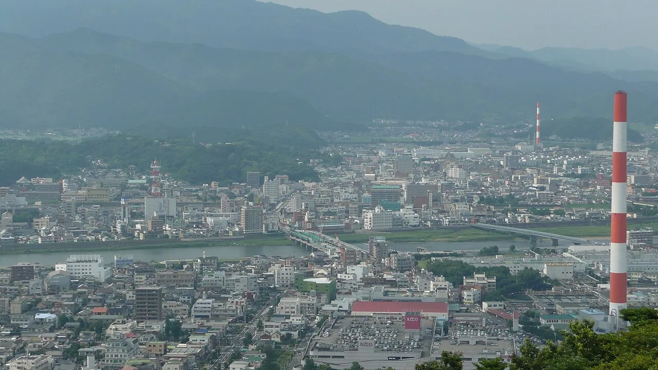
- Population
- 119,521
- 119.5K
- Elevation
- 4 m
- above sea level
- Local time
- UTC+09:00
- Asia/Tokyo · UTC+09:00
- Airports
- KMI Miyazaki Airport81 km
- KMJ Kumamoto Airport81 km
About Nobeoka
Nobeoka is a city. Location: Nobeoka Shi, Miyazaki. Population: 119,521. Elevation: 4 m.
Nobeoka (延岡市, Nobeoka-shi) is a city located in the north of Miyazaki Prefecture, Japan. As of 1 October 2023, the city had an estimated population of 113,367 in 51272 households, and a population density of 130 persons per km². The total area of the city is 868.02 km2 (335.14 sq mi).
Source: Wikipedia · CC BY-SA 4.0
Travel notes for Nobeoka
From Wikivoyage
Nobeoka (延岡) is a city in Miyazaki (prefecture).
Understand+
The city was officially founded on February 11, 1933 after it gained city status. During World War II, it was one of the most important centers of military explosives in Japan.
Tourist information site:
The local tourist association has a bilingual guide site.
Get in+
By car:
From the north or the south by expressways, take the E10 to the Nobeoka junction (延岡JCT) and then leave the expressway from the Nobeoka interchange (延岡IC). The Nobeoka Inter Access Road (延岡インターアクセス道路) will then lead you to the downtown. If you are from the south, Nobeoka Minami interchange (延岡南IC) can be a choice, but it is a little bit off-center to the downtown than Nobeoka interchange. From the west, take the E77 to the Nobeoka junction and the Nobeoka interchange will be the obvious choice.
If you don't want to use expressways, take the national route 10 from the north or the south, the national route 218 from the west.
Source: Wikivoyage · CC BY-SA 4.0 · abridged
Places bordering Nobeoka
- Kadogawa
- Misato Chō
- Hinokage
- Saiki
Population of Nobeoka over time
| 2010 | 131,182 | |
|---|---|---|
| 2015 | 125,159 | |
| 2021 | 117,711 |
Censuses and official estimates; source: Wikidata.
Climate of Nobeoka
Best months for sightseeingBest months for sightseeing: April–June, October–November.
This month · November
A good month to visit
Day 18° · Night 9° · Rain 81 mm
- Hottest month
- August (day 30°)
- Coldest month
- January (night 2°)
- Wettest month
- June (338 mm)
- Driest month
- December (45 mm)
Bars: average monthly low and high temperature. Below: precipitation. Monthly averages for 1970–2000 at about 18 km resolution, adjusted for elevation. Highlighted months are mild and relatively dry. Source: WorldClim 2.1 (CC BY 4.0).
Show values as a table
| Month | Jan | Feb | Mar | Apr | May | Jun | Jul | Aug | Sep | Oct | Nov | Dec |
|---|---|---|---|---|---|---|---|---|---|---|---|---|
| Average high (°C) | 12° | 12° | 15° | 20° | 23° | 26° | 29° | 30° | 27° | 23° | 18° | 14° |
| Average low (°C) | 2° | 3° | 6° | 11° | 15° | 19° | 23° | 23° | 20° | 15° | 9° | 4° |
| Precipitation (mm) | 53 | 81 | 132 | 206 | 246 | 338 | 266 | 265 | 300 | 169 | 81 | 45 |
Other places to visit in this season: April May June October November
How to get to Nobeoka
The nearest airport is Miyazaki Airport (KMI), 81 km to the south as the crow flies. The nearest large city is Ōita, 72 km to the north.
Airports
- Miyazaki Airport (KMI) Miyazaki 81 kmsouth
- Kumamoto Airport (KMJ) Kumamoto 81 kmwest
- Oita Airport (OIT) Oita 100 kmnorth
Nearby large cities
- Ōita Population: 477.7K 72 kmnorth
- Miyazaki Population: 401.3K 78 kmsouth
- Beppu Population: 122.6K 79 kmnorth
- Honmachi Population: 123.1K 101 kmwest
- Miyakonojō Population: 161.1K 110 kmsouthwest
Straight-line distances; road distances are longer. Airport data: OurAirports.
Sources & licences
Data last updated: · 2 independent sources