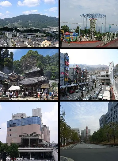
- Population
- 120,741
- 120.7K
- Elevation
- 146 m
- above sea level
- Local time
- UTC+09:00
- Asia/Tokyo · UTC+09:00
- Airports
- ITM Osaka Itami International Airport26 km
- UKB Kobe Airport44 km
About Ikoma
Ikoma is a city. Location: Ikoma-shi, Nara. Population: 120,741. Elevation: 146 m.
Ikoma (生駒市, Ikoma-shi; Japanese pronunciation: [í.kò̞.mä̀, ì.kó̞.mä́.ɕì]) is a city at the northwestern end of Nara Prefecture in the Kansai region of Japan. It was founded on November 1, 1971. As of September 1, 2023, the city has an estimated population of 117,259, with 51,478 households. It has a population density of 2,300 persons per km2, and it has the third largest population in the prefecture. The total area is 53.18 km2.
Source: Wikipedia · CC BY-SA 4.0
Travel notes for Ikoma
From Wikivoyage
Ikoma (生駒) is a city in Nara Prefecture.
Understand+
Though not frequented by foreign tourists, the city is home to Nara Institute of Science and Technology (NAIST), one of the best research institutions in Japan.
Tourist information site:
The city's tourism association has a multilingual guide site.
Get in+
By bus:
From Kansai International Airport (KIX IATA), take the Limousine Bus, get off at Gakuenmae Station, cost ¥2150.
By train:
From Kansai International Airport (KIX IATA), take the Nankai train towards Osaka-Namba Station. After that, transfer to Kintetsu Line and get off at Ikoma Station. The duration of the trip from Osaka-Namba is around 40 minutes.
1 Ikoma railway station (生駒駅). (updated Jun 2025)
Source: Wikivoyage · CC BY-SA 4.0 · abridged
Places bordering Ikoma
- Nara-shi
- Yamatokōriyama-shi
- Ikaruga-chō
- Heguri-chō
- Higashiōsaka Shi
- Shijonawate
- Daitō
- Katano
- Hirakata
- Kyōtanabe Shi
- Seika-cho
Population of Ikoma over time
| 2010 | 118,113 | |
|---|---|---|
| 2015 | 118,233 | |
| 2020 | 116,761 | |
| 2021 | 116,518 |
Censuses and official estimates; source: Wikidata.
Climate of Ikoma
Best months for sightseeingBest months for sightseeing: May–June, October.
This month · November
Outside the best season
Day 16° · Night 7° · Rain 70 mm
Better nearby cities in November
- Kochi · 236 km southwest18°
- Fujinomiya · 272 km east18°
- Fuji · 277 km east20°
- Hottest month
- August (day 31°)
- Coldest month
- January (night 0°)
- Wettest month
- June (227 mm)
- Driest month
- December (36 mm)
Bars: average monthly low and high temperature. Below: precipitation. Monthly averages for 1970–2000 at about 18 km resolution, adjusted for elevation. Highlighted months are mild and relatively dry. Source: WorldClim 2.1 (CC BY 4.0).
Show values as a table
| Month | Jan | Feb | Mar | Apr | May | Jun | Jul | Aug | Sep | Oct | Nov | Dec |
|---|---|---|---|---|---|---|---|---|---|---|---|---|
| Average high (°C) | 8° | 9° | 12° | 19° | 23° | 26° | 30° | 31° | 27° | 22° | 16° | 11° |
| Average low (°C) | 0° | 0° | 2° | 8° | 13° | 18° | 22° | 23° | 19° | 12° | 7° | 2° |
| Precipitation (mm) | 45 | 61 | 103 | 141 | 149 | 227 | 194 | 134 | 193 | 119 | 70 | 36 |
How to get to Ikoma
The nearest airport is Osaka Itami International Airport (ITM), 26 km to the northwest as the crow flies. The nearest large city is Daitō, 8 km to the northwest.
Airports
- Osaka Itami International Airport (ITM) Osaka 26 kmnorthwest
- Kobe Airport (UKB) Kobe 44 kmwest
- Kansai International Airport (KIX) Osaka 51 kmsouthwest
Nearby large cities
- Daitō Population: 119.4K 8 kmnorthwest
- Nara Population: 367.4K 10 kmeast
- Higashiosaka Population: 493.9K 11 kmwest
- Neyagawa Population: 238.5K 11 kmnorthwest
- Yao Population: 273.2K 12 kmsouthwest
Straight-line distances; road distances are longer. Airport data: OurAirports.
Day trips from Ikoma
Within 100 km: 30 historic and cultural sites, 44 natural sites, 22 lakes, rivers and coasts.
0–25 km19 places
- Mount Miwa Mountain 23 kmSE
- Mount Amanokagu Mountain 24 kmSE
- Mount Miminashi Mountain 21 kmSE
- Mount Unebi Mountain 23 kmS
25–60 km48 places
- Mount Rokkō Mountain 41 kmW
- Mount Azami Mountain 49 kmSE
- Mount Shisuniwa Mountain 45 kmSE
- Takami Yama Mountain 46 kmSE
60–100 km29 places
- Awaji Island Island 86 kmW
- Kumozu River River 78 kmE
- Mount Ōdaigahara Mountain 65 kmSE
- Mount Kunimi Mountain 61 kmSE
Straight-line distances.
Ikoma and similar cities
Side by side with cities of similar size in the same country: population, elevation and climate.
| Measure | Ikoma | Kashiwara | Nobeoka | Daitō |
|---|---|---|---|---|
| Population | 120.7K | 120.9K | 119.5K | 119.4K |
| Elevation | 146 m | 83 m | 4 m | 4 m |
| Summer day (hottest month) | 31° | 31° | 30° | 33° |
| Winter night (coldest month) | 0° | 1° | 2° | 1° |
| Annual rainfall | 1,472 mm | 1,620 mm | 2,182 mm | 1,381 mm |
| Best months | May–Jun, Oct | May–Jun, Oct | Apr–Jun, Oct–Nov | May, Oct |
| Distance | — | 27 km | 441 km | 8 km |
Climate values are 1970–2000 monthly averages; straight-line distance.
Nearby attractions & nature
Everything nearby-
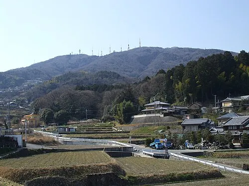 Ikoma Yama Mountain, Ikoma-shi2 km W
-
Matsuo San Mountain, Ikaruga-chō5.8 km SE
-
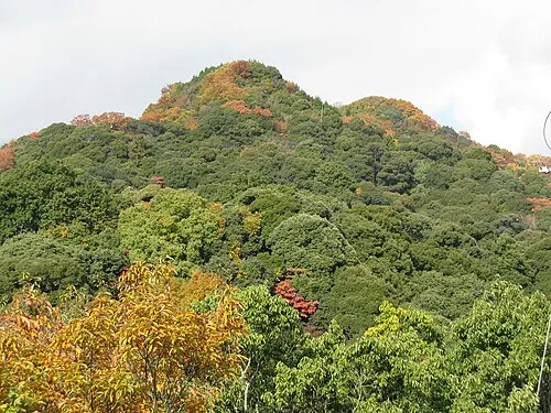 Mount Shigi Mountain, Heguri-chō8.4 km S
-
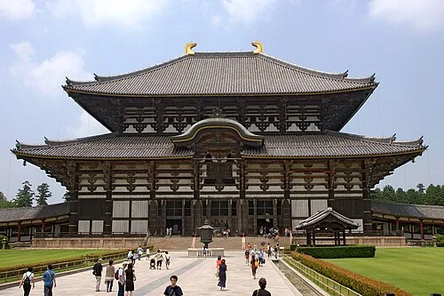 Tōdai-ji Attraction, Nara-shi13 km E
-
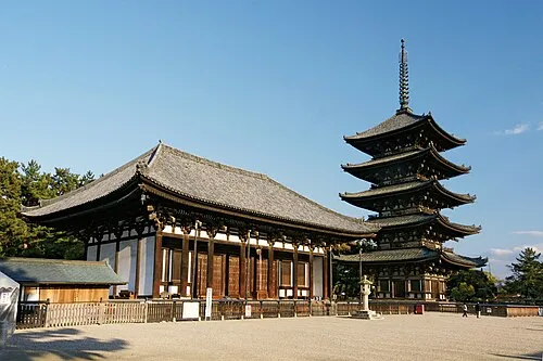 Koofukuji Attraction, Nara-shi12 km E
-
 Mount Wakakusa Mountain, Nara-shi14 km E
-
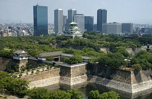 Osaka Castle Historic site, Chūō Ku16 km W
-
 Mount Amanokagu Mountain, Kashihara City24 km SE
Sources & licences
Data last updated: · 2 independent sources