Kashihara-shi
Local name: 橿原市
Located in Kashihara City, Nara Coordinates: 34°30′32″ N 135°47′34″ E
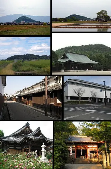
- Population
- 124,521
- 124.5K
- Elevation
- 65 m
- above sea level
- Local time
- UTC+09:00
- Asia/Tokyo · UTC+09:00
- Airports
- ITM Osaka Itami International Airport44 km
- KIX Kansai International Airport51 km
About Kashihara-shi
Kashihara-shi is a city. Location: Kashihara City, Nara. Population: 124,521. Elevation: 65 m.
Kashihara (橿原市, Kashihara-shi) is a city located in Nara Prefecture, Japan. As of 1 October 2024, the city had an estimated population of 118,674 in 56,013 households, and a population density of 3000 persons per km2. The total area of the city is 39.56 km2 (15.27 sq mi).
Source: Wikipedia · CC BY-SA 4.0
Photos of Kashihara-shi
-

m-louis .® from Osaka, Japan · CC BY-SA 2.0 -

m-louis .® from Osaka, Japan · CC BY-SA 2.0 -

m-louis .® from Osaka, Japan · CC BY-SA 2.0 -

m-louis .® from Osaka, Japan · CC BY-SA 2.0 -

m-louis .® from Osaka, Japan · CC BY-SA 2.0


Travel notes for Kashihara-shi
From Wikivoyage
Kashihara (橿原) is a city in located in the north-western part of Nara prefecture.
Understand+
Tourist information sites:
The local tourist association has a bilingual guide site, with some ads inserted.
The city government's tourism section is clean, but Japanese-only with integrated Google Translate.
Get in+
Kashihara city's two main train stations are Yamato-Yagi (大和八木) to the north, and Kashiharajingu-mae (橿原神宮前) to the south. Both are served by Kintetsu.
Yamato-Yagi: This is a major train station for Kintetsu, as it is where the Osaka and Kashihara lines intersect. From Kyoto, there are two limited express trains per hour, one of which reaches Kashiharajingu-mae (see below). The Limited Express runs to Yamato Yagi in 45-50 minutes. Slower express trains also leave twice per hour, reaching Yamato-Yagi in about an hour. The fare is ¥860, plus ¥870 if on the limited express.
Most trains from Osaka leave from Uehonmachi station. Express services leave three times per hour, reaching Yamato-Yagi in 35 minutes (¥540).
Kintetsu limited express trains also operate from Nagoya. Services run hourly (half-hourly during the evening) from Kintetsu Nagoya, running to Yamato-Yagi in approximately 1 hour and 45 minutes. The cost of this trip is ¥3520. This is the best way from Nagoya, as taking a bullet train to Kyoto and then taking a Kintetsu train from there would take the same amount of time, but would cost double.
Kashiharajingu-mae: Hourly limited express runs operate from Kyoto Station, reaching Kashihara in 50 minutes. Slower express trains run more frequently and make the run in about 75 minutes. There are usually two direct trains to Kashihara, or else change at Yamato-Saidaiji station. The fare is ¥860, plus an additional ¥870 if travelling on the limited express.
Trains from Osaka leave from Kintetsu Abenobashi station. Express trains depart twice an hour towards Yoshino, running to Kashihara in 40 minutes at a cost of ¥610. Limited express services to Kashihara take 35 minutes and require an additional ¥500 surcharge.
Source: Wikivoyage · CC BY-SA 4.0 · abridged
Places bordering Kashihara-shi
- Sakurai-shi
- Gose
- Yamatotakada-shi
- Kōryō Chō
- Tawaramoto
Population of Kashihara-shi over time
| 2010 | 125,605 | |
|---|---|---|
| 2015 | 124,111 | |
| 2021 | 121,604 | |
| 2023 | 119,146 |
Censuses and official estimates; source: Wikidata.
Climate of Kashihara-shi
Best months for sightseeingBest months for sightseeing: May, October.
This month · November
Outside the best season
Day 17° · Night 7° · Rain 75 mm
Better nearby cities in November
- Kochi · 234 km southwest18°
- Fujinomiya · 269 km east18°
- Fuji · 274 km east20°
- Hottest month
- August (day 32°)
- Coldest month
- January (night 1°)
- Wettest month
- June (231 mm)
- Driest month
- December (37 mm)
Bars: average monthly low and high temperature. Below: precipitation. Monthly averages for 1970–2000 at about 18 km resolution, adjusted for elevation. Highlighted months are mild and relatively dry. Source: WorldClim 2.1 (CC BY 4.0).
Show values as a table
| Month | Jan | Feb | Mar | Apr | May | Jun | Jul | Aug | Sep | Oct | Nov | Dec |
|---|---|---|---|---|---|---|---|---|---|---|---|---|
| Average high (°C) | 9° | 10° | 13° | 19° | 24° | 27° | 31° | 32° | 28° | 22° | 17° | 12° |
| Average low (°C) | 1° | 1° | 3° | 9° | 14° | 18° | 23° | 23° | 19° | 13° | 7° | 2° |
| Precipitation (mm) | 45 | 60 | 103 | 142 | 151 | 231 | 185 | 132 | 200 | 126 | 75 | 37 |
How to get to Kashihara-shi
The nearest airport is Osaka Itami International Airport (ITM), 44 km to the northwest as the crow flies. The nearest large city is Kashiwara, 7 km to the south.
Airports
- Osaka Itami International Airport (ITM) Osaka 44 kmnorthwest
- Kansai International Airport (KIX) Osaka 51 kmwest
- Kobe Airport (UKB) Kobe 54 kmwest
Nearby large cities
- Kashiwara Population: 120.9K 7 kmsouth
- Tondabayashi Population: 132.9K 18 kmwest
- Habikino Population: 109.5K 19 kmwest
- Nara Population: 367.4K 20 kmnorth
- Kawachi-Nagano Population: 101.7K 21 kmwest
Straight-line distances; road distances are longer. Airport data: OurAirports.
Day trips from Kashihara-shi
Within 100 km: 29 historic and cultural sites, 44 natural sites, 21 lakes, rivers and coasts.
0–25 km14 places
- Mount Miwa Mountain 7 kmE
- Mount Amanokagu Mountain 3 kmSE
- Mount Miminashi Mountain 1 kmNE
- Mount Unebi Mountain 2 kmS
25–60 km47 places
- Mount Rokkō Mountain 57 kmNW
- Mount Ōdaigahara Mountain 44 kmSE
- Mount Kunimi Mountain 41 kmSE
- Mount Azami Mountain 30 kmSE
60–100 km33 places
- Awaji Island Island 90 kmW
- Sakate-jima Island 98 kmE
- Kashiko Island Island 97 kmE
- Kumozu River River 70 kmE
Straight-line distances.
Kashihara-shi and similar cities
Side by side with cities of similar size in the same country: population, elevation and climate.
| Measure | Kashihara-shi | Uruma | Tsuruoka | Ise |
|---|---|---|---|---|
| Population | 124.5K | 125.3K | 125.4K | 123.5K |
| Elevation | 65 m | 22 m | 13 m | 56 m |
| Summer day (hottest month) | 32° | 31° | 29° | 30° |
| Winter night (coldest month) | 1° | 14° | -2° | 1° |
| Annual rainfall | 1,487 mm | 2,081 mm | 1,855 mm | 2,139 mm |
| Best months | May, Oct | Nov–May | May–Jun, Sep | May–Jun, Sep–Oct |
| Distance | — | 1,180 km | 590 km | 83 km |
Climate values are 1970–2000 monthly averages; straight-line distance.
Nearby attractions & nature
Everything nearby-
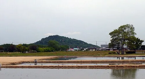 Mount Miminashi Mountain, Kashihara City1.4 km NE
-
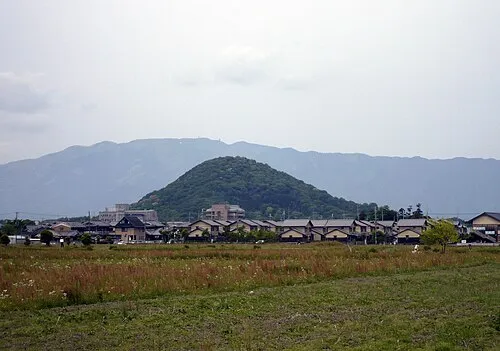 Mount Unebi Mountain, Kashihara City2 km S
-
 Mount Amanokagu Mountain, Kashihara City2.9 km SE
-
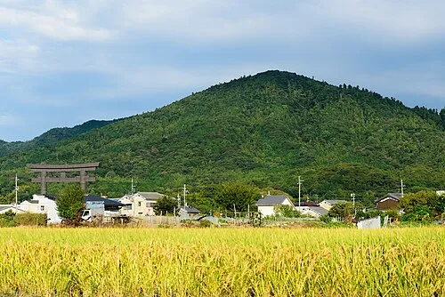 Mount Miwa Mountain, Sakurai-shi7.4 km E
-
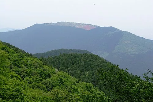 Mount Minami Katsuragi Mountain, Chihaya-akasaka Mura12 km SW
-
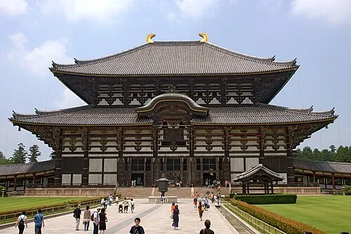 Tōdai-ji Attraction, Nara-shi20 km N
-
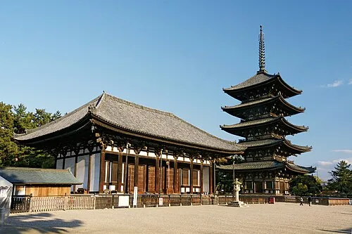 Koofukuji Attraction, Nara-shi20 km N
-
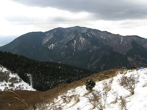 Kongō San Mountain, Gose Shi15 km SW
Sources & licences
Data last updated: · 2 independent sources