- Population
- 9,125
- 9.1K
- Elevation
- 5 m
- above sea level
- Local time
- UTC+09:00
- Asia/Tokyo · UTC+09:00
- Airports
- HSG Kyushu Saga International Airport18 km
- NGS Nagasaki Airport27 km
About Tara
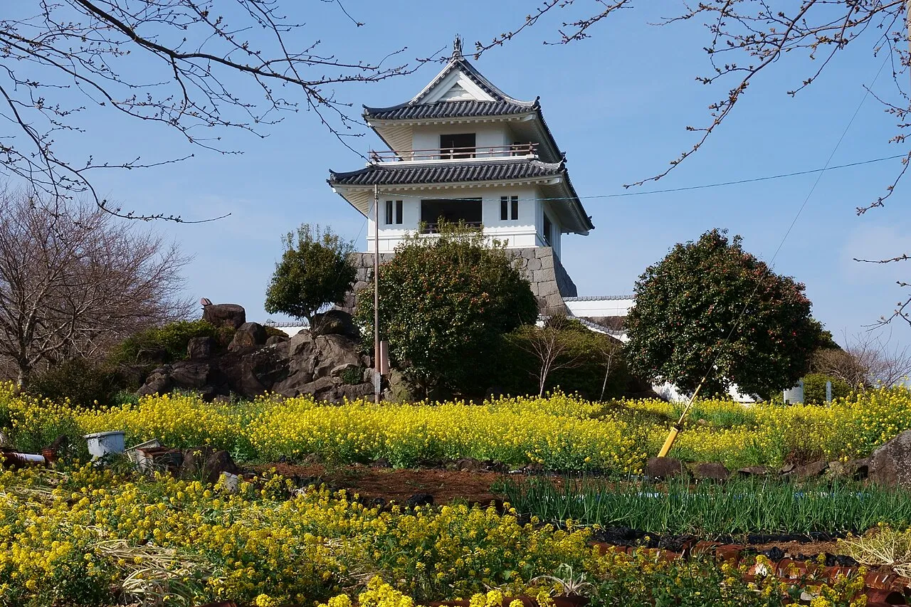
Tara is a town. Location: Tara Chō, Fujitsu-gun. Population: 9,125. Elevation: 5 m.
Tara (太良町, Tara-chō) is a town and peninsula located in Fujitsu District, Saga Prefecture, Japan. As of 31 March 2024, the town had an estimated population of 7973 in 3215 households, and a population density of 750 persons per km². The total area of the town is 74.30 km2 (28.69 sq mi)
Source: Wikipedia · CC BY-SA 4.0
Photos of Tara
-

Pekachu · CC BY-SA 4.0 -

Pekachu · CC BY-SA 4.0 -

Peka · CC BY-SA 4.0 -

Peka · CC BY-SA 4.0 -

Olegushka · CC0


Travel notes for Tara
From Wikivoyage
Tara (太良) is a town and peninsula located in Saga prefecture.
Understand+
Tara is bordered by Isahaya, Omura, Kashima and the Ariake Sea. On a clear day, it is possible to see the mountains across the sea. Tara includes Mount Tara, which is one of the highest mountains in Kyushu and part of the Tara mountains. Tara is comprised of two sections, which were once independent towns: Tara (多良) and Oura (大浦). Tara is located quite close to the Kashima Gatalympics, which takes place near Hizen-Iida Station.
Tourist information site:
The local tourist association has a Japanese-only guide site with integrated machine translation.
Get in+
By train:
Tara is serviced by the JR Kyushu railroad company. It has two stations and one switchbox.
By plane:
The closest airport is Saga Airport, followed by one in Nagasaki. Most travelers go to Fukuoka Airport for travel abroad.
By car:
Route 207 runs through the length of the town, and is the only road to Nagasaki Prefecture. The mountains are seeded with small roads, many of them one lane and unpaved. A road leads from camp Nakayama towards Kashima and Ureshino.
By boat:
While fishing is a huge industry, there is no known sea travel, nor are there ferries available.
Source: Wikivoyage · CC BY-SA 4.0 · abridged
Places bordering Tara
- Kashima
- Isahaya
- Ōmura
Population of Tara over time
| 2010 | 9,842 | |
|---|---|---|
| 2015 | 8,779 | |
| 2021 | 7,903 |
Censuses and official estimates; source: Wikidata.
Climate of Tara
Best months for sightseeingBest months for sightseeing: May, October.
This month · November
Outside the best season
Day 18° · Night 9° · Rain 71 mm
Better nearby cities in November
- Beppu · 126 km east17°
- Ōita · 134 km east18°
- Nobeoka · 147 km east18°
- Hottest month
- August (day 31°)
- Coldest month
- January (night 2°)
- Wettest month
- June (309 mm)
- Driest month
- January (59 mm)
Bars: average monthly low and high temperature. Below: precipitation. Monthly averages for 1970–2000 at about 18 km resolution, adjusted for elevation. Highlighted months are mild and relatively dry. Source: WorldClim 2.1 (CC BY 4.0).
Show values as a table
| Month | Jan | Feb | Mar | Apr | May | Jun | Jul | Aug | Sep | Oct | Nov | Dec |
|---|---|---|---|---|---|---|---|---|---|---|---|---|
| Average high (°C) | 10° | 11° | 14° | 19° | 24° | 27° | 30° | 31° | 28° | 23° | 18° | 12° |
| Average low (°C) | 2° | 3° | 5° | 10° | 15° | 19° | 23° | 24° | 20° | 14° | 9° | 4° |
| Precipitation (mm) | 59 | 75 | 108 | 154 | 164 | 309 | 291 | 183 | 204 | 93 | 71 | 60 |
How to get to Tara
The nearest airport is Kyushu Saga International Airport (HSG), 18 km to the northeast as the crow flies. The nearest large city is Isahaya, 24 km to the southwest.
Airports
- Kyushu Saga International Airport (HSG) Saga 18 kmnortheast
- Nagasaki Airport (NGS) Nagasaki 27 kmsouthwest
- Amakusa Airport (AXJ) Amakusa 60 kmsouth
Nearby large cities
- Isahaya Population: 135.5K 24 kmsouthwest
- Omuta Population: 132K 25 kmeast
- Saga Population: 233.3K 26 kmnortheast
- Nagasaki Population: 409.1K 41 kmsouthwest
- Sasebo Population: 243.2K 45 kmwest
Straight-line distances; road distances are longer. Airport data: OurAirports.
Day trips from Tara
Within 100 km: 18 historic and cultural sites, 16 natural sites, 19 lakes, rivers and coasts.
0–25 km1 place
- Chikugo River River 21 kmNE
25–60 km20 places
- Hario Jima Island 39 kmW
- Mount Unzen Mountain 32 kmS
- Ōyano Jima Island 54 kmSE
- Iō Jima Island 52 kmSW
60–100 km32 places
- Shimoshima Island Island 77 kmS
- Iki Island Island 95 kmNW
- Hi Kawa River 63 kmSE
- Kami Shima Island 65 kmS
Straight-line distances.
Sources & licences
Data last updated: · 2 independent sources