Fujinomiya
Local name: 富士宮市
Located in Fujinomiya Shi, Shizuoka Coordinates: 35°13′00″ N 138°37′00″ E
- Population
- 132,507
- 132.5K
- Elevation
- 116 m
- above sea level
- Local time
- UTC+09:00
- Asia/Tokyo · UTC+09:00
- Airports
- FSZ Mount Fuji Shizuoka Airport61 km
- OIM Oshima Airport83 km
About Fujinomiya
Fujinomiya is a city. Location: Fujinomiya Shi, Shizuoka. Population: 132,507. Elevation: 116 m.
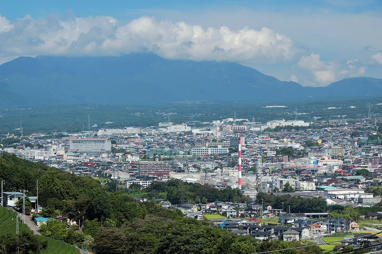
Fujinomiya (富士宮市, Fujinomiya-shi) is a city located in central Shizuoka Prefecture, Japan. As of 1 July 2019, the city had an estimated population of 132,507 in 56,655 households, and a population density of 340 persons per km2. The total area of the city is 388.99 square kilometres (150.19 sq mi).
Source: Wikipedia · CC BY-SA 4.0
Photos of Fujinomiya
-

Oka21000 · CC BY-SA 4.0 -

Oka21000 · CC BY-SA 4.0 -

Zairon · CC BY-SA 4.0 -
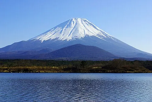
Mount Fuji 名古屋太郎 · CC BY-SA 3.0 -
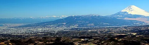
Mount Ashitaka Batholith · Public domain


Travel notes for Fujinomiya
From Wikivoyage
Fujinomiya (富士宮) is a city in Shizuoka prefecture, Japan, on the southwestern slopes of Mount Fuji.
Understand+
Tourist information site:
The local tourist association has a bilingual guide site.
Get in+
Fujinomiya is on the JR Minobu Line, linking Fuji city on the JR Tokaido Line with Kofu city on the JR Chuo Line.
There are a few ways to get to Fujinomiya from Tokyo, but the fastest method is to use the Shinkansen from Tokyo: to take a Tokaido Shinkansen Kodama train to Mishima, and change there for a Shizuoka-bound JR Tokaido Line local train. At Fuji station, you need to change again to the JR Minobu Line for the final run to Fujinomiya. This whole process will take about two hours with good connections at a cost of ¥4710.
Even substituting the Kodama journey with Tokaido Line local trains, the trip still takes about three hours from Tokyo if the connections are good, at a cost of ¥2520.
There are also buses from Tokyo station. Due to the COVID-19 pandemic, the English portion of the website may not be up to date.
There is a bus connection to Fujinomiya from Kawaguchiko station a few times a day.
The closest airport is Shizuoka Airport.
Source: Wikivoyage · CC BY-SA 4.0 · abridged
Places bordering Fujinomiya
- Shizuoka
- Fuji
- Gotemba
- Oyama Chō
- Fuji-yoshida Shi
- Nambu
- Minobu Town
- Fujikawaguchiko
- Narusawa Village
Twin towns and sister cities of Fujinomiya
- Santa Monica· United States
Source: Wikidata. Only places with a page on this site are shown.
Population of Fujinomiya over time
| 2010 | 132,001 | |
|---|---|---|
| 2015 | 130,770 | |
| 2021 | 127,252 |
Censuses and official estimates; source: Wikidata.
Climate of Fujinomiya
Best months for sightseeingBest months for sightseeing: May–June, October–November.
This month · November
A good month to visit
Day 18° · Night 7° · Rain 88 mm
- Hottest month
- August (day 31°)
- Coldest month
- January (night -1°)
- Wettest month
- June (227 mm)
- Driest month
- December (47 mm)
Bars: average monthly low and high temperature. Below: precipitation. Monthly averages for 1970–2000 at about 18 km resolution, adjusted for elevation. Highlighted months are mild and relatively dry. Source: WorldClim 2.1 (CC BY 4.0).
Show values as a table
| Month | Jan | Feb | Mar | Apr | May | Jun | Jul | Aug | Sep | Oct | Nov | Dec |
|---|---|---|---|---|---|---|---|---|---|---|---|---|
| Average high (°C) | 11° | 11° | 14° | 19° | 23° | 26° | 29° | 31° | 27° | 22° | 18° | 13° |
| Average low (°C) | -1° | 0° | 3° | 9° | 13° | 18° | 21° | 22° | 19° | 13° | 7° | 2° |
| Precipitation (mm) | 52 | 72 | 127 | 151 | 155 | 227 | 189 | 217 | 219 | 147 | 88 | 47 |
Other places to visit in this season: May June October November
How to get to Fujinomiya
The nearest airport is Mount Fuji Shizuoka Airport (FSZ), 61 km to the southwest as the crow flies. The nearest large city is Fuji, 8 km to the southeast.
Airports
- Mount Fuji Shizuoka Airport (FSZ) Makinohara / Shimada 61 kmsouthwest
- Oshima Airport (OIM) Izu Oshima 83 kmsoutheast
- Tokyo Haneda International Airport (HND) Tokyo 113 kmeast
Nearby large cities
- Fuji Population: 245.4K 8 kmsoutheast
- Numazu Population: 189.5K 26 kmsoutheast
- Mishima Population: 107.9K 29 kmeast
- Shizuoka Population: 693.4K 34 kmsouthwest
- Yaizu Population: 139.6K 47 kmsouthwest
Straight-line distances; road distances are longer. Airport data: OurAirports.
Day trips from Fujinomiya
Within 100 km: 18 historic and cultural sites, 51 natural sites, 29 lakes, rivers and coasts.
0–25 km7 places
- Mount Echizen-dake Mountain 16 kmE
- Fuji River River 11 kmS
- Mount Kenashi Mountain 23 kmN
- Taiseki Ji Attraction 8 kmN
25–60 km31 places
- Hatsu-shima Island 54 kmE
- Lake Shoji Lake 30 kmN
- Mount Aino Mountain 59 kmNW
- Mount Shiomi Mountain 56 kmNW
60–100 km60 places
- Ō Shima Island 89 kmSE
- Jōga Shima Island 92 kmE
- Enoshima Island 79 kmE
- To Shima Island 98 kmSE
Straight-line distances.
Fujinomiya and similar cities
Side by side with cities of similar size in the same country: population, elevation and climate.
| Measure | Fujinomiya | Zama | Sandachō | Tondabayashi |
|---|---|---|---|---|
| Population | 132.5K | 132.3K | 132.9K | 132.9K |
| Elevation | 116 m | 32 m | 147 m | 66 m |
| Summer day (hottest month) | 31° | 31° | 31° | 33° |
| Winter night (coldest month) | -1° | 0° | 0° | 1° |
| Annual rainfall | 1,691 mm | 1,663 mm | 1,454 mm | 1,406 mm |
| Best months | May–Jun, Oct–Nov | May–Jun, Oct | May–Jun, Sep–Oct | May, Oct |
| Distance | — | 77 km | 311 km | 287 km |
Climate values are 1970–2000 monthly averages; straight-line distance.
Nearby attractions & nature
Everything nearby-
 Shiba River River, Shizuoka5.5 km SW
-
Taiseki Ji Attraction, Fujinomiya Shi7.7 km N
-
 Fuji River River, Japan11 km S
-
Mount Fuji Mountain, Japan19 km NE
-
Mount Ashitaka Mountain, Numazu-shi18 km E
-
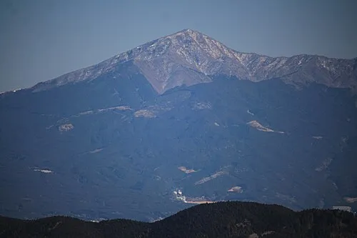 Mount Echizen-dake Mountain, Fuji Shi16 km E
-
Mount Kenashi Mountain, Fujinomiya Shi23 km N
Sources & licences
Data last updated: · 2 independent sources