- Population
- 11,960
- 12K
- Elevation
- 7 m
- above sea level
- Local time
- UTC+09:00
- Asia/Tokyo · UTC+09:00
- Airports
- KIX Kansai International Airport44 km
- SHM Nanki Shirahama Airport45 km
About Yuasa
Yuasa is a town. Location: Yuasa Chō, Arida-gun. Population: 11,960. Elevation: 7 m.
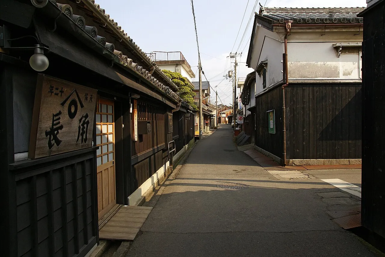
Yuasa (湯浅町, Yuasa-chō) is a town located in Arida District, Wakayama Prefecture, Japan. As of 1 December 2021, the town had an estimated population of 11,413 in 5,338 households and a population density of 550 persons per km2. The total area of the town is 20.79 square kilometres (8.03 sq mi). Yuasa claims to be the birthplace of soy sauce.
Source: Wikipedia · CC BY-SA 4.0
Photos of Yuasa
-

Kenkoku1018 · CC BY-SA 4.0 -

Gohachiyasu1214 · CC BY-SA 4.0 -

Ebiebi2 · CC BY-SA 4.0 -

Asturio Cantabrio · CC BY-SA 4.0 -

Suikotei · CC BY-SA 4.0


Places bordering Yuasa
- Arida
- Hirogawa-chō
- Aridagawa Chō
Population of Yuasa over time
| 2010 | 13,210 | |
|---|---|---|
| 2015 | 12,200 | |
| 2021 | 11,038 |
Censuses and official estimates; source: Wikidata.
Climate of Yuasa
Best months for sightseeingBest months for sightseeing: May–June, October.
This month · November
Outside the best season
Day 17° · Night 10° · Rain 94 mm
Better nearby cities in November
- Kochi · 162 km west18°
- Fujinomiya · 341 km northeast18°
- Ōita · 343 km west18°
- Hottest month
- August (day 31°)
- Coldest month
- January (night 2°)
- Wettest month
- June (254 mm)
- Driest month
- December (47 mm)
Bars: average monthly low and high temperature. Below: precipitation. Monthly averages for 1970–2000 at about 18 km resolution, adjusted for elevation. Highlighted months are mild and relatively dry. Source: WorldClim 2.1 (CC BY 4.0).
Show values as a table
| Month | Jan | Feb | Mar | Apr | May | Jun | Jul | Aug | Sep | Oct | Nov | Dec |
|---|---|---|---|---|---|---|---|---|---|---|---|---|
| Average high (°C) | 9° | 10° | 13° | 19° | 23° | 26° | 30° | 31° | 27° | 22° | 17° | 12° |
| Average low (°C) | 2° | 2° | 5° | 11° | 15° | 19° | 23° | 24° | 21° | 15° | 10° | 4° |
| Precipitation (mm) | 57 | 67 | 108 | 158 | 168 | 254 | 179 | 147 | 238 | 140 | 94 | 47 |
How to get to Yuasa
The nearest airport is Kansai International Airport (KIX), 44 km to the north as the crow flies. The nearest large city is Minato, 20 km to the north.
Airports
- Kansai International Airport (KIX) Osaka 44 kmnorth
- Nanki Shirahama Airport (SHM) Shirahama 45 kmsouth
- Tokushima Awaodori Airport / JMSDF Tokushima Air Base (TKS) Tokushima 54 kmwest
Nearby large cities
- Minato Population: 375.3K 20 kmnorth
- Wakayama Population: 356.7K 22 kmnorth
- Izumisano Population: 100.1K 44 kmnorth
- Kishiwada Population: 205.6K 51 kmnorth
- Izumi Population: 184.6K 55 kmnortheast
Straight-line distances; road distances are longer. Airport data: OurAirports.
Day trips from Yuasa
Within 100 km: 11 historic and cultural sites, 32 natural sites, 16 lakes, rivers and coasts.
0–25 km1 place
- Kinokawa River River 21 kmN
25–60 km12 places
- Awaji Island Island 51 kmNW
- Tomoga Shima Island 32 kmNW
- Osaka Bay Natural site 51 kmN
- Tomogashima Lighthouse Landmark 32 kmNW
60–100 km46 places
- Kii Ōshima Island 87 kmSE
- Mount Rokkō Mountain 83 kmN
- Mount Miwa Mountain 84 kmNE
- Mount Amanokagu Mountain 78 kmNE
Straight-line distances.
Sources & licences
Data last updated: · 2 independent sources