- Population
- 70,972
- 71K
- Elevation
- 7 m
- above sea level
- Local time
- UTC+09:00
- Asia/Tokyo · UTC+09:00
- Airports
- SHM Nanki Shirahama Airport8 km
- KIX Kansai International Airport78 km
About Tanabe
Tanabe is a city. Location: Tanabe Shi, Wakayama. Population: 70,972. Elevation: 7 m.
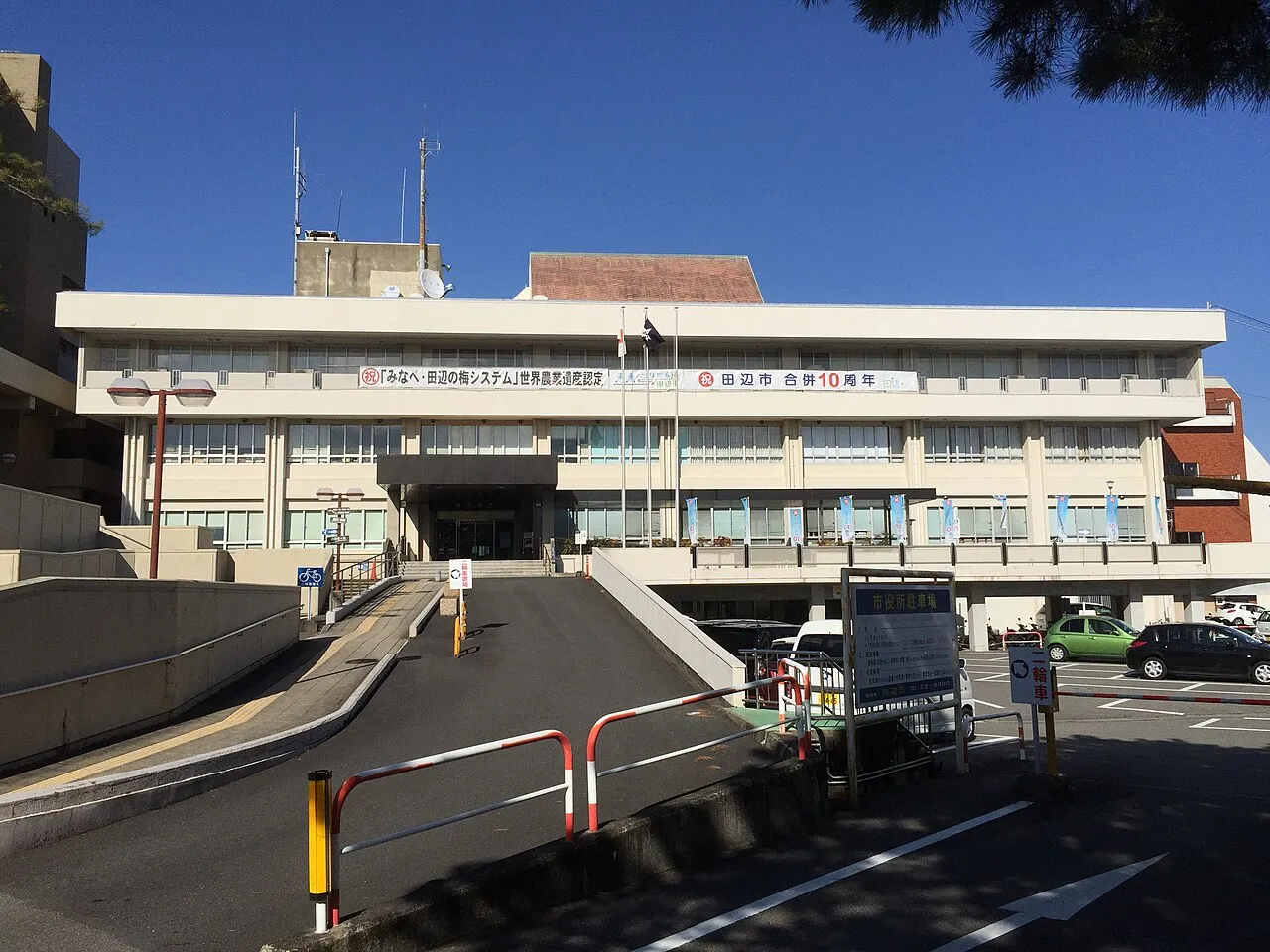
Tanabe (Japanese: 田辺市, Tanabe-shi, pronounced [tanabe ɕi]) is a city located in Wakayama Prefecture, Japan. As of 1 November 2021, the city has an estimated population of 70,972 in 35,076 households and a population density of 69 persons per km2. The total area of the city is 1,026.91 square kilometres (396.49 sq mi). Tanabe is the second most populous city in Wakayama and the largest in the Kansai region of Japan in terms of area.
Source: Wikipedia · CC BY-SA 4.0
Places bordering Tanabe
- Totsukawa Mura
- Shingū
- Minabe Chō
- Inami
- Hidakagawa Chō
- Shirahama Chō
- Kamitonda Chō
- Aridagawa Chō
- Kozagawa Chō
- Nosegawa Mura
Twin towns and sister cities of Tanabe
- Ichinoseki· Japan
- Sakai Shi· Japan
Source: Wikidata. Only places with a page on this site are shown.
Population of Tanabe over time
| 2010 | 79,119 | |
|---|---|---|
| 2015 | 74,770 | |
| 2021 | 68,986 |
Censuses and official estimates; source: Wikidata.
Climate of Tanabe
Best months for sightseeingBest months for sightseeing: May–June, October.
This month · November
A wet month
Day 18° · Night 10° · Rain 123 mm
Better nearby cities in November
- Kochi · 171 km west18°
- Fujinomiya · 340 km northeast18°
- Fuji · 343 km northeast20°
- Hottest month
- August (day 31°)
- Coldest month
- January (night 3°)
- Wettest month
- June (297 mm)
- Driest month
- December (58 mm)
Bars: average monthly low and high temperature. Below: precipitation. Monthly averages for 1970–2000 at about 18 km resolution, adjusted for elevation. Highlighted months are mild and relatively dry. Source: WorldClim 2.1 (CC BY 4.0).
Show values as a table
| Month | Jan | Feb | Mar | Apr | May | Jun | Jul | Aug | Sep | Oct | Nov | Dec |
|---|---|---|---|---|---|---|---|---|---|---|---|---|
| Average high (°C) | 10° | 11° | 14° | 19° | 23° | 26° | 29° | 31° | 28° | 23° | 18° | 13° |
| Average low (°C) | 3° | 3° | 6° | 11° | 15° | 20° | 23° | 24° | 21° | 15° | 10° | 5° |
| Precipitation (mm) | 69 | 81 | 128 | 188 | 202 | 297 | 216 | 194 | 278 | 170 | 123 | 58 |
How to get to Tanabe
The nearest airport is Nanki Shirahama Airport (SHM), 8 km to the south as the crow flies. For international flights: Kansai International Airport (KIX) (78 km). The nearest large city is Minato, 57 km to the north.
Airports
- Nanki Shirahama Airport (SHM) Shirahama 8 kmsouth
- Kansai International Airport (KIX) Osaka 78 kmnorth
- Tokushima Awaodori Airport / JMSDF Tokushima Air Base (TKS) Tokushima 83 kmnorthwest
Nearby large cities
- Minato Population: 375.3K 57 kmnorth
- Wakayama Population: 356.7K 58 kmnorth
- Izumisano Population: 100.1K 76 kmnorth
- Kawachi-Nagano Population: 101.7K 81 kmnorth
- Kishiwada Population: 205.6K 81 kmnorth
Straight-line distances; road distances are longer. Airport data: OurAirports.
Sources & licences
Data last updated: · 2 independent sources