
- Population
- 1,134
- 1.1K
- Elevation
- 344 m
- above sea level
- Local time
- UTC+01:00
- Europe/Luxembourg · UTC+01:00
- Places inside
- 1
- listed under Grosbous
- Airports
- LUX Luxembourg-Findel International Airport28 km
- HHN Frankfurt-Hahn Airport94 km
About Grosbous
Grosbous is a district. Location: Redange, Luxembourg. Population: 1,134.
Grosbous (Luxembourgish: Groussbus [ɡʀəʊ̯sˈbus] or (locally) Bus [buːs]; German: Grosbous) is a former commune and small town in northwestern Luxembourg, in the canton of Redange. As of September 2026, the town of Grosbous, which lies in the south of the commune of Groussbus-Wal, had a population of 1,082.
Source: Wikipedia · CC BY-SA 4.0
Photos of Grosbous
-

Napoléonsgaard Cayambe · CC BY-SA 3.0

Places bordering Grosbous
- Préizerdaul
Population of Grosbous over time
| 2011 | 887 | |
|---|---|---|
| 2012 | 913 | |
| 2013 | 892 | |
| 2014 | 919 | |
| 2015 | 937 | |
| 2016 | 992 | |
| 2017 | 1,026 | |
| 2018 | 1,054 | |
| 2019 | 1,089 | |
| 2020 | 1,111 | |
| 2021 | 1,112 | |
| 2023 | 1,134 |
Censuses and official estimates; source: Wikidata.
Climate of Grosbous
Best months for sightseeingBest months for sightseeing: June–August.
This month · November
A cold month
Day 7° · Night 2° · Rain 86 mm
- Hottest month
- August (day 22°)
- Coldest month
- February (night -1°)
- Wettest month
- December (103 mm)
- Driest month
- August (56 mm)
Bars: average monthly low and high temperature. Below: precipitation. Monthly averages for 1970–2000 at about 18 km resolution, adjusted for elevation. Highlighted months are mild and relatively dry. Source: WorldClim 2.1 (CC BY 4.0).
Show values as a table
| Month | Jan | Feb | Mar | Apr | May | Jun | Jul | Aug | Sep | Oct | Nov | Dec |
|---|---|---|---|---|---|---|---|---|---|---|---|---|
| Average high (°C) | 3° | 5° | 9° | 12° | 17° | 20° | 22° | 22° | 18° | 13° | 7° | 4° |
| Average low (°C) | -1° | -1° | 1° | 3° | 7° | 10° | 12° | 12° | 9° | 6° | 2° | 0° |
| Precipitation (mm) | 92 | 69 | 75 | 57 | 70 | 71 | 64 | 56 | 68 | 82 | 86 | 103 |
How to get to Grosbous
The nearest airport is Luxembourg-Findel International Airport (LUX), 28 km to the southeast as the crow flies. The nearest large city is Trier, 49 km to the east.
Airports
- Luxembourg-Findel International Airport (LUX) Luxembourg 28 kmsoutheast
- Frankfurt-Hahn Airport (HHN) Frankfurt am Main (Lautzenhausen) 94 kmeast
- Metz-Nancy-Lorraine Airport (ETZ) Goin 96 kmsouth
Nearby large cities
- Trier Population: 100.1K 49 kmeast
- Metz Population: 123.9K 80 kmsouth
- Liège Population: 195.3K 94 kmnorth
- Saarbrücken Population: 183K 100 kmsoutheast
- Namur Population: 110.9K 106 kmnorthwest
Straight-line distances; road distances are longer. Airport data: OurAirports.
Day trips from Grosbous
Within 100 km: 269 historic and cultural sites, 2,271 natural sites, 673 lakes, rivers and coasts.
0–25 km65 places
- Château de Berg Historic site 9 kmE
- Montagne de Stockem Mountain 22 kmSW
- Wackendflass Natural site 21 kmW
- Bois du Vicaire Natural site 23 kmNW
25–60 km864 places
- Étang des Épioux Lake 49 kmW
- Lac de Nisramont Lake 41 kmNW
- Steinkopf Mountain 44 kmN
- Steiner Berg Mountain 52 kmN
60–100 km2,284 places
- Île du Moulin Island 86 kmN
- Île Monsin Island 95 kmN
- Île de Franche Garenne Island 99 kmN
- Île d'Androssart Island 90 kmNW
Straight-line distances.
Places in Grosbous
1 place
Dellen
Population: 110
Nearby attractions & nature
Everything nearby-
Napoléonsgaard Mountain, Rambrouch6.3 km W
-
 Château de Berg Historic site, Schieren8.8 km E
-
 Lac de la Haute Sûre Lake, Wiltz9.4 km NW
-
 Wark River, Diekirch10 km E
-
 Alzett River, Luxembourg11 km E
-
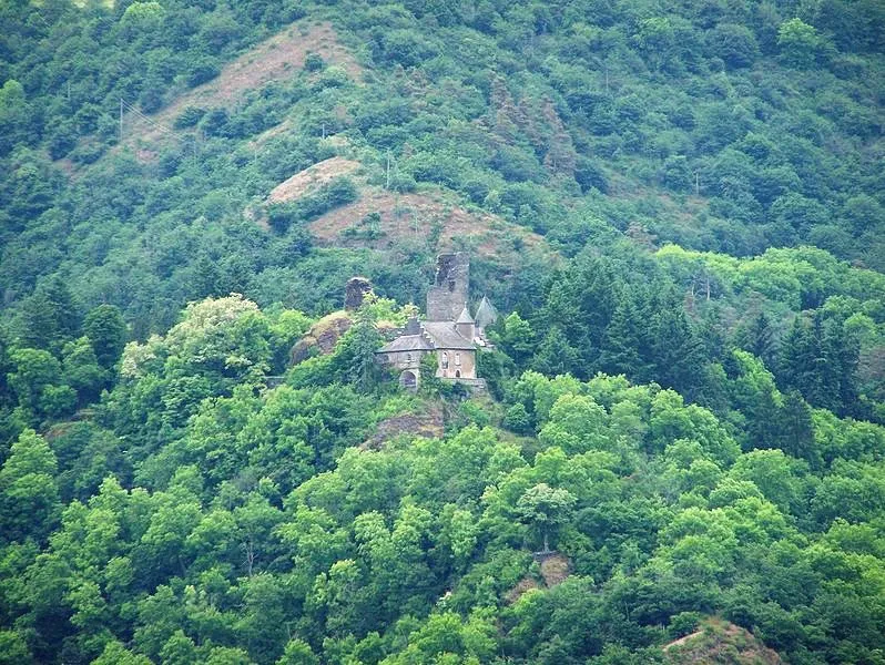 Schloß Falkenstein Historic site, Waldhof-Falkenstein23 km NE
Other regions in Redange


Sources & licences
Data last updated: · 2 independent sources