
- Population
- 335
- 335
- Elevation
- 310 m
- above sea level
- Local time
- UTC+01:00
- Europe/Luxembourg · UTC+01:00
- Airports
- LUX Luxembourg-Findel International Airport43 km
- LGG Liège Airport82 km
About Pintsch
Pintsch is a village. Location: Kiischpelt, Wiltz. Population: 335. Elevation: 310 m.
Pintsch (German pronunciation: [ˈpɪntʃ]; Luxembourgish: Pënsch [pənʃ] ) is a village in the commune of Kiischpelt, in northern Luxembourg. As of September 2026, the village has a population of 349. It was the site of intense fighting between German and American troops in the January 1945, and one of the last sites of conflict of the Battle of the Bulge, being reduced to ruins by the fighting.
Source: Wikipedia · CC BY-SA 4.0
Photos of Pintsch
-

Clerve Self-photographed by Jwh · CC BY-SA 3.0 lu -

Schuttburg Château Hejnjahns · CC BY-SA 4.0


Population of Pintsch over time
| 2021 | 287 | |
|---|---|---|
| 2022 | 293 | |
| 2023 | 315 |
Censuses and official estimates; source: Wikidata.
Climate of Pintsch
Best months for sightseeingBest months for sightseeing: June–August.
This month · November
A cold month
Day 7° · Night 2° · Rain 81 mm
- Hottest month
- August (day 22°)
- Coldest month
- January (night -1°)
- Wettest month
- December (92 mm)
- Driest month
- August (57 mm)
Bars: average monthly low and high temperature. Below: precipitation. Monthly averages for 1970–2000 at about 18 km resolution, adjusted for elevation. Highlighted months are mild and relatively dry. Source: WorldClim 2.1 (CC BY 4.0).
Show values as a table
| Month | Jan | Feb | Mar | Apr | May | Jun | Jul | Aug | Sep | Oct | Nov | Dec |
|---|---|---|---|---|---|---|---|---|---|---|---|---|
| Average high (°C) | 4° | 5° | 9° | 12° | 17° | 20° | 22° | 22° | 18° | 13° | 7° | 5° |
| Average low (°C) | -1° | -1° | 1° | 4° | 8° | 11° | 13° | 12° | 10° | 6° | 2° | 0° |
| Precipitation (mm) | 84 | 63 | 70 | 59 | 70 | 69 | 69 | 57 | 70 | 76 | 81 | 92 |
How to get to Pintsch
The nearest airport is Luxembourg-Findel International Airport (LUX), 43 km to the south as the crow flies. The nearest large city is Trier, 52 km to the southeast.
Airports
- Luxembourg-Findel International Airport (LUX) Luxembourg 43 kmsouth
- Liège Airport (LGG) Grâce-Hollogne 82 kmnorthwest
- Frankfurt-Hahn Airport (HHN) Frankfurt am Main (Lautzenhausen) 90 kmeast
Nearby large cities
- Trier Population: 100.1K 52 kmsoutheast
- Liège Population: 195.3K 78 kmnorthwest
- Aachen Population: 265.2K 87 kmnorth
- Namur Population: 110.9K 97 kmnorthwest
- Maastricht Population: 122.4K 98 kmnorth
Straight-line distances; road distances are longer. Airport data: OurAirports.
Day trips from Pintsch
Within 100 km: 293 historic and cultural sites, 2,455 natural sites, 751 lakes, rivers and coasts.
0–25 km93 places
- Château de Berg Historic site 21 kmS
- Preis Berg Mountain 25 kmNE
- Koppiger Berg Mountain 25 kmN
- Heckenberg Mountain 24 kmN
25–60 km1,159 places
- Étang des Épioux Lake 58 kmSW
- Lac de Nisramont Lake 30 kmNW
- Lac de Robertville Lake 51 kmN
- Mont de la Tour de Coo Mountain 46 kmN
60–100 km2,247 places
- Île du Moulin Island 70 kmNW
- Île Monsin Island 78 kmN
- Île de Franche Garenne Island 82 kmN
- Île d'Androssart Island 87 kmW
Straight-line distances.
Nearby attractions & nature
Everything nearby-
Schuttburg Château Historic site, Parc Hosingen3.4 km S
-
Clerve River, Wiltz4.7 km S
-
Wiltz River, Belgium4.9 km S
-
Affler Höhe Mountain, Affler10 km E
-
Huscherichberg Mountain, Preischeid11 km E
-
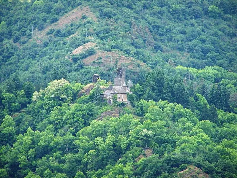 Schloß Falkenstein Historic site, Waldhof-Falkenstein13 km E
Other cities and towns in Kiischpelt
-
 Merkholz Village, Kiischpelt4.4 km SW
-
 Kautenbach Village, Kiischpelt4.7 km S
Sources & licences
Data last updated: · 2 independent sources