Al Hoceima National Park
Local name: ⴰⴼⵔⴰⴳ ⴰⵏⴰⵎⵓⵔ ⵏⵍⵃⵓⵙⵉⵎⴰ
Located in Al-Hoceima, Tanger-Tetouan-Al Hoceima Coordinates: 35°09′58″ N 4°07′51″ W

- Elevation
- 382 m
- above sea level
- Local time
- UTC+00:00
- Africa/Casablanca · UTC+00:00
- Airports
- AHU Cherif Al Idrissi Airport27 km
- NDR Nador Al Aaroui International Airport102 km
About Al Hoceima National Park
Al Hoceima National Park is a natural site. Location: Al-Hoceima, Tanger-Tetouan-Al Hoceima.
Al Hoceima National Park (Arabic: المنتزه الوطني للحسيمة, Tarifit: Afrag Anamur n Lhusima) is a national park located outside the town of Al Hoceima in Morocco. It covers an area of 480 km2 (185 sq mi), including 196 km2 (76 sq mi) of sea. The park was created in 2004 and is managed by the Haut-Commissariat des eaux et forêts et de la lutte contre la désertification.
Source: Wikipedia · CC BY-SA 4.0
Climate of Al Hoceima National Park
Best months for sightseeingBest months for sightseeing: April–May, October.
This month · November
Outside the best season
Day 19° · Night 10° · Rain 35 mm
Better nearby cities in November
- Al Hoceima · 20 km northeast20°
- Ksar El Kebir · 162 km west21°
- Salé Al Jadida · 272 km southwest21°
- Hottest month
- July (day 32°)
- Coldest month
- January (night 6°)
- Wettest month
- March (57 mm)
- Driest month
- July (2 mm)
Bars: average monthly low and high temperature. Below: precipitation. Monthly averages for 1970–2000 at about 18 km resolution, adjusted for elevation. Highlighted months are mild and relatively dry. Source: WorldClim 2.1 (CC BY 4.0).
Show values as a table
| Month | Jan | Feb | Mar | Apr | May | Jun | Jul | Aug | Sep | Oct | Nov | Dec |
|---|---|---|---|---|---|---|---|---|---|---|---|---|
| Average high (°C) | 15° | 16° | 18° | 21° | 24° | 28° | 32° | 32° | 28° | 23° | 19° | 16° |
| Average low (°C) | 6° | 7° | 9° | 11° | 13° | 16° | 19° | 19° | 17° | 13° | 10° | 7° |
| Precipitation (mm) | 54 | 54 | 57 | 52 | 33 | 10 | 2 | 4 | 13 | 24 | 35 | 57 |
How to get to Al Hoceima National Park
The nearest airport is Cherif Al Idrissi Airport (AHU), 27 km to the east as the crow flies. For international flights: Nador Al Aaroui International Airport (NDR) (102 km). The nearest large city is Al Hoceima, 20 km to the northeast.
Airports
- Cherif Al Idrissi Airport (AHU) Al Hoceima 27 kmeast
- Nador Al Aaroui International Airport (NDR) Al Aaroui 102 kmeast
- Melilla Airport (MLN) Melilla 108 kmeast
Nearby large cities
- Al Hoceima Population: 395.6K 20 kmnortheast
- Tétouan Population: 415.8K 121 kmnorthwest
- Algeciras Population: 121.4K 161 kmnorthwest
- Ksar El Kebir Population: 138.3K 163 kmwest
- Marbella Population: 156.3K 165 kmnorthwest
Straight-line distances; road distances are longer. Airport data: OurAirports.
Day trips from Al Hoceima National Park
Within 100 km: 1 historic or cultural site, 4 natural sites, 5 lakes, rivers and coasts.
0–25 km7 places
- Peñón de Vélez de la Gomera Island 15 kmW
- Isla de Mar Island 22 kmE
- Peñón de Alhucemas Island 23 kmE
- Alhucemas Lighthouse Landmark 23 kmE
25–60 km1 place
- Koudiet Tirbîrhîne Mountain 50 kmSW
60–100 km2 places
- Talassemtane National Park Natural site 87 kmW
- Jebel Hamza Mountain 89 kmE
Straight-line distances.
Nearest towns and villages
-
 Rouadi Municipality, Al-Hoceima4.5 km W
-
Senada Municipality, Al-Hoceima11 km SW
-
Ait Kamra Municipality, Al-Hoceima11 km E
-
 Izemmouren Municipality, Al-Hoceima11 km E
-
Izmorene Village, Al-Hoceima13 km E
-
Douar Touzouighine Village, Al-Hoceima8.2 km SE
Nearby attractions & nature
Everything nearby-
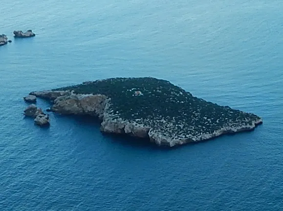 Isla de Tierra Island, Spain21 km E
-
 Rif Mountain, Tanger-Tetouan-Al Hoceima22 km SE
-
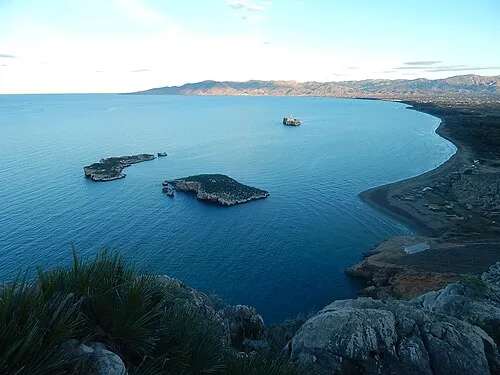 Alhucemas Islands Island, Spain22 km E
-
Isla de Mar Island, Spain22 km E
-
Peñón de Vélez de la Gomera Island, Spain15 km W
-
Peñón de Alhucemas Island, Spain23 km E
-
Alhucemas Lighthouse Landmark, Spain23 km E
Sources & licences
Data last updated: · 2 independent sources