- Elevation
- 775 m
- above sea level
- Local time
- UTC+01:00
- Europe/Skopje · UTC+01:00
- Airports
- SKP Skopje International Airport80 km
- SOF Sofia Airport107 km
About Kalimanci
Kalimanci is a village. Location: Vinica, North Macedonia. Elevation: 775 m. The best months to visit are May–June, September. The nearest airport is Skopje International Airport (80 km). Nearby sights include Ruen and Viničko Kale.
Climate of Kalimanci
Best months for sightseeingBest months for sightseeing: May–June, September.
This month · November
A cold month
Day 10° · Night 0° · Rain 50 mm
- Hottest month
- July (day 28°)
- Coldest month
- January (night -5°)
- Wettest month
- May (55 mm)
- Driest month
- January (29 mm)
Bars: average monthly low and high temperature. Below: precipitation. Monthly averages for 1970–2000 at about 18 km resolution, adjusted for elevation. Highlighted months are mild and relatively dry. Source: WorldClim 2.1 (CC BY 4.0).
Show values as a table
| Month | Jan | Feb | Mar | Apr | May | Jun | Jul | Aug | Sep | Oct | Nov | Dec |
|---|---|---|---|---|---|---|---|---|---|---|---|---|
| Average high (°C) | 4° | 6° | 11° | 16° | 21° | 25° | 28° | 28° | 24° | 17° | 10° | 4° |
| Average low (°C) | -5° | -4° | -1° | 3° | 8° | 11° | 13° | 12° | 9° | 4° | 0° | -4° |
| Precipitation (mm) | 29 | 36 | 37 | 45 | 55 | 53 | 44 | 38 | 37 | 43 | 50 | 43 |
How to get to Kalimanci
The nearest airport is Skopje International Airport (SKP), 80 km to the west as the crow flies. The nearest large city is Skopje, 96 km to the west.
Airports
- Skopje International Airport (SKP) Ilinden 80 kmwest
- Sofia Airport (SOF) Sofia 107 kmnortheast
- Priština Adem Jashari International Airport (PRN) Prishtina 145 kmnorthwest
Nearby large cities
- Skopje Population: 474.9K 96 kmwest
- Sofia Population: 1.2M 102 kmnortheast
- Pristina Population: 550K 142 kmnorthwest
- Prizren Population: 171.5K 156 kmwest
- Niš Population: 250K 162 kmnorth
Straight-line distances; road distances are longer. Airport data: OurAirports.
Day trips from Kalimanci
Within 100 km: 9 historic and cultural sites, 57 natural sites, 9 lakes, rivers and coasts.
0–25 km8 places
- Golak Mountain 13 kmSE
- Viničko Kale Historic site 12 kmSW
- Plačkovica Mountain 22 kmS
- Ruen Mountain 23 kmN
25–60 km19 places
- Stanica Mountain 28 kmNW
- Rizvan Mountain 37 kmSW
- Tapan Mountain 57 kmW
- Dukat Mountain 56 kmN
60–100 km48 places
- Kapnótopos Historic site 92 kmSE
- Oblik Mountain 94 kmNW
- Grot Mountain 93 kmNW
- Gramada Mountain 94 kmN
Straight-line distances.
Nearby attractions & nature
Everything nearby-
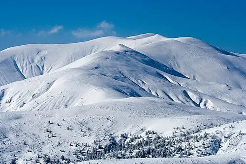 Ruen Mountain, Kyustendil23 km N
-
Viničko Kale Historic site, Vinica12 km SW
-
Crvena Kiselica Mountain, Bulgaria16 km NE
-
Gradska Mogila Mountain, Bulgaria25 km E
-
Borova Mogila Mountain, Blagoevgrad23 km E
-
Kamenita Mogila Mountain, Bulgaria20 km NE
Other cities and towns in Vinica


Sources & licences
Data last updated: