- Local time
- UTC+01:00
- Europe/Oslo · UTC+01:00
- Elevation
- 885 m
- above sea level
- Airports
- RRS Røros Airport122 km
- SCR Scandinavian Mountains Airport156 km
About Venabygd fjellkapell
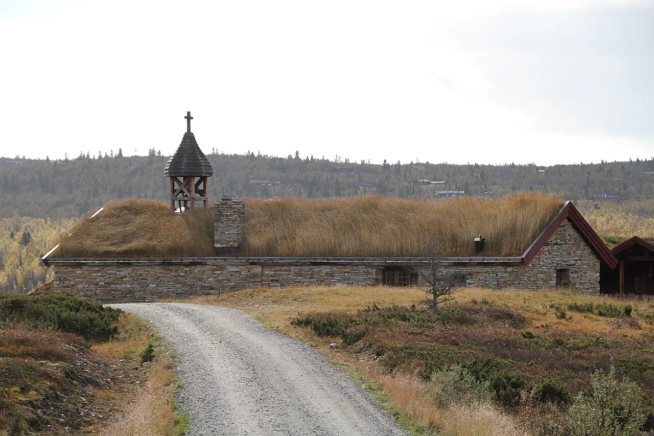
Venabygd fjellkapell is a tourist attraction. Location: Ringebu, Innlandet.
Venabygd Chapel (Norwegian: Venabygd fjellkapell) is a parish church of the Church of Norway in Ringebu Municipality in Innlandet county, Norway. It is located in the village of Venabu. It is an annex chapel for the Venabygd parish which is part of the Sør-Gudbrandsdal prosti (deanery) in the Diocese of Hamar. The brown, wood church was built in a long church design in 1979 using plans drawn up by the architect Odd Østbye. The church seats about 50 people.
Source: Wikipedia · CC BY-SA 4.0
Climate of Venabygd fjellkapell
Best months for sightseeingBest months for sightseeing: July.
This month · November
A cold month
Day -3° · Night -8° · Rain 48 mm
- Hottest month
- July (day 16°)
- Coldest month
- January (night -12°)
- Wettest month
- July (80 mm)
- Driest month
- April (24 mm)
Bars: average monthly low and high temperature. Below: precipitation. Monthly averages for 1970–2000 at about 18 km resolution, adjusted for elevation. Highlighted months are mild and relatively dry. Source: WorldClim 2.1 (CC BY 4.0).
Show values as a table
| Month | Jan | Feb | Mar | Apr | May | Jun | Jul | Aug | Sep | Oct | Nov | Dec |
|---|---|---|---|---|---|---|---|---|---|---|---|---|
| Average high (°C) | -6° | -5° | -2° | 4° | 10° | 14° | 16° | 14° | 9° | 3° | -3° | -6° |
| Average low (°C) | -12° | -12° | -9° | -5° | 0° | 5° | 7° | 6° | 2° | -3° | -8° | -12° |
| Precipitation (mm) | 38 | 25 | 32 | 24 | 45 | 72 | 80 | 77 | 62 | 60 | 48 | 35 |
Other places to visit in this season: July
How to get to Venabygd fjellkapell
The nearest airport is Røros Airport (RRS), 122 km to the northeast as the crow flies. For international flights: Scandinavian Mountains Airport (SCR) (156 km). The nearest large city is Oslo, 196 km to the south.
Airports
- Røros Airport (RRS) Røros 122 kmnortheast
- Scandinavian Mountains Airport (SCR) Malung-Sälen 156 kmeast
- Oslo-Gardermoen International Airport (OSL) Oslo (Gardermoen) 171 kmsouth
Nearby large cities
- Oslo Population: 1.1M 196 kmsouth
- Trondheim Population: 216.5K 199 kmnorth
- Drammen Population: 106K 212 kmsouth
- Bergen Population: 294K 293 kmsouthwest
- Stavanger Population: 151.7K 383 kmsouthwest
Straight-line distances; road distances are longer. Airport data: OurAirports.
Day trips from Venabygd fjellkapell
Within 100 km: 5 historic and cultural sites.
25–60 km3 places
- Sjoa kapell Attraction 29 kmW
- Espedalen fjellkirke Attraction 40 kmSW
- Nordseter fjellkirke Attraction 59 kmSE
60–100 km2 places
- Nykirke Attraction 84 kmS
- Eysteinkyrkja Attraction 70 kmNW
Straight-line distances.
Nearest towns and villages
Sources & licences
Data last updated: · 2 independent sources