- Local time
- UTC+01:00
- Europe/Oslo · UTC+01:00
- Elevation
- 780 m
- above sea level
- Airports
- RRS Røros Airport160 km
- OSL Oslo-Gardermoen International Airport164 km
About Espedalen fjellkirke
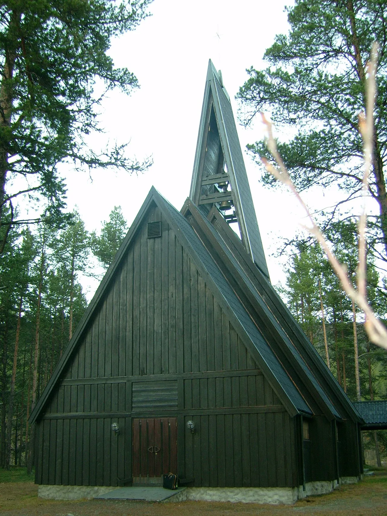
Espedalen fjellkirke is a tourist attraction. Location: Sør-Fron, Innlandet.
Espedalen Church (Norwegian: Espedalen fjellkirke) is a parish church of the Church of Norway in Sør-Fron Municipality in Innlandet county, Norway. It is located in the Espedalen valley, at Verksodden. It is one of the churches for the Sør-Fron parish which is part of the Sør-Gudbrandsdal prosti (deanery) in the Diocese of Hamar. The brown, wooden church was built in a long church design in 1974 using plans drawn up by the architect Bjarne Bystad Ellefsen. The church seats about 130 people.
Source: Wikipedia · CC BY-SA 4.0
Climate of Espedalen fjellkirke
Best months for sightseeingBest months for sightseeing: July.
This month · November
A cold month
Day -1° · Night -7° · Rain 55 mm
- Hottest month
- July (day 17°)
- Coldest month
- February (night -11°)
- Wettest month
- July (85 mm)
- Driest month
- April (28 mm)
Bars: average monthly low and high temperature. Below: precipitation. Monthly averages for 1970–2000 at about 18 km resolution, adjusted for elevation. Highlighted months are mild and relatively dry. Source: WorldClim 2.1 (CC BY 4.0).
Show values as a table
| Month | Jan | Feb | Mar | Apr | May | Jun | Jul | Aug | Sep | Oct | Nov | Dec |
|---|---|---|---|---|---|---|---|---|---|---|---|---|
| Average high (°C) | -4° | -3° | -1° | 4° | 10° | 15° | 17° | 15° | 10° | 5° | -1° | -3° |
| Average low (°C) | -11° | -11° | -9° | -4° | 1° | 5° | 8° | 7° | 3° | -1° | -7° | -10° |
| Precipitation (mm) | 44 | 30 | 36 | 28 | 49 | 81 | 85 | 79 | 73 | 65 | 55 | 40 |
Other places to visit in this season: July
How to get to Espedalen fjellkirke
The nearest airport is Røros Airport (RRS), 160 km to the northeast as the crow flies. For international flights: Oslo-Gardermoen International Airport (OSL) (164 km). The nearest large city is Oslo, 183 km to the south.
Airports
- Røros Airport (RRS) Røros 160 kmnortheast
- Oslo-Gardermoen International Airport (OSL) Oslo (Gardermoen) 164 kmsoutheast
- Scandinavian Mountains Airport (SCR) Malung-Sälen 181 kmeast
Nearby large cities
- Oslo Population: 1.1M 183 kmsouth
- Drammen Population: 106K 192 kmsouth
- Trondheim Population: 216.5K 227 kmnorth
- Bergen Population: 294K 254 kmsouthwest
- Stavanger Population: 151.7K 345 kmsouthwest
Straight-line distances; road distances are longer. Airport data: OurAirports.
Day trips from Espedalen fjellkirke
Within 100 km: 6 historic and cultural sites.
25–60 km2 places
- Venabygd fjellkapell Attraction 40 kmNE
- Sjoa kapell Attraction 27 kmN
60–100 km4 places
- Nykirke Attraction 75 kmSE
- Lykkja kapell Attraction 71 kmSW
- Eysteinkyrkja Attraction 88 kmN
- Nordseter fjellkirke Attraction 67 kmSE
Straight-line distances.
Nearest towns and villages

Sources & licences
Data last updated: · 2 independent sources