- Population
- 343
- 343
- Elevation
- 420 m
- above sea level
- Local time
- UTC+01:00
- Europe/Oslo · UTC+01:00
- Airports
- OSL Oslo-Gardermoen International Airport153 km
- HOV Ørsta-Volda Airport, Hovden196 km
About Slidre
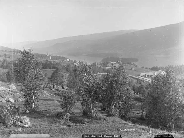
Slidre is a city. Location: Vestre Slidre, Innlandet. Population: 343. Elevation: 420 m.
Slidre is the administrative centre of Vestre Slidre Municipality in Innlandet county, Norway. The village is located along the Slidrefjorden in the Valdres district. The village is located along the European route E16 highway, about 25 kilometres (16 mi) northwest of Fagernes. The 0.47-square-kilometre (120-acre) village has a population (2024) of 310 and a population density of 660 inhabitants per square kilometre (1,700/sq mi).
Source: Wikipedia · CC BY-SA 4.0
At a glance
- Area
- 45 ha
Source: Wikidata
Photos of Slidre
-

Johannes Flintoe · Public domain

Population of Slidre over time
| 2019 | 343 | |
|---|---|---|
| 2020 | 343 | |
| 2021 | 337 | |
| 2022 | 322 | |
| 2023 | 301 | |
| 2024 | 310 | |
| 2025 | 309 |
Censuses and official estimates; source: Wikidata.
Climate of Slidre
Best months for sightseeingBest months for sightseeing: June–August.
This month · November
A cold month
Day 1° · Night -5° · Rain 59 mm
- Hottest month
- July (day 19°)
- Coldest month
- January (night -10°)
- Wettest month
- July (81 mm)
- Driest month
- April (29 mm)
Bars: average monthly low and high temperature. Below: precipitation. Monthly averages for 1970–2000 at about 18 km resolution, adjusted for elevation. Highlighted months are mild and relatively dry. Source: WorldClim 2.1 (CC BY 4.0).
Show values as a table
| Month | Jan | Feb | Mar | Apr | May | Jun | Jul | Aug | Sep | Oct | Nov | Dec |
|---|---|---|---|---|---|---|---|---|---|---|---|---|
| Average high (°C) | -3° | -1° | 2° | 6° | 13° | 17° | 19° | 18° | 12° | 7° | 1° | -2° |
| Average low (°C) | -10° | -10° | -7° | -3° | 3° | 7° | 9° | 8° | 4° | 0° | -5° | -9° |
| Precipitation (mm) | 48 | 31 | 37 | 29 | 45 | 74 | 81 | 75 | 69 | 65 | 59 | 44 |
How to get to Slidre
The nearest airport is Oslo-Gardermoen International Airport (OSL), 153 km to the southeast as the crow flies. The nearest large city is Oslo, 163 km to the southeast.
Airports
- Oslo-Gardermoen International Airport (OSL) Oslo (Gardermoen) 153 kmsoutheast
- Ørsta-Volda Airport, Hovden (HOV) Ørsta 196 kmnorthwest
- Molde Airport, Årø (MOL) Årø 206 kmnorthwest
Nearby large cities
- Oslo Population: 1.1M 163 kmsoutheast
- Drammen Population: 106K 164 kmsoutheast
- Bergen Population: 294K 214 kmwest
- Trondheim Population: 216.5K 271 kmnorth
- Stavanger Population: 151.7K 297 kmsouthwest
Straight-line distances; road distances are longer. Airport data: OurAirports.
Day trips from Slidre
Within 100 km: 6 historic and cultural sites.
0–25 km1 place
- Lykkja kapell Attraction 24 kmS
25–60 km1 place
- Espedalen fjellkirke Attraction 48 kmNE
60–100 km4 places
- Venabygd fjellkapell Attraction 86 kmNE
- Nykirke Attraction 76 kmE
- Sjoa kapell Attraction 72 kmNE
- Nordseter fjellkirke Attraction 89 kmE
Straight-line distances.
Sources & licences
Data last updated: · 2 independent sources