Police Custody Camp Falstad
Local name: Falstad
Located in Levanger, Trøndelag Coordinates: 63°39′38″ N 11°15′21″ E
- Local time
- UTC+01:00
- Europe/Oslo · UTC+01:00
- Elevation
- 260 m
- above sea level
About Police Custody Camp Falstad
Police Custody Camp Falstad is a historic site. Location: Levanger, Trøndelag.
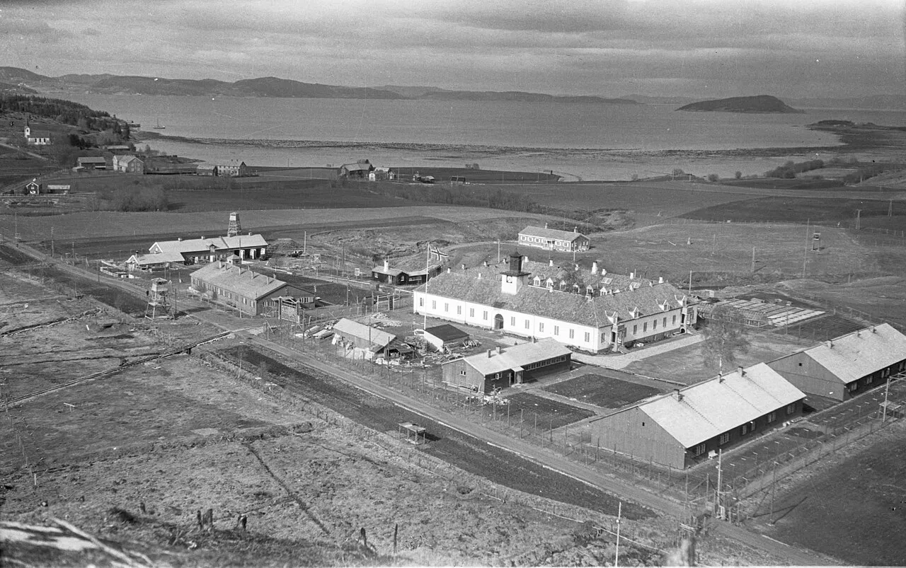
Falstad concentration camp (Norwegian: Falstad fangeleir or German: SS-Strafgefangenenlager Falstad) was situated in the village of Ekne in what was Skogn Municipality (now part of Levanger Municipality in Trøndelag county) in Norway. It was used mostly for political prisoners from Nazi-occupied territories.
Read more on Wikipedia Text: Wikipedia contributors · CC BY-SA 4.0 · shortened
At a glance
- Built
- 1941
Source: Wikidata
Climate of Police Custody Camp Falstad
Best months for sightseeing: July–August.
| Month | Jan | Feb | Mar | Apr | May | Jun | Jul | Aug | Sep | Oct | Nov | Dec |
|---|---|---|---|---|---|---|---|---|---|---|---|---|
| Average high (°C) | -1° | -1° | 2° | 6° | 12° | 16° | 18° | 17° | 12° | 7° | 2° | 0° |
| Average low (°C) | -7° | -6° | -4° | -1° | 4° | 7° | 10° | 9° | 6° | 2° | -3° | -6° |
| Precipitation (mm) | 108 | 89 | 77 | 72 | 69 | 92 | 113 | 112 | 137 | 128 | 96 | 121 |
Monthly averages for 1970–2000 at about 18 km resolution, adjusted for elevation. Highlighted months are mild and relatively dry. Source: WorldClim 2.1 (CC BY 4.0).
Airports nearest to Police Custody Camp Falstad
- Trondheim Airport, Værnes (TRD) Trondheim 28 km
- Ørland Airport (OLA) Ørland 82 km
- Røros Airport (RRS) Røros 121 km
Straight-line distance; airports with scheduled flights only. Source: OurAirports (public domain).
Nearest towns and villages
Sources & licences
Data last updated: · 2 independent sources