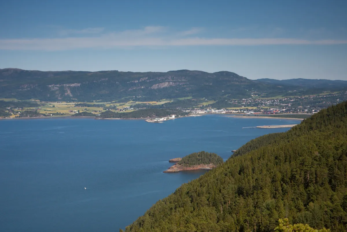
- Population
- 15,693
- 15.7K
- Elevation
- 15 m
- above sea level
- Local time
- UTC+01:00
- Europe/Oslo · UTC+01:00
- Airports
- TRD Trondheim Airport, Værnes1 km
- OLA Ørland Airport71 km
About Stjørdalshalsen
Stjørdalshalsen is a town. Location: Stjørdal, Trøndelag. Population: 15,693. Elevation: 15 m.
Stjørdalshalsen or Stjørdal (nickname: Halsen) is a town and the administrative centre of Stjørdal Municipality in Trøndelag county, Norway. It is located between the rivers Stjørdalselva and Gråelva to the south and north and by the Trondheimsfjord to the west. The 8.74-square-kilometre (2,160-acre) town has a population (2024) of 15,693 and a population density of 1,796 inhabitants per square kilometre (4,650/sq mi). Stjørdalshalsen was granted town status in 1997.
Source: Wikipedia · CC BY-SA 4.0
At a glance
- Area
- 6.8 km²
Source: Wikidata
Travel notes for Stjørdalshalsen
From Wikivoyage
Stjørdalshalsen, Stjørdal for short, is a town in Trøndelag in Norway.
Understand+
Stjørdalshalsen is at the mouth of the valley Stjørdal. It is the centre for Stjørdal district. The Stjørdal valley stretches for some 70 km from Trondheimsfjord to the border with Sweden. The lower part of the valley is relatively wide agricultural flatlands. The flatlands at the mouth is home to Stjørdal town with some 12,000 people as well as Trondheim's airport and the Hell suburb on the other side of the airport. The upper part of the valley is more or less a river gorge, except at Meråker village.
Stjørdalshalsen/Hell is an important junction as the road and the railway connections with Sweden joins the Norwegian network there.
Hell:
Hell is a village and suburb of Stjørdal town, separated from the centre by the runway. Hell has some 1,400 inhabitants administratively part of the Stjørdal municipality. While there's very little to see there, except for an annual blues festival in September, it's always fun to get a picture of yourself outside Gods Expedition (freight forwarding office).
While the Old Norse word Hel is the same as today's English Hell, the name stems from the Old Norse word hellir, which means "overhang", "cliff cave". The Norwegian word hell can also mean "luck". As a proper noun, Hel was the ruler of Hel. In modern Norwegian the word for hell is helvete.
Hell is 1.5 km (1 mile) from the airport.
Get in+
By car:
The town is on E6, Norway's main north-south highway, 40 km east from Trondheim, the road continuing to the north from Strjørndal.
Coming from Sweden, E14 (from Östersund and E45) ends in Stjørdal north of the airport.
By plane:
1 Trondheim Airport Værnes (TRD IATA). There are plenty of flights every day from Oslo and several other important cities in Norway and elsewhere in Europe, as well as from some Norwegian short-field airports. There are also flights from many destinations in the Mediterranean and on the Canary Islands. There is a train and bus connection from the airport.
By train:
Trains are operated by Vy (formerly NSB), who also sells the tickets.
2 Stjørdal station.
3 Værnes station. Railway station for the airport.
4 Hell station. Local trains from Trondheim, the airport and Steinkjer stop here. There are one or two departures per hour. There are also trains from Sweden (twice per day) that stop in Hell. If you want to take the train from Hell, be aware that the train will only stop if they see someone standing at the platform, otherwise it will pass.
Source: Wikivoyage · CC BY-SA 4.0 · abridged
Population of Stjørdalshalsen over time
| 2019 | 14,723 | |
|---|---|---|
| 2020 | 14,868 | |
| 2021 | 13,394 | |
| 2022 | 13,378 | |
| 2023 | 13,596 | |
| 2024 | 15,693 | |
| 2025 | 15,874 |
Censuses and official estimates; source: Wikidata.
Climate of Stjørdalshalsen
Best months for sightseeingBest months for sightseeing: June–August.
This month · November
A cold month
Day 4° · Night -2° · Rain 74 mm
- Hottest month
- July (day 19°)
- Coldest month
- January (night -5°)
- Wettest month
- September (111 mm)
- Driest month
- April (52 mm)
Bars: average monthly low and high temperature. Below: precipitation. Monthly averages for 1970–2000 at about 18 km resolution, adjusted for elevation. Highlighted months are mild and relatively dry. Source: WorldClim 2.1 (CC BY 4.0).
Show values as a table
| Month | Jan | Feb | Mar | Apr | May | Jun | Jul | Aug | Sep | Oct | Nov | Dec |
|---|---|---|---|---|---|---|---|---|---|---|---|---|
| Average high (°C) | 1° | 2° | 4° | 8° | 14° | 17° | 19° | 18° | 14° | 9° | 4° | 2° |
| Average low (°C) | -5° | -5° | -3° | 0° | 5° | 8° | 10° | 10° | 7° | 3° | -2° | -4° |
| Precipitation (mm) | 75 | 65 | 58 | 52 | 56 | 81 | 101 | 94 | 111 | 99 | 74 | 89 |
How to get to Stjørdalshalsen
The nearest airport is Trondheim Airport, Værnes (TRD), 1 km to the south as the crow flies. The nearest large city is Trondheim, 27 km to the west.
Airports
- Trondheim Airport, Værnes (TRD) Trondheim 1 kmsouth
- Ørland Airport (OLA) Ørland 71 kmwest
- Røros Airport (RRS) Røros 101 kmsouth
Nearby large cities
- Trondheim Population: 216.5K 27 kmwest
- Oslo Population: 1.1M 396 kmsouth
Straight-line distances; road distances are longer. Airport data: OurAirports.
Day trips from Stjørdalshalsen
Within 100 km: 4 historic and cultural sites, 27 natural sites, 3 lakes, rivers and coasts.
25–60 km4 places
- Kristiansten Fortress Historic site 26 kmW
- Police Custody Camp Falstad Historic site 27 kmNE
- Skarnsund Bridge Landmark 42 kmN
- Ceciliebrua Landmark 28 kmW
60–100 km30 places
- Järpön Island 86 kmE
- Godön Island 82 kmE
- Årsön Island 85 kmE
- Skiltjulke Mountain 97 kmSE
Straight-line distances.
Sources & licences
Data last updated: · 2 independent sources