Konopnica
Located in Wieluń County, Łódź Voivodeship Coordinates: 51°21′12″ N 18°49′24″ E
- Population
- 3,815
- 3.8K
- Elevation
- 161 m
- above sea level
- Local time
- UTC+01:00
- Europe/Warsaw · UTC+01:00
- Places inside
- 1
- listed under Konopnica
- Airports
- LCJ Łódź Władysław Reymont Airport57 km
- KTW Katowice Wojciech Korfanty International Airport99 km
About Konopnica
Konopnica is a municipality. Location: Wieluń County, Łódź Voivodeship. Population: 3,815. Elevation: 161 m. The best months to visit are June–August. The nearest airport is Łódź Władysław Reymont Airport (57 km). Nearby sights include Osjaków Ghetto and Widawa Ghetto.
Climate of Konopnica
Best months for sightseeingBest months for sightseeing: June–August.
This month · November
A cold month
Day 6° · Night 1° · Rain 39 mm
- Hottest month
- July (day 23°)
- Coldest month
- January (night -4°)
- Wettest month
- July (80 mm)
- Driest month
- February (26 mm)
Bars: average monthly low and high temperature. Below: precipitation. Monthly averages for 1970–2000 at about 18 km resolution, adjusted for elevation. Highlighted months are mild and relatively dry. Source: WorldClim 2.1 (CC BY 4.0).
Show values as a table
| Month | Jan | Feb | Mar | Apr | May | Jun | Jul | Aug | Sep | Oct | Nov | Dec |
|---|---|---|---|---|---|---|---|---|---|---|---|---|
| Average high (°C) | 1° | 2° | 7° | 13° | 19° | 21° | 23° | 23° | 18° | 13° | 6° | 2° |
| Average low (°C) | -4° | -4° | 0° | 3° | 8° | 11° | 13° | 12° | 9° | 5° | 1° | -3° |
| Precipitation (mm) | 30 | 26 | 32 | 36 | 56 | 69 | 80 | 64 | 50 | 40 | 39 | 39 |
How to get to Konopnica
The nearest airport is Łódź Władysław Reymont Airport (LCJ), 57 km to the northeast as the crow flies. The nearest large city is Brno, 287 km to the southwest.
Airports
- Łódź Władysław Reymont Airport (LCJ) Łódź 57 kmnortheast
- Katowice Wojciech Korfanty International Airport (KTW) Katowice 99 kmsouth
- Copernicus Wrocław Airport (WRO) Wrocław 138 kmwest
Nearby large cities
- Brno Population: 404.3K 287 kmsouthwest
- Prague Population: 1.2M 341 kmsouthwest
- Košice Population: 225K 341 kmsoutheast
- Dresden Population: 564.9K 357 kmwest
- Bratislava Population: 423.7K 377 kmsouth
Straight-line distances; road distances are longer. Airport data: OurAirports.
Day trips from Konopnica
Within 100 km: 53 historic and cultural sites, 14 natural sites.
0–25 km4 places
- Widawa Ghetto Historic site 12 kmNE
- Wieluń Ghetto Historic site 24 kmSW
- Osjaków Ghetto Historic site 7 kmS
- Złoczew Ghetto Historic site 17 kmNW
25–60 km19 places
- Borowa Góra Mountain 46 kmE
- Wieruszów Ghetto Historic site 46 kmW
- Bełchatów Ghetto Historic site 37 kmE
- Bugaj Ghetto Historic site 50 kmNE
60–100 km44 places
- Góra Diabla Mountain 84 kmE
- Złota Góra Mountain 98 kmN
- Zielona Góra Mountain 70 kmSE
- Winna Góra Mountain 85 kmW
Straight-line distances.
Places in Konopnica
1 placeBar: population relative to the most populous place in this list.
Nearby attractions & nature
Everything nearby-
Osjaków Ghetto Historic site, Osjaków7.4 km S
-
Widawa Ghetto Historic site, Widawa12 km NE
-
Wieluń Ghetto Historic site, Gmina Wieluń24 km SW
-
Złoczew Ghetto Historic site, Gmina Złoczew17 km NW
Other cities and towns in Wieluń County
-
Ostrówek Municipality, Wieluń County14 km W
-
Gmina Wieluń Municipality, Wieluń County23 km SW
-
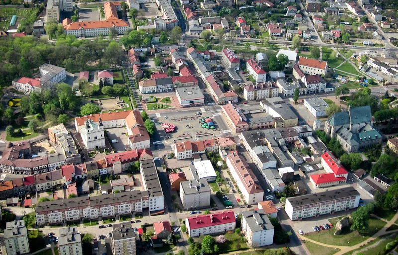 Wieluń Town, Gmina Wieluń23 km SW
-
Gmina Czarnożyły Municipality, Wieluń County20 km SW
-
Wierzchlas Municipality, Wieluń County22 km S
-
Gmina Pątnów Municipality, Wieluń County27 km SW
Sources & licences
Data last updated: