- Elevation
- 777 m
- above sea level
- Local time
- UTC+01:00
- Europe/Warsaw · UTC+01:00
- Airports
- WRO Copernicus Wrocław Airport54 km
- PED Pardubice Airport92 km
About Młyńsko
Młyńsko is a mountain. Location: Pieszyce, Dzierżoniów County. Elevation: 777 m. The best months to visit are June–August. The nearest airport is Copernicus Wrocław Airport (54 km). Nearby sights include Wielka Sowa and Rymarz.
Photos of Młyńsko
-

Włodarz Wikimedia Commons · CC BY-SA 3.0 -
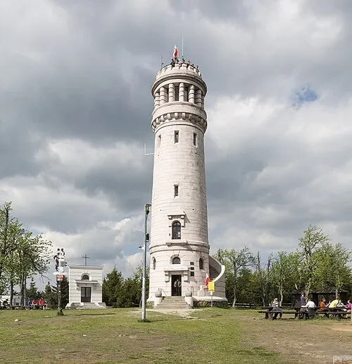
Wielka Sowa Jacek Halicki · CC BY-SA 4.0 -
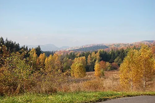
Góra Ostoia Lilly M · CC BY 2.5 -
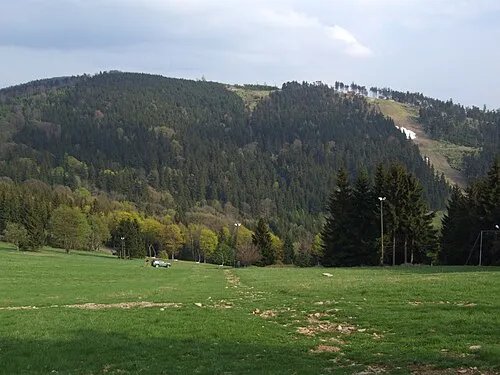
Rymarz Pudelek · CC BY-SA 3.0 -
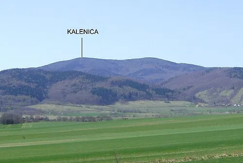
Kalenica Timaska · CC0


Climate of Młyńsko
Best months for sightseeingBest months for sightseeing: June–August.
This month · November
A cold month
Day 3° · Night -3° · Rain 35 mm
- Hottest month
- August (day 20°)
- Coldest month
- January (night -8°)
- Wettest month
- July (92 mm)
- Driest month
- February (24 mm)
Bars: average monthly low and high temperature. Below: precipitation. Monthly averages for 1970–2000 at about 18 km resolution, adjusted for elevation. Highlighted months are mild and relatively dry. Source: WorldClim 2.1 (CC BY 4.0).
Show values as a table
| Month | Jan | Feb | Mar | Apr | May | Jun | Jul | Aug | Sep | Oct | Nov | Dec |
|---|---|---|---|---|---|---|---|---|---|---|---|---|
| Average high (°C) | -2° | -1° | 4° | 9° | 15° | 18° | 19° | 20° | 15° | 9° | 3° | -1° |
| Average low (°C) | -8° | -7° | -4° | -1° | 4° | 7° | 8° | 8° | 5° | 1° | -3° | -6° |
| Precipitation (mm) | 25 | 24 | 30 | 38 | 60 | 84 | 92 | 73 | 49 | 37 | 35 | 33 |
How to get to Młyńsko
The nearest airport is Copernicus Wrocław Airport (WRO), 54 km to the northeast as the crow flies. The nearest large city is Prague, 162 km to the southwest.
Airports
- Copernicus Wrocław Airport (WRO) Wrocław 54 kmnortheast
- Pardubice Airport (PED) Pardubice 92 kmsouthwest
- Leoš Janáček Airport Ostrava (OSR) Mošnov 159 kmsoutheast
Nearby large cities
- Prague Population: 1.2M 162 kmsouthwest
- Brno Population: 404.3K 166 kmsouth
- Dresden Population: 564.9K 199 kmwest
- Chemnitz Population: 247.2K 253 kmwest
- Bratislava Population: 423.7K 286 kmsouth
Straight-line distances; road distances are longer. Airport data: OurAirports.
Day trips from Młyńsko
Within 100 km: 69 historic and cultural sites, 535 natural sites.
0–25 km108 places
- Leszek Mountain 23 kmSE
- Klimek Mountain 23 kmSE
- Włodarz Mountain 7 kmW
- Wielka Sowa Mountain 1 kmSW
25–60 km256 places
- Sucha Kopa Mountain 57 kmSE
- Bielec Mountain 43 kmW
- Goworek Mountain 59 kmS
- Parkowa Mountain 49 kmW
60–100 km240 places
- Tvarožník Mountain 70 kmW
- Jastrzębiec Mountain 74 kmW
- Baranek Wawrzyn Mountain 77 kmN
- Wysoka Kopa Mountain 78 kmW
Straight-line distances.
Nearest towns and villages

Nearby attractions & nature
Everything nearby-
Wielka Sowa Mountain, Pieszyce1.3 km SW
-
Rymarz Mountain, Nowa Ruda4.5 km SE
-
Korczak Mountain, Pieszyce4.6 km SE
-
Kalenica Mountain, Nowa Ruda5.7 km SE
-
Słoneczna Mountain, Bielawa5 km SE
-
Moszna Mountain, Głuszyca5.5 km W
-
Góra Ostoia Mountain, Głuszyca5.9 km W
-
 Włodarz Mountain, Głuszyca6.6 km W
Sources & licences
Data last updated: · 2 independent sources