- Population
- 4,648
- 4.6K
- Elevation
- 235 m
- above sea level
- Local time
- UTC+01:00
- Europe/Warsaw · UTC+01:00
- Airports
- DRS Dresden Airport106 km
- WRO Copernicus Wrocław Airport114 km
About Leśna
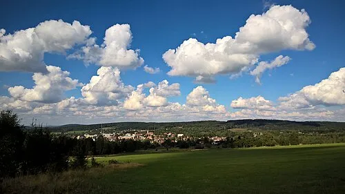
Leśna is a village. Location: Gmina Leśna, Lubań County. Population: 4,648. Elevation: 235 m.
Leśna [ˈlɛɕna] (German: Marklissa) is a town in Lubań County, Lower Silesian Voivodeship, in south-western Poland, close to the Czech border. It is the seat of the administrative district (gmina) called Gmina Leśna. As of 2019, the town has a population of 4,439.
Source: Wikipedia · CC BY-SA 4.0
Climate of Leśna
Best months for sightseeingBest months for sightseeing: June–August.
This month · November
A cold month
Day 6° · Night 1° · Rain 44 mm
- Hottest month
- August (day 23°)
- Coldest month
- January (night -4°)
- Wettest month
- July (78 mm)
- Driest month
- February (31 mm)
Bars: average monthly low and high temperature. Below: precipitation. Monthly averages for 1970–2000 at about 18 km resolution, adjusted for elevation. Highlighted months are mild and relatively dry. Source: WorldClim 2.1 (CC BY 4.0).
Show values as a table
| Month | Jan | Feb | Mar | Apr | May | Jun | Jul | Aug | Sep | Oct | Nov | Dec |
|---|---|---|---|---|---|---|---|---|---|---|---|---|
| Average high (°C) | 1° | 3° | 7° | 13° | 18° | 21° | 23° | 23° | 18° | 13° | 6° | 3° |
| Average low (°C) | -4° | -3° | 0° | 3° | 8° | 11° | 12° | 12° | 9° | 5° | 1° | -2° |
| Precipitation (mm) | 39 | 31 | 37 | 46 | 66 | 70 | 78 | 75 | 47 | 44 | 44 | 47 |
How to get to Leśna
The nearest airport is Dresden Airport (DRS), 106 km to the west as the crow flies. The nearest large city is Dresden, 107 km to the west.
Airports
- Dresden Airport (DRS) Dresden 106 kmwest
- Copernicus Wrocław Airport (WRO) Wrocław 114 kmeast
- Pardubice Airport (PED) Pardubice 117 kmsouth
Nearby large cities
- Dresden Population: 564.9K 107 kmwest
- Prague Population: 1.2M 120 kmsouthwest
- Chemnitz Population: 247.2K 165 kmwest
- Leipzig Population: 505K 205 kmwest
- Berlin Population: 3.4M 210 kmnorthwest
Straight-line distances; road distances are longer. Airport data: OurAirports.
Day trips from Leśna
Within 100 km: 132 historic and cultural sites, 913 natural sites, 113 lakes, rivers and coasts.
0–25 km37 places
- Jastrzębiec Mountain 24 kmSE
- Steinbach River 22 kmW
- Pließnitz River 21 kmW
- Kleine Gaule River 22 kmW
25–60 km421 places
- Tvarožník Mountain 32 kmSE
- Bielec Mountain 52 kmSE
- Speicherbecken Quitzdorf Lake 45 kmNW
- Großteich Lake 47 kmNW
60–100 km700 places
- Pirna-Sonnenstein Mountain 92 kmW
- Lysá Mountain 63 kmSW
- Hořidla Mountain 88 kmSW
- Vosí vrch Mountain 62 kmW
Straight-line distances.
Nearby attractions & nature
Everything nearby-
Wysoka Stróża Mountain, Gmina Leśna2.8 km SW
-
Hartmannsdorf Concentration Camp Historic site, Gmina Leśna2.7 km SW
-
Kukačka Mountain, Jindřichovice pod Smrkem5.8 km S
-
 Hřebenáč Mountain, Jindřichovice pod Smrkem9.7 km S
-
Gebhardsdorf Concentration Camp Historic site, Gmina Mirsk7.8 km SE
-
Gräflich-Röhrsdorf Concentration Camp Historic site, Gmina Mirsk10 km SE
Sources & licences
Data last updated: · 2 independent sources