- Population
- 324
- 324
- Elevation
- 166 m
- above sea level
- Local time
- UTC+01:00
- Europe/Warsaw · UTC+01:00
- Airports
- WRO Copernicus Wrocław Airport30 km
- POZ Poznań-Ławica Airport131 km
About Węgrów
Węgrów is a village. Location: Długołęka, Wrocław County. Population: 324. Elevation: 166 m. The best months to visit are June–August. The nearest airport is Copernicus Wrocław Airport (30 km). Nearby sights include Wzgórze Cielętnik and Winna Góra.
Climate of Węgrów
Best months for sightseeingBest months for sightseeing: June–August.
This month · November
A cold month
Day 6° · Night 0° · Rain 39 mm
- Hottest month
- August (day 23°)
- Coldest month
- January (night -4°)
- Wettest month
- July (83 mm)
- Driest month
- February (24 mm)
Bars: average monthly low and high temperature. Below: precipitation. Monthly averages for 1970–2000 at about 18 km resolution, adjusted for elevation. Highlighted months are mild and relatively dry. Source: WorldClim 2.1 (CC BY 4.0).
Show values as a table
| Month | Jan | Feb | Mar | Apr | May | Jun | Jul | Aug | Sep | Oct | Nov | Dec |
|---|---|---|---|---|---|---|---|---|---|---|---|---|
| Average high (°C) | 2° | 3° | 7° | 13° | 19° | 21° | 23° | 23° | 18° | 13° | 6° | 3° |
| Average low (°C) | -4° | -3° | -1° | 3° | 8° | 11° | 12° | 12° | 8° | 4° | 0° | -2° |
| Precipitation (mm) | 29 | 24 | 30 | 37 | 54 | 73 | 83 | 71 | 50 | 38 | 39 | 37 |
How to get to Węgrów
The nearest airport is Copernicus Wrocław Airport (WRO), 30 km to the southwest as the crow flies. The nearest large city is Brno, 234 km to the south.
Airports
- Copernicus Wrocław Airport (WRO) Wrocław 30 kmsouthwest
- Poznań-Ławica Airport (POZ) Poznań 131 kmnorth
- Zielona Góra-Babimost Airport (IEG) Nowe Kramsko 138 kmnorthwest
Nearby large cities
- Brno Population: 404.3K 234 kmsouth
- Prague Population: 1.2M 237 kmsouthwest
- Dresden Population: 564.9K 245 kmwest
- Berlin Population: 3.4M 297 kmnorthwest
- Chemnitz Population: 247.2K 305 kmwest
Straight-line distances; road distances are longer. Airport data: OurAirports.
Day trips from Węgrów
Within 100 km: 52 historic and cultural sites, 133 natural sites.
0–25 km26 places
- Baranek Wawrzyn Mountain 23 kmW
- Góra Holtei'a Mountain 21 kmW
- Winna Góra Mountain 11 kmNW
- Gnieździec Mountain 19 kmW
25–60 km13 places
- Winna Góra Mountain 32 kmNE
- Psia Góra Mountain 48 kmE
- Góra Kobyla Mountain 47 kmE
- Wiezyca - 415 m npm Mountain 54 kmSW
60–100 km146 places
- Leszek Mountain 90 kmSW
- Czuba Mountain 96 kmSW
- Klimek Mountain 90 kmSW
- Włodarz Mountain 85 kmSW
Straight-line distances.
Nearby attractions & nature
Everything nearby-
Wzgórze Cielętnik Mountain, Zawonia3.1 km N
-
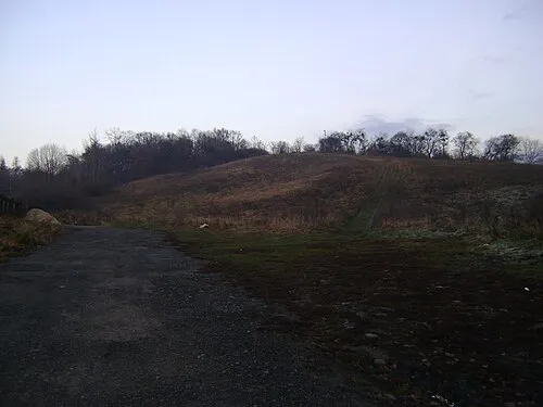 Winna Góra Mountain, Trzebnica11 km NW
-
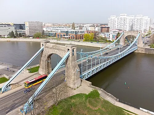 Grunwaldzki Bridge Landmark, Wrocław21 km SW
-
 Stadion Miejski Landmark, Wrocław24 km SW
-
Kapliczne Wzgórze Mountain, Trzebnica12 km W
-
Wiszniak Mountain, Gmina Wisznia Mała14 km W
Sources & licences
Data last updated: