- Population
- 1,118
- 1.1K
- Elevation
- 214 m
- above sea level
- Local time
- UTC+01:00
- Europe/Warsaw · UTC+01:00
- Airports
- WRO Copernicus Wrocław Airport77 km
- IEG Zielona Góra-Babimost Airport104 km
About Olszanica
Olszanica is a village. Location: Gmina Zagrodno, Złotoryja County. Population: 1,118. Elevation: 214 m. The best months to visit are June–August. The nearest airport is Copernicus Wrocław Airport (77 km). Nearby sights include Grodziec and Ostrzyca.
Climate of Olszanica
Best months for sightseeingBest months for sightseeing: June–August.
This month · November
A cold month
Day 6° · Night 1° · Rain 39 mm
- Hottest month
- August (day 23°)
- Coldest month
- January (night -5°)
- Wettest month
- July (80 mm)
- Driest month
- February (27 mm)
Bars: average monthly low and high temperature. Below: precipitation. Monthly averages for 1970–2000 at about 18 km resolution, adjusted for elevation. Highlighted months are mild and relatively dry. Source: WorldClim 2.1 (CC BY 4.0).
Show values as a table
| Month | Jan | Feb | Mar | Apr | May | Jun | Jul | Aug | Sep | Oct | Nov | Dec |
|---|---|---|---|---|---|---|---|---|---|---|---|---|
| Average high (°C) | 0° | 2° | 7° | 13° | 18° | 21° | 23° | 23° | 18° | 13° | 6° | 2° |
| Average low (°C) | -5° | -4° | 0° | 3° | 7° | 11° | 12° | 12° | 9° | 5° | 1° | -3° |
| Precipitation (mm) | 32 | 27 | 33 | 41 | 57 | 68 | 80 | 71 | 45 | 40 | 39 | 41 |
How to get to Olszanica
The nearest airport is Copernicus Wrocław Airport (WRO), 77 km to the east as the crow flies. The nearest large city is Dresden, 145 km to the west.
Airports
- Copernicus Wrocław Airport (WRO) Wrocław 77 kmeast
- Zielona Góra-Babimost Airport (IEG) Nowe Kramsko 104 kmnorth
- Pardubice Airport (PED) Pardubice 133 kmsouth
Nearby large cities
- Dresden Population: 564.9K 145 kmwest
- Prague Population: 1.2M 158 kmsouthwest
- Chemnitz Population: 247.2K 206 kmwest
- Berlin Population: 3.4M 220 kmnorthwest
- Potsdam Population: 184.8K 231 kmnorthwest
Straight-line distances; road distances are longer. Airport data: OurAirports.
Day trips from Olszanica
Within 100 km: 111 historic and cultural sites, 588 natural sites, 46 lakes, rivers and coasts.
0–25 km8 places
- Gora Trupien Mountain 19 kmSE
- Grodziec Mountain 4 kmSW
- Leśniak Mountain 24 kmS
- Ostrzyca Mountain 17 kmS
25–60 km156 places
- Tvarožník Mountain 51 kmSW
- Jastrzębiec Mountain 43 kmSW
- Bielec Mountain 43 kmS
- Kleine Gaule River 60 kmW
60–100 km581 places
- Baranek Wawrzyn Mountain 78 kmE
- Buschteich Lake 97 kmW
- Obersee Lake 97 kmW
- Winkelteich Lake 95 kmW
Straight-line distances.
Nearby attractions & nature
Everything nearby-
Grodziec Mountain, Gmina Zagrodno4.4 km SW
-
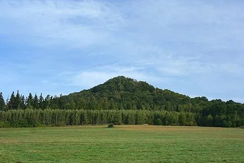 Ostrzyca Mountain, Pielgrzymka17 km S
-
Leśniak Mountain, Gmina Świerzawa24 km S
-
Wiesau Concentration Camp Historic site, Bolesławiec19 km NW
-
Bunzlau I Concentration Camp Historic site, Bolesławiec18 km W
-
Bunzlau II Concentration Camp Historic site, Bolesławiec18 km W
Sources & licences
Data last updated: