Gmina Łabunie
Located in Powiat zamojski, Lublin Voivodeship Coordinates: 50°39′32″ N 23°21′25″ E
- Population
- 6,292
- 6.3K
- Elevation
- 222 m
- above sea level
- Local time
- UTC+01:00
- Europe/Warsaw · UTC+01:00
- Places inside
- 2
- listed under Gmina Łabunie
- Airports
- LUZ Lublin Airport79 km
- RZE Rzeszów-Jasionka Airport113 km
About Gmina Łabunie
Gmina Łabunie is a municipality. Location: Powiat zamojski, Lublin Voivodeship. Population: 6,292. Elevation: 222 m. The best months to visit are June–August. The nearest airport is Lublin Airport (79 km). Nearby sights include Zamość Ghetto and Komarów Ghetto.
Climate of Gmina Łabunie
Best months for sightseeingBest months for sightseeing: June–August.
This month · November
A cold month
Day 6° · Night 0° · Rain 39 mm
- Hottest month
- July (day 23°)
- Coldest month
- January (night -6°)
- Wettest month
- July (84 mm)
- Driest month
- January (29 mm)
Bars: average monthly low and high temperature. Below: precipitation. Monthly averages for 1970–2000 at about 18 km resolution, adjusted for elevation. Highlighted months are mild and relatively dry. Source: WorldClim 2.1 (CC BY 4.0).
Show values as a table
| Month | Jan | Feb | Mar | Apr | May | Jun | Jul | Aug | Sep | Oct | Nov | Dec |
|---|---|---|---|---|---|---|---|---|---|---|---|---|
| Average high (°C) | 0° | 1° | 6° | 12° | 19° | 21° | 23° | 22° | 18° | 12° | 6° | 1° |
| Average low (°C) | -6° | -5° | -2° | 2° | 8° | 11° | 12° | 11° | 8° | 4° | 0° | -4° |
| Precipitation (mm) | 29 | 30 | 33 | 42 | 66 | 82 | 84 | 70 | 55 | 43 | 39 | 39 |
How to get to Gmina Łabunie
The nearest airport is Lublin Airport (LUZ), 79 km to the northwest as the crow flies. The nearest large city is Košice, 264 km to the southwest.
Airports
- Lublin Airport (LUZ) Lublin 79 kmnorthwest
- Rzeszów-Jasionka Airport (RZE) Jasionka 113 kmsouthwest
- Brest International Airport (BQT) Brest 166 kmnorth
Nearby large cities
- Košice Population: 225K 264 kmsouthwest
- Satu Mare Population: 112.5K 320 kmsouth
- Nyíregyháza Population: 117.7K 323 kmsouth
- Baia Mare Population: 108.8K 334 kmsouth
- Miskolc Population: 154.5K 340 kmsouthwest
Straight-line distances; road distances are longer. Airport data: OurAirports.
Day trips from Gmina Łabunie
Within 100 km: 32 historic and cultural sites, 4 natural sites.
0–25 km7 places
- Wapięlnia Mountain 21 kmS
- Krasnobród Ghetto Historic site 16 kmSW
- Tomaszów Lubelski Ghetto Historic site 24 kmS
- Tyszowce Ghetto Historic site 25 kmE
25–60 km12 places
- Bełżec Extermination Camp Historic site 33 kmS
- Krasnystaw Ghetto Historic site 38 kmN
- Gora Kapliczna Mountain 33 kmSW
- Biłgoraj Ghetto Historic site 48 kmW
60–100 km17 places
- Bełżyce Ghetto Historic site 95 kmNW
- Kraśnik Ghetto Historic site 84 kmW
- Radomyśl nad Sanem Ghetto Historic site 99 kmW
- Łysa Góra Mountain 61 kmN
Straight-line distances.
Places in Gmina Łabunie
2 placesŁabunie
Population: 1.7K

Majdan Ruszkowski
Population: 263
Nearby attractions & nature
Everything nearby-
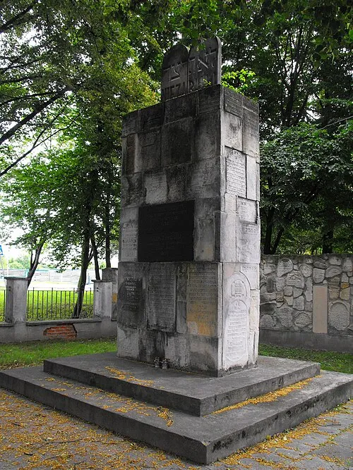 Zamość Ghetto Historic site, Zamość9.9 km NW
-
Komarów Ghetto Historic site, Gmina Komarów-Osada9.1 km SE
-
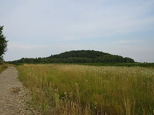 Wapięlnia Mountain, Gmina Krasnobród21 km S
-
Krasnobród Ghetto Historic site, Gmina Krasnobród16 km SW
-
Tomaszów Lubelski Ghetto Historic site, Tomaszów Lubelski24 km S
-
Grabowiec Ghetto Historic site, Grabowiec24 km NE
-
Tyszowce Ghetto Historic site, Gmina Tyszowce25 km E
Sources & licences
Data last updated: