Puńsk
Located in Sejny County, Podlasie Voivodship Coordinates: 54°14′58″ N 23°11′01″ E
- Population
- 4,193
- 4.2K
- Elevation
- 171 m
- above sea level
- Local time
- UTC+01:00
- Europe/Warsaw · UTC+01:00
- Places inside
- 1
- listed under Puńsk
- Airports
- KUN Kaunas International Airport99 km
- VNO Vilnius International Airport143 km
About Puńsk
Puńsk is a municipality. Location: Sejny County, Podlasie Voivodship. Population: 4,193. Elevation: 171 m. The best months to visit are June–August. The nearest airport is Kaunas International Airport (99 km). Nearby sights include Góra Zamkowa and Góra Leszczynowa.
Climate of Puńsk
Best months for sightseeingBest months for sightseeing: June–August.
This month · November
A cold month
Day 4° · Night -1° · Rain 47 mm
- Hottest month
- July (day 22°)
- Coldest month
- January (night -7°)
- Wettest month
- July (85 mm)
- Driest month
- February (26 mm)
Bars: average monthly low and high temperature. Below: precipitation. Monthly averages for 1970–2000 at about 18 km resolution, adjusted for elevation. Highlighted months are mild and relatively dry. Source: WorldClim 2.1 (CC BY 4.0).
Show values as a table
| Month | Jan | Feb | Mar | Apr | May | Jun | Jul | Aug | Sep | Oct | Nov | Dec |
|---|---|---|---|---|---|---|---|---|---|---|---|---|
| Average high (°C) | -2° | -1° | 4° | 11° | 18° | 20° | 22° | 22° | 16° | 10° | 4° | 0° |
| Average low (°C) | -7° | -6° | -3° | 2° | 7° | 10° | 12° | 11° | 7° | 3° | -1° | -5° |
| Precipitation (mm) | 35 | 26 | 35 | 39 | 50 | 72 | 85 | 65 | 56 | 49 | 47 | 44 |
How to get to Puńsk
The nearest airport is Kaunas International Airport (KUN), 99 km to the northeast as the crow flies.
Airports
- Kaunas International Airport (KUN) Kaunas 99 kmnortheast
- Vilnius International Airport (VNO) Vilnius 143 kmeast
- Olsztyn-Mazury Airport (SZY) Szymany 171 kmsouthwest
Straight-line distances; road distances are longer. Airport data: OurAirports.
Day trips from Puńsk
Within 100 km: 11 historic and cultural sites, 8 natural sites.
0–25 km2 places
- Góra Leszczynowa Mountain 25 kmW
- Góra Zamkowa Mountain 20 kmW
25–60 km2 places
- Augustów Ghetto Historic site 46 kmS
- Szeska Góra Mountain 56 kmW
60–100 km15 places
- Góra Jelonka Mountain 93 kmSW
- Dąbrowa Ghetto Historic site 66 kmS
- Grajewo Ghetto Historic site 82 kmSW
- Rajgród Ghetto Historic site 66 kmSW
Straight-line distances.
Places in Puńsk
1 placeBar: population relative to the most populous place in this list.
Nearby attractions & nature
Everything nearby-
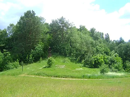 Góra Zamkowa Mountain, Gmina Jeleniewo20 km W
-
Góra Leszczynowa Mountain, Przerośl25 km W
Sources & licences
Data last updated: